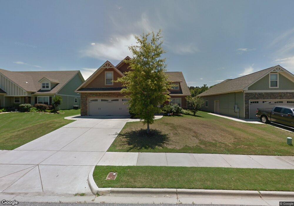
26 Boulder Dr Pike Road, AL 36064
East Montgomery NeighborhoodEstimated Value: $348,000 - $365,000
4
Beds
3
Baths
2,700
Sq Ft
$132/Sq Ft
Est. Value
About This Home
This home is located at 26 Boulder Dr, Pike Road, AL 36064 and is currently estimated at $356,614, approximately $132 per square foot. 26 Boulder Dr is a home located in Montgomery County with nearby schools including Pike Road Elementary School, Pike Road Intermediate School, and Pike Road Junior High School.
Ownership History
Date
Name
Owned For
Owner Type
Purchase Details
Closed on
Jun 30, 2011
Sold by
Mathews Development Company L L C
Bought by
Freeman Constance T and Freeman Wilson
Current Estimated Value
Home Financials for this Owner
Home Financials are based on the most recent Mortgage that was taken out on this home.
Original Mortgage
$238,000
Interest Rate
4.4%
Mortgage Type
VA
Create a Home Valuation Report for This Property
The Home Valuation Report is an in-depth analysis detailing your home's value as well as a comparison with similar homes in the area
Home Values in the Area
Average Home Value in this Area
Purchase History
| Date | Buyer | Sale Price | Title Company |
|---|---|---|---|
| Freeman Constance T | -- | None Available |
Source: Public Records
Mortgage History
| Date | Status | Borrower | Loan Amount |
|---|---|---|---|
| Previous Owner | Freeman Constance T | $238,000 |
Source: Public Records
Tax History Compared to Growth
Tax History
| Year | Tax Paid | Tax Assessment Tax Assessment Total Assessment is a certain percentage of the fair market value that is determined by local assessors to be the total taxable value of land and additions on the property. | Land | Improvement |
|---|---|---|---|---|
| 2025 | -- | $35,040 | $3,500 | $31,540 |
| 2024 | -- | $33,800 | $3,500 | $30,300 |
| 2023 | $0 | $34,680 | $3,500 | $31,180 |
| 2022 | $0 | $30,920 | $3,500 | $27,420 |
| 2021 | $2,809 | $28,760 | $0 | $0 |
| 2020 | $2,809 | $28,090 | $3,500 | $24,590 |
| 2019 | $2,836 | $28,360 | $3,500 | $24,860 |
| 2018 | $2,766 | $27,660 | $3,500 | $24,160 |
| 2017 | $2,352 | $52,260 | $7,000 | $45,260 |
| 2014 | $2,224 | $24,710 | $3,500 | $21,210 |
| 2013 | -- | $24,340 | $3,500 | $20,840 |
Source: Public Records
Map
Nearby Homes
- 33 Boulder Ct
- 39 N Onyx Ct
- 29 S Onyx Ct
- 44 Stone Park Trail
- 155 Pinetree Dr
- 12645 Highway 80
- 36 Blackberry Blvd
- 233 Everley Ave
- 326 Heron Hill
- 306 Heron Hill
- 307 Queenston Dr
- 309 Heron Hill
- 357 Heron Hill
- 313 Heron Hill
- 258 Crosslake Way
- 105 Plaza Dr
- 120 Malia Ln
- 561 Ingleside Way
- 317 Millers Creek Dr
- Lot 28 Hidden Oaks Ave
- 20 Boulder Dr
- 568 Stone Park Blvd
- 564 Stone Park Blvd
- 572 Stone Park Blvd
- 27 Boulder Dr
- 33 Boulder Dr
- 21 Boulder Dr
- 44 Boulder Dr
- 560 Stone Park Blvd
- 20 Stone Park Trail
- 50 Boulder Dr
- 556 Stone Park Blvd
- 461 Stone Park Blvd
- 55 Boulder Dr
- 39 Boulder Dr
- 19 Stone Park Trail
- 26 Stone Park Trail
- 569 Stone Park Blvd
- 565 Stone Park Blvd
- 573 Stone Park Blvd