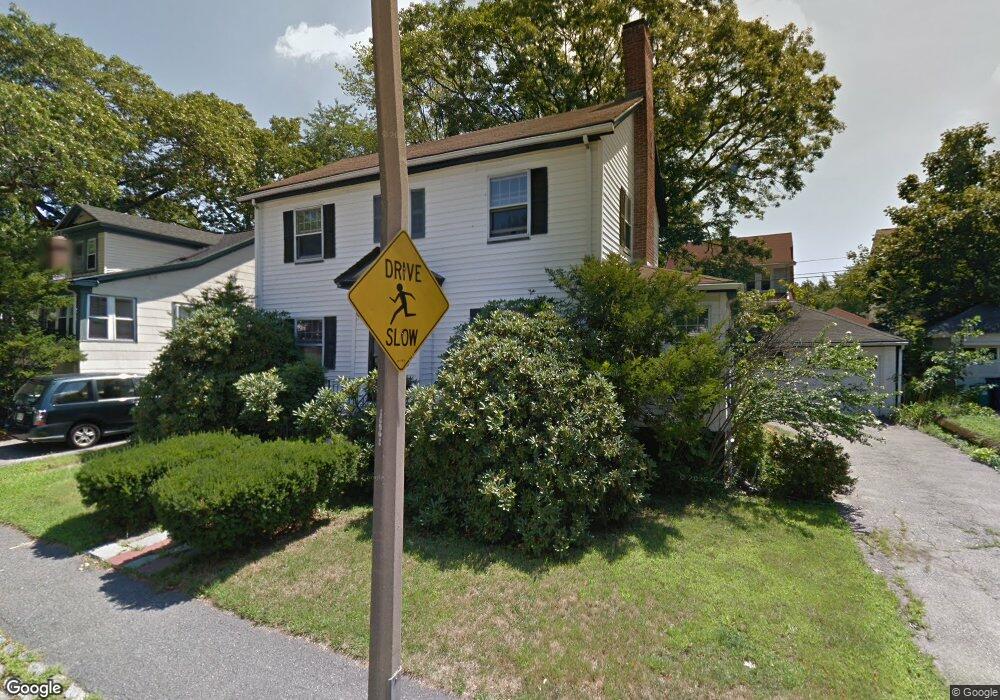
26 Bourne St Jamaica Plain, MA 02130
Jamaica Plain NeighborhoodEstimated Value: $802,000 - $1,198,000
3
Beds
2
Baths
1,536
Sq Ft
$621/Sq Ft
Est. Value
About This Home
This home is located at 26 Bourne St, Jamaica Plain, MA 02130 and is currently estimated at $953,452, approximately $620 per square foot. 26 Bourne St is a home located in Suffolk County with nearby schools including Brooke Charter School Roslindale, The Croft School - Jamaica Plain, and St. Clare High School.
Ownership History
Date
Name
Owned For
Owner Type
Purchase Details
Closed on
Mar 29, 2017
Sold by
Shufro Libbie J
Bought by
T Shufro and West T
Current Estimated Value
Purchase Details
Closed on
Sep 24, 1992
Sold by
Hauser William E and Hauser Judy S
Bought by
Shufro Libbie J
Home Financials for this Owner
Home Financials are based on the most recent Mortgage that was taken out on this home.
Original Mortgage
$82,500
Interest Rate
7.9%
Mortgage Type
Purchase Money Mortgage
Create a Home Valuation Report for This Property
The Home Valuation Report is an in-depth analysis detailing your home's value as well as a comparison with similar homes in the area
Home Values in the Area
Average Home Value in this Area
Purchase History
| Date | Buyer | Sale Price | Title Company |
|---|---|---|---|
| T Shufro | -- | -- | |
| Shufro Libbie J | $172,500 | -- |
Source: Public Records
Mortgage History
| Date | Status | Borrower | Loan Amount |
|---|---|---|---|
| Previous Owner | Shufro Libbie J | $82,500 |
Source: Public Records
Tax History Compared to Growth
Tax History
| Year | Tax Paid | Tax Assessment Tax Assessment Total Assessment is a certain percentage of the fair market value that is determined by local assessors to be the total taxable value of land and additions on the property. | Land | Improvement |
|---|---|---|---|---|
| 2025 | $9,186 | $793,300 | $271,600 | $521,700 |
| 2024 | $7,966 | $730,800 | $245,900 | $484,900 |
| 2023 | $7,333 | $682,800 | $229,800 | $453,000 |
| 2022 | $6,813 | $626,200 | $210,700 | $415,500 |
| 2021 | $6,487 | $608,000 | $204,600 | $403,400 |
| 2020 | $6,008 | $568,900 | $195,800 | $373,100 |
| 2019 | $5,713 | $542,000 | $174,000 | $368,000 |
| 2018 | $5,071 | $483,900 | $174,000 | $309,900 |
| 2017 | $5,026 | $474,600 | $174,000 | $300,600 |
| 2016 | $5,118 | $465,300 | $174,000 | $291,300 |
| 2015 | $5,120 | $422,800 | $166,500 | $256,300 |
| 2014 | $4,658 | $370,300 | $166,500 | $203,800 |
Source: Public Records
Map
Nearby Homes
- 31 Rodman St Unit 2
- 31 Rodman St Unit 1
- 50 Southbourne Rd
- 140 Wachusett St
- 158 Wachusett St Unit 3
- 18-20 Northbourne Rd Unit 18
- 178 Hyde Park Ave Unit 3
- 348-350 Hyde Park Ave Unit 2
- 143-171 Hyde Park Ave Unit 169A
- 24 Waterman Rd
- 71 Wyvern St
- 19 Delford St
- 19 Delford St Unit 1
- 105 Neponset Ave Unit 105
- 602 Canterbury St Unit 14
- 602 Canterbury St Unit 4
- 602 Canterbury St Unit 5
- 602 Canterbury St Unit 2
- 602 Canterbury St Unit 9
- 103 Neponset Ave Unit 103A