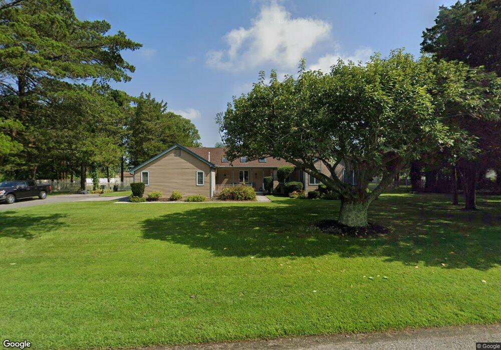
26 Brookridge Rd Cape May Court House, NJ 08210
Estimated Value: $508,377 - $647,000
--
Bed
--
Bath
2,094
Sq Ft
$275/Sq Ft
Est. Value
About This Home
This home is located at 26 Brookridge Rd, Cape May Court House, NJ 08210 and is currently estimated at $576,344, approximately $275 per square foot. 26 Brookridge Rd is a home located in Cape May County with nearby schools including Middle Township Elementary No. 1, Middle Township Elementary No. 2, and Middle Township Middle School.
Ownership History
Date
Name
Owned For
Owner Type
Purchase Details
Closed on
Oct 31, 2003
Current Estimated Value
Purchase Details
Closed on
Sep 22, 1995
Sold by
Worthley Wm
Bought by
Reichner Joseph and Reichner Kathleen
Create a Home Valuation Report for This Property
The Home Valuation Report is an in-depth analysis detailing your home's value as well as a comparison with similar homes in the area
Home Values in the Area
Average Home Value in this Area
Purchase History
| Date | Buyer | Sale Price | Title Company |
|---|---|---|---|
| -- | $375,000 | -- | |
| Reichner Joseph | $200,000 | -- |
Source: Public Records
Tax History Compared to Growth
Tax History
| Year | Tax Paid | Tax Assessment Tax Assessment Total Assessment is a certain percentage of the fair market value that is determined by local assessors to be the total taxable value of land and additions on the property. | Land | Improvement |
|---|---|---|---|---|
| 2025 | $6,924 | $328,300 | $175,300 | $153,000 |
| 2024 | $6,924 | $328,300 | $175,300 | $153,000 |
| 2023 | $6,750 | $328,300 | $175,300 | $153,000 |
| 2022 | $6,556 | $328,300 | $175,300 | $153,000 |
| 2021 | $6,399 | $328,300 | $175,300 | $153,000 |
| 2020 | $6,267 | $328,300 | $175,300 | $153,000 |
| 2019 | $6,106 | $328,300 | $175,300 | $153,000 |
| 2018 | $6,011 | $328,300 | $175,300 | $153,000 |
| 2017 | $5,890 | $328,300 | $175,300 | $153,000 |
| 2016 | $5,742 | $328,300 | $175,300 | $153,000 |
| 2015 | $5,699 | $328,300 | $175,300 | $153,000 |
| 2014 | $5,663 | $328,300 | $175,300 | $153,000 |
Source: Public Records
Map
Nearby Homes
- 18 Brook Ridge Rd
- 28 Pinewood Ct
- 26 Pine Wood Ct
- 3 Fairway Dr
- 19 Eagle Way Ct
- 17 Eagle Way Ct
- 18 Avalon Blvd
- 12 Seagrove Ave
- 30 Brooks Ave
- 201 Saint Andrews Dr Unit 201
- 1845 Route 9 N
- 1877 Route 9 N
- 57 Siegtown Rd
- 63 Siegtown Rd
- 5 Timber Ln
- 809 Turnberry Ct Unit 809 TURNBERRY COURT
- 105 Congressional Dr
- 23 Siegtown #7c Rd Unit 7C
- 23 Siegtown Rd Unit 7C
- 506 W Hampton Ct Unit C1
- 24 Brook Ridge Rd
- 24 Brook Ridge Rd
- 28 Brookridge Rd
- 25 Brookridge Rd
- 27 Brookridge Rd
- 23 Brookridge Rd
- 22 Brookridge Rd
- 30 Brookridge Rd
- 29 Brookridge Rd
- 20 Brookridge Rd
- 21 Brookridge Rd
- 32 Brookridge Rd
- 31 Brookridge Rd
- 18 W Beaver Dam Rd
- 101 Brook Ridge Rd
- 21 W Beaver Dam Rd
- 34 Brookridge Rd
- 18 Brookridge Rd
- 21 Pine Wood Ct
- 23 Pine Wood Ct