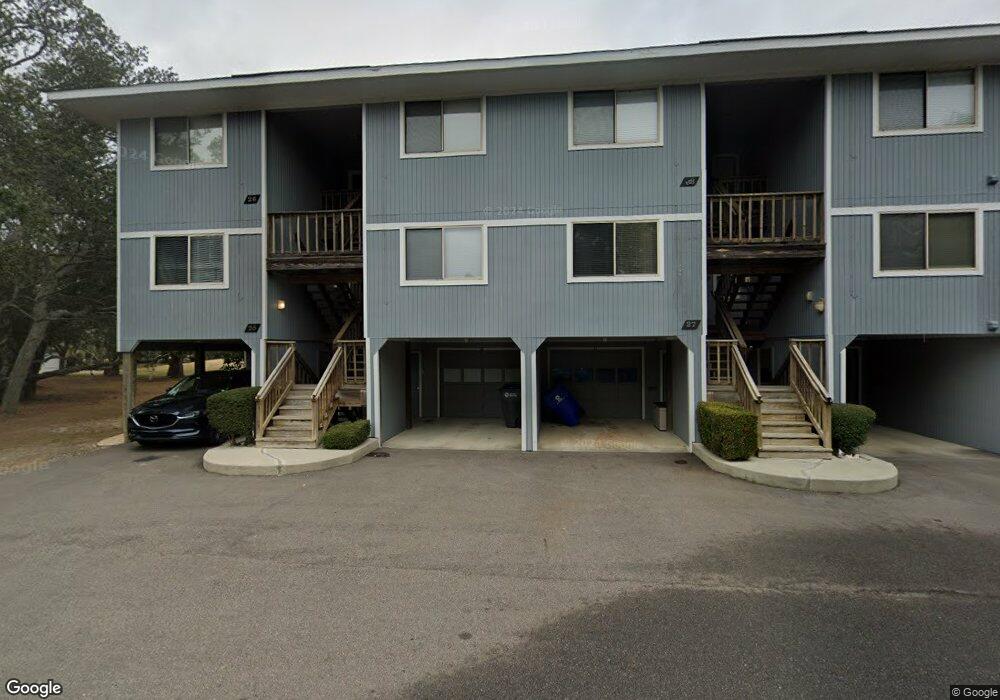
26 Bunker Ct Unit 16b Oak Island, NC 28465
Estimated Value: $491,000 - $524,602
3
Beds
2
Baths
1,312
Sq Ft
$384/Sq Ft
Est. Value
About This Home
This home is located at 26 Bunker Ct Unit 16b, Oak Island, NC 28465 and is currently estimated at $503,401, approximately $383 per square foot. 26 Bunker Ct Unit 16b is a home located in Brunswick County with nearby schools including Southport Elementary School, South Brunswick Middle School, and South Brunswick High School.
Ownership History
Date
Name
Owned For
Owner Type
Purchase Details
Closed on
May 15, 2025
Sold by
Whelan David M and Whelan Martha L
Bought by
Lee Ellen James
Current Estimated Value
Home Financials for this Owner
Home Financials are based on the most recent Mortgage that was taken out on this home.
Original Mortgage
$371,250
Outstanding Balance
$369,981
Interest Rate
6.83%
Mortgage Type
New Conventional
Estimated Equity
$133,420
Purchase Details
Closed on
Aug 15, 2022
Sold by
Barmar Properties Llc
Bought by
Whelan David M and Whelan Martha L
Purchase Details
Closed on
Aug 20, 2019
Sold by
Walker Christopher Edward and Walker Robyn Allison
Bought by
Barmar Proeprties Llc
Purchase Details
Closed on
Jan 1, 2002
Bought by
Smith Joan B Etvir Edgar B
Create a Home Valuation Report for This Property
The Home Valuation Report is an in-depth analysis detailing your home's value as well as a comparison with similar homes in the area
Home Values in the Area
Average Home Value in this Area
Purchase History
| Date | Buyer | Sale Price | Title Company |
|---|---|---|---|
| Lee Ellen James | $495,000 | None Listed On Document | |
| Lee Ellen James | $495,000 | None Listed On Document | |
| Whelan David M | $458,000 | Taxes Sandra L | |
| Whelan David M | $458,000 | Taxes Sandra L | |
| Barmar Proeprties Llc | $215,000 | None Available | |
| Smith Joan B Etvir Edgar B | -- | -- |
Source: Public Records
Mortgage History
| Date | Status | Borrower | Loan Amount |
|---|---|---|---|
| Open | Lee Ellen James | $371,250 | |
| Closed | Lee Ellen James | $371,250 |
Source: Public Records
Tax History Compared to Growth
Tax History
| Year | Tax Paid | Tax Assessment Tax Assessment Total Assessment is a certain percentage of the fair market value that is determined by local assessors to be the total taxable value of land and additions on the property. | Land | Improvement |
|---|---|---|---|---|
| 2025 | $2,830 | $458,270 | $0 | $458,270 |
| 2024 | $2,830 | $458,270 | $0 | $458,270 |
| 2023 | $1,823 | $458,270 | $0 | $458,270 |
| 2022 | $0 | $201,570 | $0 | $201,570 |
| 2021 | $1,492 | $201,570 | $0 | $201,570 |
| 2020 | $0 | $201,570 | $0 | $201,570 |
| 2019 | $1,667 | $0 | $0 | $0 |
| 2018 | $1,492 | $0 | $0 | $0 |
| 2017 | $1,492 | $0 | $0 | $0 |
| 2016 | $1,431 | $0 | $0 | $0 |
| 2015 | $1,431 | $178,640 | $0 | $178,640 |
| 2014 | $1,736 | $250,650 | $0 | $250,650 |
Source: Public Records
Map
Nearby Homes
- 27 Bunker Ct
- 37 Bunker Ct Unit 18A
- 38 Bunker Ct
- 123 Fairway Dr
- 301 Wisteria Way
- 184 Ryder Cup
- 501 Periwinkle Way
- 98 Foxfire Trace
- 730 Alyssum Ave
- 119 Flowering Bridge Path
- 31 Augusta Dr
- 1000 Caswell Beach Rd Unit 1206
- 1000 Caswell Beach Rd Unit 1303
- 1000 Caswell Beach Rd Unit 405
- 1000 Caswell Beach Rd Unit 802
- 103 Throckmorton St
- 214 McGlamery St
- 302 McGlamery St
- 81 Yaupon Dr
- 217 Sellers St