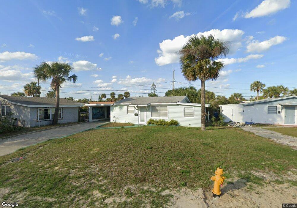
26 Carol Rd Ormond Beach, FL 32176
Estimated Value: $221,042 - $267,000
2
Beds
1
Bath
625
Sq Ft
$390/Sq Ft
Est. Value
About This Home
This home is located at 26 Carol Rd, Ormond Beach, FL 32176 and is currently estimated at $243,761, approximately $390 per square foot. 26 Carol Rd is a home located in Volusia County with nearby schools including Ormond Beach Middle School, Seabreeze High School, and St Brendan Catholic School.
Ownership History
Date
Name
Owned For
Owner Type
Purchase Details
Closed on
Mar 9, 2021
Sold by
Cheney Martha J and Martha J Cheney Trust
Bought by
Goepper Frederica M
Current Estimated Value
Purchase Details
Closed on
Jan 31, 2007
Sold by
Cheney Martha J and Reeves Jane
Bought by
The Martha J Cheney Trust
Purchase Details
Closed on
Feb 2, 1996
Sold by
Sylvester Charles E
Bought by
Reeves Jane
Home Financials for this Owner
Home Financials are based on the most recent Mortgage that was taken out on this home.
Original Mortgage
$41,000
Interest Rate
7.2%
Purchase Details
Closed on
Jan 23, 1995
Sold by
Baird Frances A
Bought by
Sylvester Charles E and Combs Darla K
Purchase Details
Closed on
Sep 15, 1986
Bought by
Cheney Martha J Tr
Purchase Details
Closed on
May 15, 1980
Bought by
Cheney Martha J Tr
Create a Home Valuation Report for This Property
The Home Valuation Report is an in-depth analysis detailing your home's value as well as a comparison with similar homes in the area
Home Values in the Area
Average Home Value in this Area
Purchase History
| Date | Buyer | Sale Price | Title Company |
|---|---|---|---|
| Goepper Frederica M | -- | Accommodation | |
| The Martha J Cheney Trust | -- | Attorney | |
| Reeves Jane | $50,000 | -- | |
| Sylvester Charles E | -- | -- | |
| Cheney Martha J Tr | $31,000 | -- | |
| Cheney Martha J Tr | $29,000 | -- |
Source: Public Records
Mortgage History
| Date | Status | Borrower | Loan Amount |
|---|---|---|---|
| Previous Owner | Reeves Jane | $41,000 |
Source: Public Records
Tax History
| Year | Tax Paid | Tax Assessment Tax Assessment Total Assessment is a certain percentage of the fair market value that is determined by local assessors to be the total taxable value of land and additions on the property. | Land | Improvement |
|---|---|---|---|---|
| 2026 | $3,849 | $198,165 | $100,375 | $97,790 |
| 2025 | $3,849 | $198,676 | $100,375 | $98,301 |
| 2024 | $3,882 | $209,797 | $100,375 | $109,422 |
| 2023 | $3,882 | $206,456 | $92,950 | $113,506 |
| 2022 | $3,534 | $174,446 | $74,250 | $100,196 |
| 2021 | $2,917 | $131,605 | $52,250 | $79,355 |
| 2020 | $2,745 | $123,056 | $49,500 | $73,556 |
| 2019 | $2,756 | $121,814 | $49,500 | $72,314 |
| 2018 | $2,590 | $115,981 | $43,450 | $72,531 |
| 2017 | $2,414 | $103,724 | $42,350 | $61,374 |
| 2016 | $2,265 | $93,790 | $0 | $0 |
| 2015 | -- | $82,986 | $0 | $0 |
| 2014 | -- | $61,424 | $0 | $0 |
Source: Public Records
Map
Nearby Homes
- 29 Ocean Shore Dr
- 56 Margaret Rd
- 36 River Shore Dr
- 59 Margaret Rd
- 4 Ocean Shore Dr
- 31 River Shore Dr
- 1575 Ocean Shore Blvd Unit 304
- 1575 Ocean Shore Blvd Unit 603
- 1575 Ocean Shore Blvd Unit J010
- 1575 Ocean Shore Blvd Unit 901
- 66 Ocean Shore Dr
- 55 Seaside Dr
- 82 Margaret Rd
- 1510 Ocean Shore Blvd Unit 3150
- 1510 Ocean Shore Blvd Unit 4140
- 1510 Ocean Shore Blvd Unit 4150
- 1510 Ocean Shore Blvd Unit 406
- 1510 Ocean Shore Blvd Unit 415
- 1510 Ocean Shore Blvd Unit 4120
- 142 Holland Rd
Your Personal Tour Guide
Ask me questions while you tour the home.