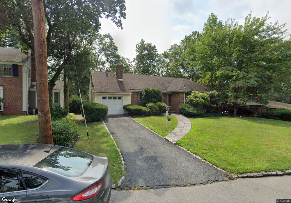
26 Carter Rd West Orange, NJ 07052
Estimated Value: $730,035 - $874,000
--
Bed
--
Bath
2,181
Sq Ft
$368/Sq Ft
Est. Value
About This Home
This home is located at 26 Carter Rd, West Orange, NJ 07052 and is currently estimated at $803,259, approximately $368 per square foot. 26 Carter Rd is a home located in Essex County with nearby schools including West Orange High School and Golda Och Academy Lower School.
Ownership History
Date
Name
Owned For
Owner Type
Purchase Details
Closed on
Jun 12, 2023
Sold by
Hodge Denise Le and Downer-Hodge Dylan Dawonn
Bought by
Hodge Denise and Ageday Antyone Aaron
Current Estimated Value
Purchase Details
Closed on
Jul 21, 2021
Sold by
Daniels Barbara A
Bought by
Ageday Antyone Aaron Courtney and Downer Hodge Dylan
Purchase Details
Closed on
Sep 28, 2005
Sold by
Tadesse Yoseff
Bought by
Daniels Barbara
Home Financials for this Owner
Home Financials are based on the most recent Mortgage that was taken out on this home.
Original Mortgage
$324,350
Interest Rate
5.81%
Mortgage Type
New Conventional
Purchase Details
Closed on
Sep 21, 2001
Sold by
Baron Deborah
Bought by
Tadesse Yossef
Home Financials for this Owner
Home Financials are based on the most recent Mortgage that was taken out on this home.
Original Mortgage
$140,000
Interest Rate
6.89%
Purchase Details
Closed on
Nov 11, 1994
Sold by
Athason Bennett
Bought by
Baron Deborah and Baron David
Home Financials for this Owner
Home Financials are based on the most recent Mortgage that was taken out on this home.
Original Mortgage
$178,000
Interest Rate
8.81%
Purchase Details
Closed on
Aug 4, 1993
Sold by
Nathanson Bennett and Nathanson Joy M
Bought by
Nathanson Bennett
Purchase Details
Closed on
Jul 12, 1989
Sold by
Nathanson Joy M
Bought by
Nathanson Bennett and Nathanson Joy M
Create a Home Valuation Report for This Property
The Home Valuation Report is an in-depth analysis detailing your home's value as well as a comparison with similar homes in the area
Home Values in the Area
Average Home Value in this Area
Purchase History
| Date | Buyer | Sale Price | Title Company |
|---|---|---|---|
| Hodge Denise | -- | None Listed On Document | |
| Ageday Antyone Aaron Courtney | $107,107 | Green Label Title | |
| Daniels Barbara | $499,000 | -- | |
| Tadesse Yossef | $340,000 | -- | |
| Baron Deborah | $190,000 | -- | |
| Nathanson Bennett | $100 | -- | |
| Bennett Nathanson Trust | $100 | -- | |
| Nathanson Bennett | $100 | -- |
Source: Public Records
Mortgage History
| Date | Status | Borrower | Loan Amount |
|---|---|---|---|
| Previous Owner | Daniels Barbara | $324,350 | |
| Previous Owner | Tadesse Yossef | $140,000 | |
| Previous Owner | Baron Deborah | $178,000 |
Source: Public Records
Tax History Compared to Growth
Tax History
| Year | Tax Paid | Tax Assessment Tax Assessment Total Assessment is a certain percentage of the fair market value that is determined by local assessors to be the total taxable value of land and additions on the property. | Land | Improvement |
|---|---|---|---|---|
| 2025 | $16,323 | $710,000 | $319,600 | $390,400 |
| 2024 | $16,323 | $355,000 | $178,100 | $176,900 |
| 2022 | $15,751 | $355,000 | $178,100 | $176,900 |
| 2021 | $15,457 | $355,000 | $178,100 | $176,900 |
| 2020 | $15,208 | $355,000 | $178,100 | $176,900 |
| 2019 | $14,772 | $355,000 | $178,100 | $176,900 |
| 2018 | $14,335 | $355,000 | $178,100 | $176,900 |
| 2017 | $14,150 | $355,000 | $178,100 | $176,900 |
| 2016 | $13,810 | $355,000 | $178,100 | $176,900 |
| 2015 | $13,550 | $355,000 | $178,100 | $176,900 |
| 2014 | $13,284 | $355,000 | $178,100 | $176,900 |
Source: Public Records
Map
Nearby Homes
- 8 Colony Dr E
- 152 Mitchell St
- 2 Linden Ave
- 21 Glen Rd
- 45 Oakridge Rd
- 47 Quinby Place
- 19 Cobane Terrace
- 92 Riggs Place
- 88 Riggs Place
- 59 Oakridge Rd
- 76 Mitchell St
- 54 Mitchell St
- 37 Kingsley St
- 84 Gregory Ave
- 17 Mountain Dr
- 31 Mitchell St
- 412 S Valley Rd
- 9 Joyce St
- 31 Collamore Terrace
- 33 Lafayette St