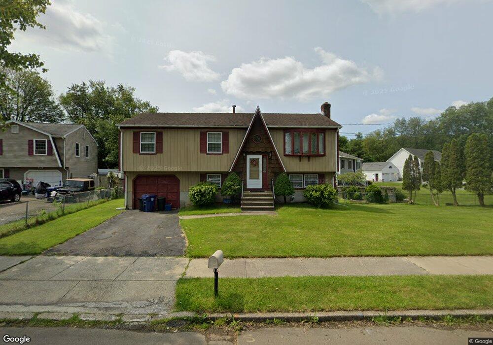
26 Cove Brook Rd West Haven, CT 06516
West Shore NeighborhoodEstimated Value: $428,089 - $454,000
3
Beds
2
Baths
1,100
Sq Ft
$400/Sq Ft
Est. Value
About This Home
This home is located at 26 Cove Brook Rd, West Haven, CT 06516 and is currently estimated at $439,522, approximately $399 per square foot. 26 Cove Brook Rd is a home located in New Haven County with nearby schools including Carrigan 5/6 Intermediate School, Harry M. Bailey Middle School, and West Haven High School.
Ownership History
Date
Name
Owned For
Owner Type
Purchase Details
Closed on
Mar 13, 2003
Sold by
Jozokos Deron and Kelley Michael T
Bought by
Joseph Norbert
Current Estimated Value
Home Financials for this Owner
Home Financials are based on the most recent Mortgage that was taken out on this home.
Original Mortgage
$200,600
Interest Rate
5.94%
Mortgage Type
Purchase Money Mortgage
Purchase Details
Closed on
Oct 2, 1996
Sold by
Zuppe Robert J and Zuppe Kathleen A
Bought by
Cooney Catalina A and Cooney Michael C
Create a Home Valuation Report for This Property
The Home Valuation Report is an in-depth analysis detailing your home's value as well as a comparison with similar homes in the area
Home Values in the Area
Average Home Value in this Area
Purchase History
| Date | Buyer | Sale Price | Title Company |
|---|---|---|---|
| Joseph Norbert | $209,000 | -- | |
| Cooney Catalina A | $142,000 | -- | |
| Joseph Norbert | $209,000 | -- | |
| Cooney Catalina A | $142,000 | -- |
Source: Public Records
Mortgage History
| Date | Status | Borrower | Loan Amount |
|---|---|---|---|
| Open | Cooney Catalina A | $150,500 | |
| Closed | Cooney Catalina A | $200,600 | |
| Closed | Cooney Catalina A | $4,950 |
Source: Public Records
Tax History Compared to Growth
Tax History
| Year | Tax Paid | Tax Assessment Tax Assessment Total Assessment is a certain percentage of the fair market value that is determined by local assessors to be the total taxable value of land and additions on the property. | Land | Improvement |
|---|---|---|---|---|
| 2025 | $8,341 | $241,570 | $87,710 | $153,860 |
| 2024 | $7,751 | $159,740 | $60,760 | $98,980 |
| 2023 | $7,430 | $159,740 | $60,760 | $98,980 |
| 2022 | $7,284 | $159,740 | $60,760 | $98,980 |
| 2021 | $7,284 | $159,740 | $60,760 | $98,980 |
| 2020 | $7,359 | $145,810 | $55,930 | $89,880 |
| 2019 | $7,097 | $145,810 | $55,930 | $89,880 |
| 2018 | $7,035 | $145,810 | $55,930 | $89,880 |
| 2017 | $6,658 | $145,810 | $55,930 | $89,880 |
| 2016 | $6,643 | $145,810 | $55,930 | $89,880 |
| 2015 | $6,412 | $158,900 | $60,060 | $98,840 |
| 2014 | $6,372 | $158,900 | $60,060 | $98,840 |
Source: Public Records
Map
Nearby Homes
- 26 Lawncrest Rd
- 144 Hilltop Ln
- 798 W Main St
- 80 Phipps Dr
- 79 Linden St
- 74 Linden St
- 56 Edward St
- 52 Saw Mill Rd
- 109 Parker Ave E
- 166 Saw Mill Rd
- 137 Harding Ave
- 125 Harding Ave
- 481 Savin Ave
- 105 Church St
- 314 Park St
- 99 Roosevelt Ave
- 79 Claudia Dr Unit 256
- 79 Claudia Dr Unit 354
- 79 Claudia Dr Unit 358
- 159 Leete St
- 30 Cove Brook Rd
- 22 Cove Brook Rd
- 19 Cove Brook Rd
- 18 Cove Brook Rd
- 21 Cove Brook Rd
- 25 Cove Brook Rd
- 34 Cove Brook Rd
- 15 Cove Brook Rd
- 14 Cove Brook Rd
- 29 Woodhill Ln
- 29 Cove Brook Rd
- 11 Cove Brook Rd
- 10 Cove Brook Rd
- 44 Lawncrest Rd
- 58 Lawncrest Road Extension
- 27 Michael Dr
- 33 Michael Dr
- 38 Lawncrest Rd
- 41 Cove Brook Rd
- 21 Michael Dr