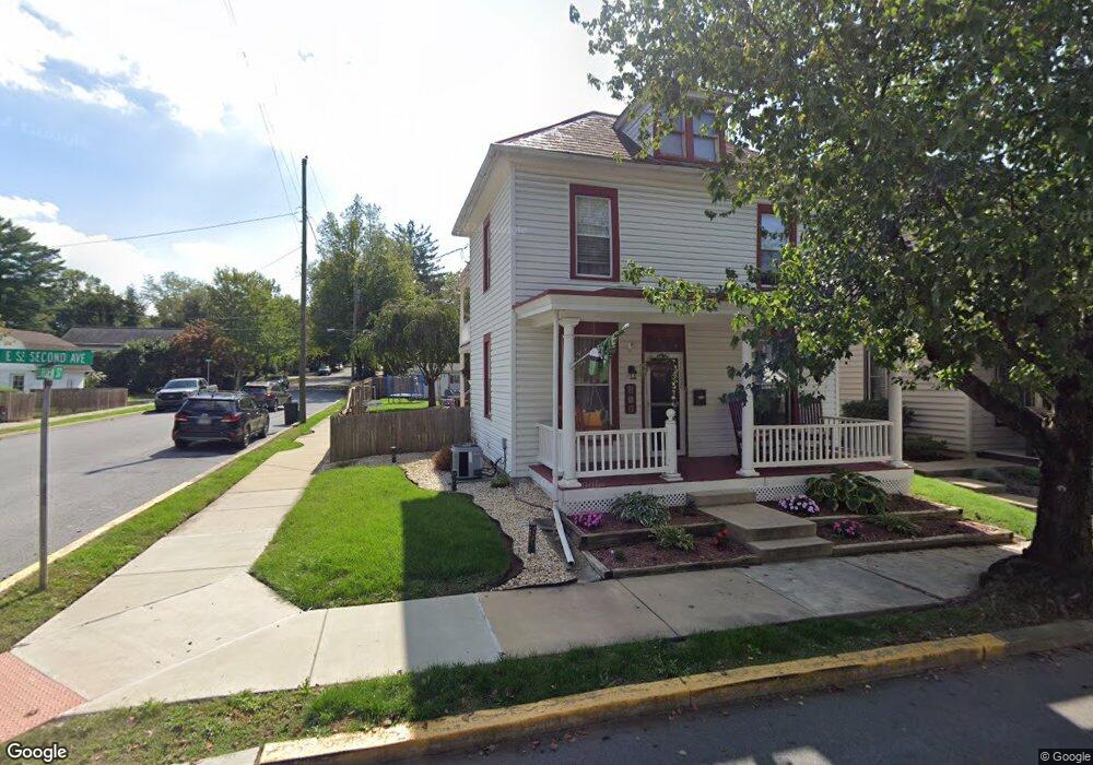
26 E 2nd Ave Lititz, PA 17543
Estimated Value: $342,016 - $408,000
3
Beds
1
Bath
1,696
Sq Ft
$226/Sq Ft
Est. Value
About This Home
This home is located at 26 E 2nd Ave, Lititz, PA 17543 and is currently estimated at $383,504, approximately $226 per square foot. 26 E 2nd Ave is a home located in Lancaster County with nearby schools including Warwick Senior High School, Lititz Christian School, and Linden Hall.
Ownership History
Date
Name
Owned For
Owner Type
Purchase Details
Closed on
Oct 31, 2013
Sold by
Mansbery Kathy A and Huggard Kathy A
Bought by
Drakely Alex N and Drakely Kathleen M
Current Estimated Value
Home Financials for this Owner
Home Financials are based on the most recent Mortgage that was taken out on this home.
Original Mortgage
$176,739
Outstanding Balance
$131,908
Interest Rate
4.25%
Mortgage Type
FHA
Estimated Equity
$251,596
Purchase Details
Closed on
Jun 25, 2010
Sold by
Mansbery Kathy A
Bought by
Mansbery Kathy A
Home Financials for this Owner
Home Financials are based on the most recent Mortgage that was taken out on this home.
Original Mortgage
$105,000
Interest Rate
4.88%
Mortgage Type
New Conventional
Purchase Details
Closed on
Feb 22, 2002
Sold by
Mansbery William F and Krout Kathy A
Bought by
Mansbery William F and Mansbery Kathy A
Home Financials for this Owner
Home Financials are based on the most recent Mortgage that was taken out on this home.
Original Mortgage
$110,000
Interest Rate
7.01%
Create a Home Valuation Report for This Property
The Home Valuation Report is an in-depth analysis detailing your home's value as well as a comparison with similar homes in the area
Home Values in the Area
Average Home Value in this Area
Purchase History
| Date | Buyer | Sale Price | Title Company |
|---|---|---|---|
| Drakely Alex N | $180,000 | None Available | |
| Mansbery Kathy A | -- | None Available | |
| Mansbery William F | -- | -- |
Source: Public Records
Mortgage History
| Date | Status | Borrower | Loan Amount |
|---|---|---|---|
| Open | Drakely Alex N | $176,739 | |
| Previous Owner | Mansbery Kathy A | $105,000 | |
| Previous Owner | Mansbery William F | $110,000 |
Source: Public Records
Tax History
| Year | Tax Paid | Tax Assessment Tax Assessment Total Assessment is a certain percentage of the fair market value that is determined by local assessors to be the total taxable value of land and additions on the property. | Land | Improvement |
|---|---|---|---|---|
| 2025 | $3,864 | $170,800 | $47,000 | $123,800 |
| 2024 | $3,864 | $170,800 | $47,000 | $123,800 |
| 2023 | $3,848 | $170,800 | $47,000 | $123,800 |
| 2022 | $3,635 | $170,800 | $47,000 | $123,800 |
| 2021 | $3,635 | $170,800 | $47,000 | $123,800 |
| 2020 | $3,635 | $170,800 | $47,000 | $123,800 |
| 2019 | $3,635 | $170,800 | $47,000 | $123,800 |
| 2018 | $2,682 | $170,800 | $47,000 | $123,800 |
| 2017 | $3,423 | $126,400 | $31,500 | $94,900 |
| 2016 | $3,423 | $126,400 | $31,500 | $94,900 |
| 2015 | $801 | $126,400 | $31,500 | $94,900 |
| 2014 | $2,377 | $126,400 | $31,500 | $94,900 |
Source: Public Records
Map
Nearby Homes
- 147 S Spruce St
- 133 S Spruce St
- 24 E Orange St
- 504 Hensley St
- 146 S Oak St
- 4 Justin Ct
- 514 Woodcrest Ave
- 588 Crosswinds Dr
- LOT 14 Thaton Rd
- LOT 12 Thaton Rd
- 601 E Main St
- 146 N Cedar St
- 637 Lititz Reserve Ln
- 2 Tupelo St
- 1 Tupelo St
- 0 Tupelo St
- 24 Heron Rd
- 361 Autumn Harvest Ln Unit 2
- 16 E Market St
- 622 Shelley Ct
Your Personal Tour Guide
Ask me questions while you tour the home.