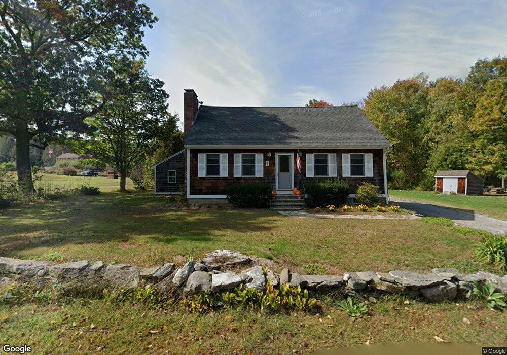
26 E End Rd Bolton, MA 01740
Estimated Value: $549,587 - $668,000
3
Beds
2
Baths
1,287
Sq Ft
$467/Sq Ft
Est. Value
About This Home
This home is located at 26 E End Rd, Bolton, MA 01740 and is currently estimated at $601,647, approximately $467 per square foot. 26 E End Rd is a home located in Worcester County with nearby schools including Florence Sawyer School, Nashoba Regional High School, and Darnell School For Educational & Behavioral Service.
Ownership History
Date
Name
Owned For
Owner Type
Purchase Details
Closed on
Oct 29, 2014
Sold by
Traylor Andrew D
Bought by
Traylor Andrew D and Traylor Kathleen S
Current Estimated Value
Purchase Details
Closed on
Dec 15, 2004
Sold by
Newell Doris R and Traylor Doris R
Bought by
Traylor Andrew D and Newell Doris R
Home Financials for this Owner
Home Financials are based on the most recent Mortgage that was taken out on this home.
Original Mortgage
$85,000
Interest Rate
5.68%
Mortgage Type
Purchase Money Mortgage
Create a Home Valuation Report for This Property
The Home Valuation Report is an in-depth analysis detailing your home's value as well as a comparison with similar homes in the area
Home Values in the Area
Average Home Value in this Area
Purchase History
| Date | Buyer | Sale Price | Title Company |
|---|---|---|---|
| Traylor Andrew D | -- | -- | |
| Traylor Andrew D | -- | -- |
Source: Public Records
Mortgage History
| Date | Status | Borrower | Loan Amount |
|---|---|---|---|
| Previous Owner | Traylor Andrew D | $85,000 |
Source: Public Records
Tax History
| Year | Tax Paid | Tax Assessment Tax Assessment Total Assessment is a certain percentage of the fair market value that is determined by local assessors to be the total taxable value of land and additions on the property. | Land | Improvement |
|---|---|---|---|---|
| 2025 | $7,843 | $471,900 | $187,500 | $284,400 |
| 2024 | $7,158 | $440,200 | $173,000 | $267,200 |
| 2023 | $6,365 | $363,700 | $173,000 | $190,700 |
| 2022 | $6,110 | $307,500 | $163,400 | $144,100 |
| 2021 | $6,110 | $292,900 | $163,400 | $129,500 |
| 2020 | $6,515 | $319,500 | $163,900 | $155,600 |
| 2019 | $6,202 | $303,000 | $159,200 | $143,800 |
| 2018 | $6,006 | $290,700 | $154,500 | $136,200 |
| 2017 | $5,796 | $273,400 | $149,800 | $123,600 |
| 2016 | $5,715 | $273,300 | $140,500 | $132,800 |
| 2015 | $4,974 | $237,100 | $131,100 | $106,000 |
| 2014 | $5,107 | $240,900 | $145,100 | $95,800 |
Source: Public Records
Map
Nearby Homes
- 98 Meadow Rd
- 90 Corn Rd
- 21 Sylvan Dr
- 99 Corn Rd
- 53 Sylvan Dr
- 13 Pine Hill Way
- 18 B Pine Hill Way Unit BB
- 16 A Pine Hill Way Unit 16AA
- 14 Pine Hill Way
- 54 Orchard Dr Unit 54
- 0 Long Hill Rd
- 28 Mcintosh Dr Unit 22
- 28 Mcintosh Dr
- 143 Hudson Rd
- 94 Hudson Rd
- 11 Quail Run
- 555 Old Harvard Rd
- 54 Main St
- 265 Manning St
- 385 Green Rd
- 19 E End Rd
- 36 E End Rd
- 20 E End Rd
- 115 Main St
- 3 E End Rd
- 0 Main St
- 0 Main St Unit 11348291
- 0 Main St Unit 1 72894680
- 49 E End Rd
- 10 Harris Farm Rd
- 14 Harris Farm Rd
- 1 Lt 1a Harris Farm Rd
- 7 Lt 7a Harris Farm Rd
- 2 Lt 2 Harris Farm Rd
- 6 L 6a Harris Farm Rd
- 5 Lot 5a Harris Farm Rd
- 8 Lot 8 Harris Farm Rd
- 4 L 4a Harris Farm Rd
- 58 E End Rd
- 9 Harris Farm Rd
Your Personal Tour Guide
Ask me questions while you tour the home.