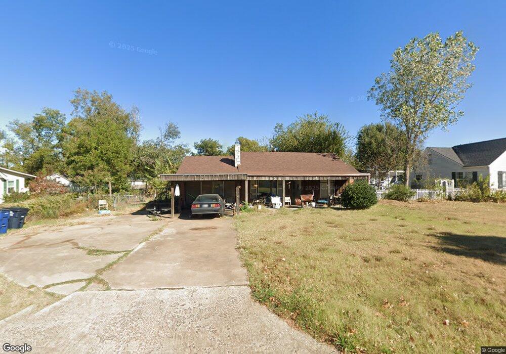
26 E Pulaski St Shawnee, OK 74804
Estimated Value: $147,000 - $233,000
3
Beds
2
Baths
2,444
Sq Ft
$79/Sq Ft
Est. Value
About This Home
This home is located at 26 E Pulaski St, Shawnee, OK 74804 and is currently estimated at $193,651, approximately $79 per square foot. 26 E Pulaski St is a home located in Pottawatomie County with nearby schools including Will Rogers Elementary School, Shawnee Middle School, and Shawnee High School.
Ownership History
Date
Name
Owned For
Owner Type
Purchase Details
Closed on
Jun 9, 2009
Sold by
Yellope Cynthia A
Bought by
Yellope Michael C
Current Estimated Value
Purchase Details
Closed on
Jul 1, 2005
Sold by
Simpson Billy Gene and Simpson Bill
Bought by
Yellope Michael C and Yellope Cynthia A
Home Financials for this Owner
Home Financials are based on the most recent Mortgage that was taken out on this home.
Original Mortgage
$90,155
Outstanding Balance
$46,100
Interest Rate
5.64%
Mortgage Type
New Conventional
Estimated Equity
$147,551
Create a Home Valuation Report for This Property
The Home Valuation Report is an in-depth analysis detailing your home's value as well as a comparison with similar homes in the area
Purchase History
| Date | Buyer | Sale Price | Title Company |
|---|---|---|---|
| Yellope Michael C | -- | None Available | |
| Yellope Michael C | $95,000 | None Available |
Source: Public Records
Mortgage History
| Date | Status | Borrower | Loan Amount |
|---|---|---|---|
| Open | Yellope Michael C | $90,155 |
Source: Public Records
Tax History
| Year | Tax Paid | Tax Assessment Tax Assessment Total Assessment is a certain percentage of the fair market value that is determined by local assessors to be the total taxable value of land and additions on the property. | Land | Improvement |
|---|---|---|---|---|
| 2025 | $1,436 | $15,389 | $987 | $14,402 |
| 2024 | $1,411 | $14,941 | $987 | $13,954 |
| 2023 | $1,411 | $14,506 | $1,620 | $12,886 |
| 2022 | $1,386 | $14,506 | $1,620 | $12,886 |
| 2021 | $1,343 | $14,506 | $1,620 | $12,886 |
| 2020 | $1,305 | $13,913 | $1,506 | $12,407 |
| 2019 | $1,306 | $13,508 | $1,419 | $12,089 |
| 2018 | $1,240 | $13,114 | $1,345 | $11,769 |
| 2017 | $1,184 | $12,733 | $1,244 | $11,489 |
| 2016 | $1,159 | $12,362 | $1,198 | $11,164 |
| 2015 | $1,100 | $12,001 | $1,069 | $10,932 |
| 2014 | $1,066 | $11,653 | $1,051 | $10,602 |
Source: Public Records
Map
Nearby Homes
- 2615 N Market Ave
- 115 W Georgia St
- 216 W Georgia St
- 2415 N Minnesota Cir
- 404 E Franklin St
- 3003 N Bell Ave
- 3306 N Oklahoma Ave
- 2304 N Tucker Ave
- 1921 N Bell Ave
- 3406 N Market Ave
- 806 E Midland St
- 1928 N Broadway Ave
- 1926 N Market Ave
- 1919 N Union Ave
- 1901 N Bell Ave
- 1822 N Philadelphia Ave
- 210 E Cammack
- 801 W Franklin St
- 815 W Franklin St
- 1725 N Louisa Ave
- 12 E Pulaski St
- 30 E Pulaski St
- 4 E Pulaski St
- 5 E Chicago St
- 2 E Pulaski St
- 15 E Pulaski St
- 11 E Chicago St
- 17 E Pulaski St
- 9 E Pulaski St
- 3 E Chicago St
- 102 E Pulaski St
- 5 E Pulaski St
- 21 E Pulaski St
- 1 E Pulaski St
- 105 E Chicago St
- 2525 N Bdwy Ave
- 104 E Pulaski St
- 2510 N Broadway Ave
- 107 E Chicago St
- 2429 N Bell Ave
Your Personal Tour Guide
Ask me questions while you tour the home.