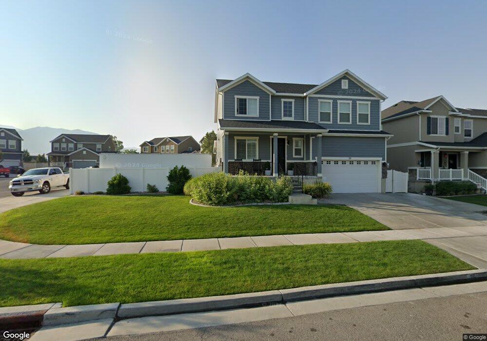
26 E Starside Dr Tooele, UT 84074
Estimated Value: $527,000 - $610,000
--
Bed
--
Bath
3,836
Sq Ft
$149/Sq Ft
Est. Value
About This Home
This home is located at 26 E Starside Dr, Tooele, UT 84074 and is currently estimated at $571,664, approximately $149 per square foot. 26 E Starside Dr is a home with nearby schools including Old Mill Elementary School, Clarke N. Johnsen Junior High School, and Stansbury High School.
Ownership History
Date
Name
Owned For
Owner Type
Purchase Details
Closed on
Jul 14, 2020
Sold by
Ringwood Forrest Shaun and Ringwood Jennifer Lee
Bought by
Ringwood Forrest and Ringwood Jennifer
Current Estimated Value
Home Financials for this Owner
Home Financials are based on the most recent Mortgage that was taken out on this home.
Original Mortgage
$227,165
Outstanding Balance
$193,440
Interest Rate
3.1%
Mortgage Type
New Conventional
Estimated Equity
$378,224
Purchase Details
Closed on
Dec 30, 2016
Sold by
Richmond American Homes Of Utah Inc
Bought by
Ringwood Forrest Shaun and Ringwood Jennifer Lee
Home Financials for this Owner
Home Financials are based on the most recent Mortgage that was taken out on this home.
Original Mortgage
$234,374
Interest Rate
3.94%
Mortgage Type
New Conventional
Create a Home Valuation Report for This Property
The Home Valuation Report is an in-depth analysis detailing your home's value as well as a comparison with similar homes in the area
Home Values in the Area
Average Home Value in this Area
Purchase History
| Date | Buyer | Sale Price | Title Company |
|---|---|---|---|
| Ringwood Forrest | -- | Meridian Title Company | |
| Ringwood Forrest Shaun | -- | First American Title Insuran |
Source: Public Records
Mortgage History
| Date | Status | Borrower | Loan Amount |
|---|---|---|---|
| Open | Ringwood Forrest | $227,165 | |
| Closed | Ringwood Forrest Shaun | $234,374 |
Source: Public Records
Tax History Compared to Growth
Tax History
| Year | Tax Paid | Tax Assessment Tax Assessment Total Assessment is a certain percentage of the fair market value that is determined by local assessors to be the total taxable value of land and additions on the property. | Land | Improvement |
|---|---|---|---|---|
| 2025 | $3,506 | $551,023 | $135,200 | $415,823 |
| 2024 | $3,841 | $300,925 | $74,360 | $226,565 |
| 2023 | $3,841 | $289,506 | $78,430 | $211,076 |
| 2022 | $2,163 | $195,304 | $42,680 | $152,624 |
| 2021 | $2,580 | $195,304 | $42,680 | $152,624 |
| 2020 | $2,670 | $355,098 | $77,600 | $277,498 |
| 2019 | $2,703 | $355,098 | $77,600 | $277,498 |
| 2018 | $2,633 | $327,498 | $50,000 | $277,498 |
| 2017 | $2,456 | $327,498 | $50,000 | $277,498 |
| 2016 | $676 | $50,000 | $50,000 | $0 |
| 2015 | $676 | $50,000 | $0 | $0 |
| 2014 | -- | $12,500 | $0 | $0 |
Source: Public Records
Map
Nearby Homes
- 33 E Delgada Ln
- 6545 N Valley Point Way
- 6628 Malachite Way
- 6496 Spur Ln N Unit 1219
- 5742 N Gray Hawk Dr
- 6488 N Spur Ln
- 6508 N Spur Ln Unit 1220
- 6508 N Spur Ln
- 6445 Black Ridge Dr
- 173 Lakeview Dr
- 6456 Black Ridge Dr
- Ammolite Plan at Wild Horse Ranch
- Pearl Plan at Wild Horse Ranch
- 343 W Wrangler Cove
- Moonstone Plan at Wild Horse Ranch
- 331 W Wrangler Cove
- 307 W Box Creek Dr Unit 101
- Citrine Plan at Wild Horse Ranch
- 42 Millpond
- 364 W Hideout Ct
- 25 W Starside Dr
- 22 E Starside Dr
- 6509 N Valley Point Way
- 14 E Starside Dr
- 6497 N Valley Point Way
- 6535 N Valley Point Way
- 44 E Starside Dr
- 8 E Starside Dr
- 6474 N Sunset Ridge Ct
- 6498 N Valley Point Way
- 6510 N Valley Point Way Unit 334
- 6530 N Valley Point Way
- 11 E Starside Dr
- 6549 N Valley Point Way Unit 359
- 6549 N Valley Point Way
- 6470 N Sunset Ridge Ct
- 6534 N Valley Point Way
- 6553 N Valley Point Way Unit 358
- 7 E Starside Dr Unit 337
- 7 E Starside Dr