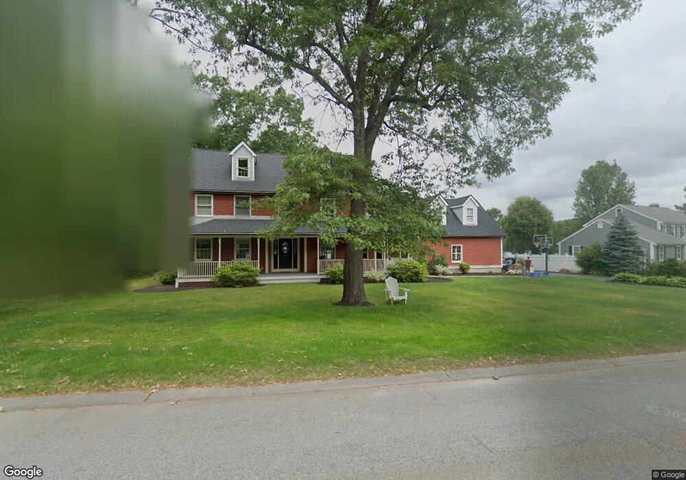
26 Emerson Rd East Walpole, MA 02032
Estimated Value: $1,208,803 - $1,375,000
4
Beds
3
Baths
3,451
Sq Ft
$381/Sq Ft
Est. Value
About This Home
This home is located at 26 Emerson Rd, East Walpole, MA 02032 and is currently estimated at $1,315,701, approximately $381 per square foot. 26 Emerson Rd is a home located in Norfolk County with nearby schools including Old Post Road School, Walpole Middle School, and Walpole High School.
Create a Home Valuation Report for This Property
The Home Valuation Report is an in-depth analysis detailing your home's value as well as a comparison with similar homes in the area
Home Values in the Area
Average Home Value in this Area
Tax History Compared to Growth
Tax History
| Year | Tax Paid | Tax Assessment Tax Assessment Total Assessment is a certain percentage of the fair market value that is determined by local assessors to be the total taxable value of land and additions on the property. | Land | Improvement |
|---|---|---|---|---|
| 2025 | $14,937 | $1,164,200 | $369,200 | $795,000 |
| 2024 | $14,371 | $1,087,100 | $355,000 | $732,100 |
| 2023 | $13,247 | $953,700 | $308,700 | $645,000 |
| 2022 | $12,073 | $834,900 | $285,900 | $549,000 |
| 2021 | $11,893 | $801,400 | $269,700 | $531,700 |
| 2020 | $11,162 | $744,600 | $254,400 | $490,200 |
| 2019 | $11,106 | $735,500 | $264,200 | $471,300 |
| 2018 | $11,220 | $734,800 | $255,000 | $479,800 |
| 2017 | $10,916 | $712,100 | $245,200 | $466,900 |
| 2016 | $10,603 | $681,400 | $236,000 | $445,400 |
| 2015 | $10,321 | $657,400 | $224,900 | $432,500 |
| 2014 | $9,965 | $632,300 | $224,900 | $407,400 |
Source: Public Records
Map
Nearby Homes
- 486 Washington St
- 2 Alexandra Way
- 270 Moosehill Rd
- 363 - 367 Washington St
- 1 Palace Ct
- 52 Baker St
- 11 Park Ln
- Unit 11 Powder House Ln Unit 11
- 8 Powder House Ln Unit 2
- Unit 12 Powder House Ln Unit 12
- Unit 3 Powder House Ln Unit 3
- 7 Washington Green
- 8 Rainbow Pond Dr Unit 8
- 4403 Pennington Dr Unit 4403
- 5 Powder House Ln Unit 14
- 2213 Pennington Dr Unit 2213
- 0 Charlotte Rd
- 305 Centre Ln
- 22 Coolidge Rd
- 256 Norwood St