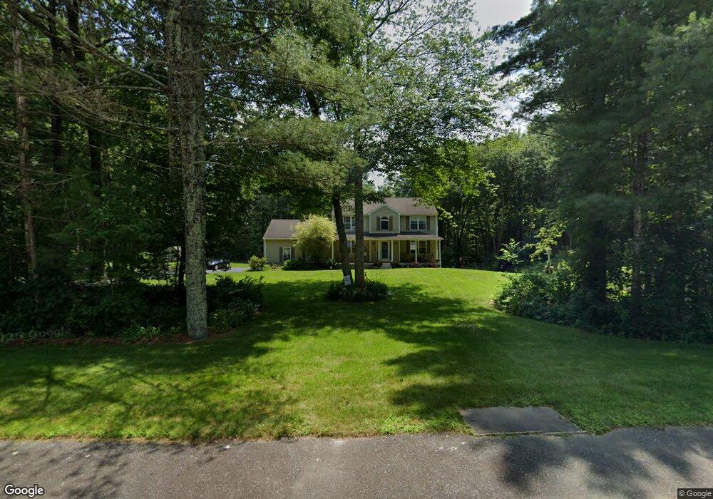
26 Foxwood Ln Uxbridge, MA 01569
Estimated Value: $631,000 - $779,000
3
Beds
3
Baths
1,960
Sq Ft
$358/Sq Ft
Est. Value
About This Home
This home is located at 26 Foxwood Ln, Uxbridge, MA 01569 and is currently estimated at $701,928, approximately $358 per square foot. 26 Foxwood Ln is a home located in Worcester County with nearby schools including Uxbridge High School.
Ownership History
Date
Name
Owned For
Owner Type
Purchase Details
Closed on
Dec 17, 1997
Sold by
Trees To Keys Inc
Bought by
Ensom Ted W and Ensom Lori A
Current Estimated Value
Home Financials for this Owner
Home Financials are based on the most recent Mortgage that was taken out on this home.
Original Mortgage
$120,000
Interest Rate
7.14%
Mortgage Type
Purchase Money Mortgage
Create a Home Valuation Report for This Property
The Home Valuation Report is an in-depth analysis detailing your home's value as well as a comparison with similar homes in the area
Home Values in the Area
Average Home Value in this Area
Purchase History
| Date | Buyer | Sale Price | Title Company |
|---|---|---|---|
| Ensom Ted W | $197,900 | -- |
Source: Public Records
Mortgage History
| Date | Status | Borrower | Loan Amount |
|---|---|---|---|
| Open | Ensom Ted W | $80,000 | |
| Closed | Ensom Ted W | $120,000 |
Source: Public Records
Tax History Compared to Growth
Tax History
| Year | Tax Paid | Tax Assessment Tax Assessment Total Assessment is a certain percentage of the fair market value that is determined by local assessors to be the total taxable value of land and additions on the property. | Land | Improvement |
|---|---|---|---|---|
| 2025 | $80 | $613,200 | $176,200 | $437,000 |
| 2024 | $7,625 | $590,200 | $167,500 | $422,700 |
| 2023 | $7,274 | $521,400 | $144,400 | $377,000 |
| 2022 | $6,581 | $434,100 | $127,000 | $307,100 |
| 2021 | $6,231 | $393,900 | $124,400 | $269,500 |
| 2020 | $6,351 | $379,400 | $122,600 | $256,800 |
| 2019 | $6,040 | $348,100 | $122,600 | $225,500 |
| 2018 | $5,889 | $343,000 | $122,600 | $220,400 |
| 2017 | $5,361 | $316,100 | $112,900 | $203,200 |
| 2016 | $5,728 | $326,000 | $117,900 | $208,100 |
| 2015 | $5,605 | $322,100 | $117,900 | $204,200 |
Source: Public Records
Map
Nearby Homes
- 405 West St
- 104 Eber Taft Rd
- 153 Davis St
- 138 Mantell Rd
- 145 Mantell Rd
- 169 Mantell Rd
- 137 Mantell Rd
- 33 Summerfield Dr Unit 33
- 296 Yew St
- 395 High St
- 103 Uxbridge St
- 127 Turner Farm Rd
- 139 Turner Farm Rd
- 117 Turner Farm Rd
- 100 Spring Hill Dr Unit 100
- Layla Plan at Pine Ridge
- Ashley Plan at Pine Ridge
- Lily Plan at Pine Ridge
- Brooklyn Plan at Pine Ridge
- Tucker Plan at Pine Ridge
- 32 Lot 32 Foxwoods
- 36 Foxwood Ln
- 25 Foxwood Ln
- 18 Lot 18 Foxwoods
- 17 Lot 17 Foxwoods
- 35 Foxwood Ln
- 4 Wildlife Dr
- 0 Foxwoods Lane L-31 Unit 50481249
- 15 Foxwood Ln
- 16 Foxwood Ln
- 3 Wildlife Dr
- 5 Foxwood Ln
- 3 Deer View Ln
- 6 Foxwood Ln
- 2 Deer View Ln
- 4 Deer View Ln
- 6 Longmeadow Rd
- 16 Longmeadow Rd
- 485 West St
- 475 West St