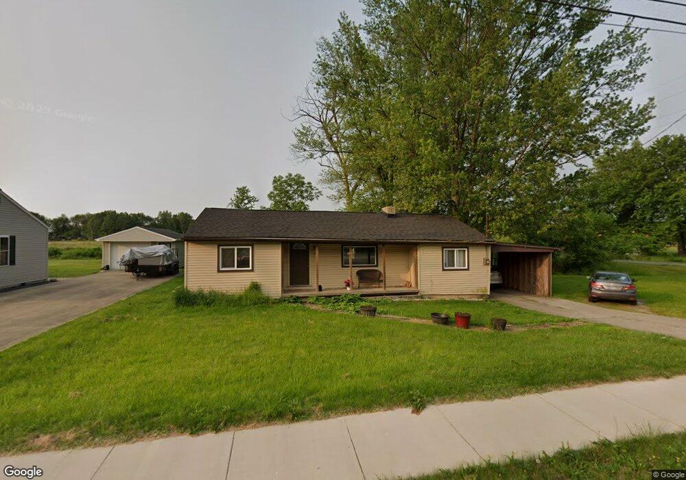
26 Gallup Ave Norwalk, OH 44857
Estimated Value: $108,159 - $156,000
3
Beds
1
Bath
1,080
Sq Ft
$118/Sq Ft
Est. Value
About This Home
This home is located at 26 Gallup Ave, Norwalk, OH 44857 and is currently estimated at $127,540, approximately $118 per square foot. 26 Gallup Ave is a home located in Huron County with nearby schools including Maplehurst Elementary School, League Elementary School, and Pleasant Elementary School.
Ownership History
Date
Name
Owned For
Owner Type
Purchase Details
Closed on
Jan 8, 2021
Sold by
Carroll Shirley and Carroll Emmitt
Bought by
Howk David S
Current Estimated Value
Home Financials for this Owner
Home Financials are based on the most recent Mortgage that was taken out on this home.
Original Mortgage
$69,525
Outstanding Balance
$56,483
Interest Rate
2.7%
Mortgage Type
Future Advance Clause Open End Mortgage
Estimated Equity
$71,057
Purchase Details
Closed on
Dec 11, 2002
Sold by
Fleet Hatley Est
Bought by
Owens Sheila Kay H
Purchase Details
Closed on
Nov 25, 1991
Bought by
Hatley Fleet
Create a Home Valuation Report for This Property
The Home Valuation Report is an in-depth analysis detailing your home's value as well as a comparison with similar homes in the area
Home Values in the Area
Average Home Value in this Area
Purchase History
| Date | Buyer | Sale Price | Title Company |
|---|---|---|---|
| Howk David S | $77,300 | Chicago Title | |
| Owens Sheila Kay H | -- | -- | |
| Hatley Fleet | -- | -- |
Source: Public Records
Mortgage History
| Date | Status | Borrower | Loan Amount |
|---|---|---|---|
| Open | Howk David S | $69,525 |
Source: Public Records
Tax History Compared to Growth
Tax History
| Year | Tax Paid | Tax Assessment Tax Assessment Total Assessment is a certain percentage of the fair market value that is determined by local assessors to be the total taxable value of land and additions on the property. | Land | Improvement |
|---|---|---|---|---|
| 2024 | $1,157 | $28,350 | $6,940 | $21,410 |
| 2023 | $1,157 | $24,580 | $5,860 | $18,720 |
| 2022 | $991 | $24,580 | $5,860 | $18,720 |
| 2021 | $991 | $24,580 | $5,860 | $18,720 |
| 2020 | $1,003 | $23,180 | $5,860 | $17,320 |
| 2019 | $982 | $23,180 | $5,860 | $17,320 |
| 2018 | $965 | $23,180 | $5,860 | $17,320 |
| 2017 | $874 | $20,890 | $5,860 | $15,030 |
| 2016 | $1,013 | $24,650 | $5,860 | $18,790 |
| 2015 | $1,012 | $24,650 | $5,860 | $18,790 |
| 2014 | $1,021 | $24,650 | $5,850 | $18,800 |
| 2013 | $891 | $24,650 | $5,850 | $18,800 |
Source: Public Records
Map
Nearby Homes
- 0 Milan Ave
- 14 Republic St
- 6 Blossom Dr Unit B
- 107 Gallup Ave
- 6 White Tail Way Unit A
- 33 Falcon Crest Dr Unit C
- 19 Deer Track Trail
- 45 Grove Ave
- 203 Spino St
- 32 Stower Ln
- 11 Deer Track Trail Unit A
- 230 Whittlesey Ave Unit 72
- 230 Whittlesey Ave Unit 46
- 154 Gallup Ave
- 13 Spring St
- 173 Saint Marys St
- 4 Deer Track Trail Unit A
- 15 E Washington St
- 42 Grassland Cir
- 57 Milan Ave