Estimated Value: $157,539 - $173,000
3
Beds
1
Bath
1,078
Sq Ft
$150/Sq Ft
Est. Value
About This Home
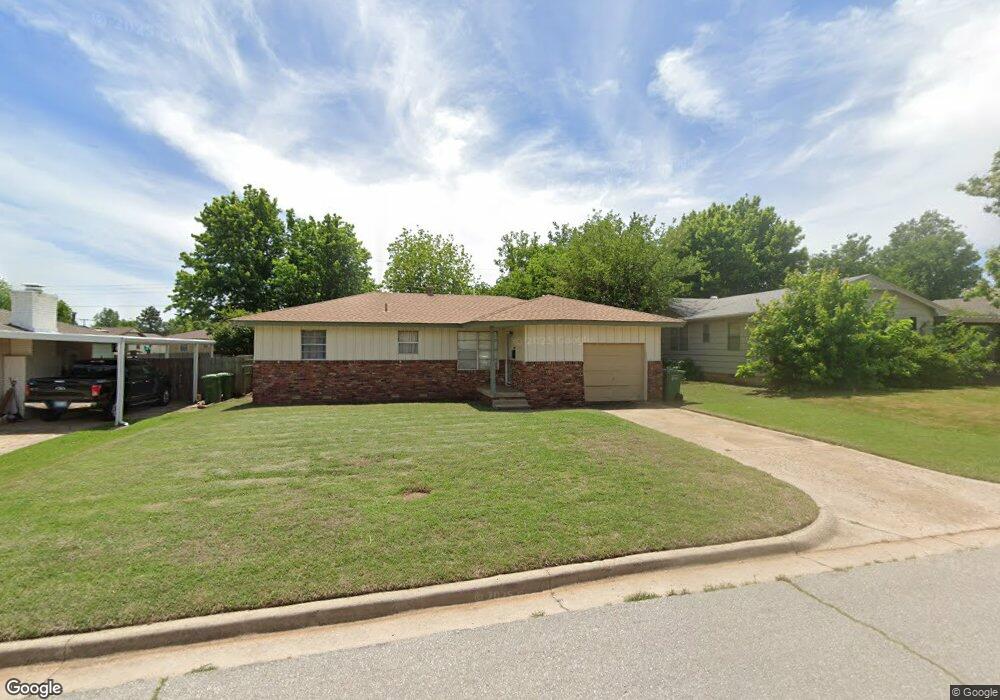
This home is located at 26 Glenda Dr, Yukon, OK 73099 and is currently estimated at $161,635, approximately $149 per square foot. 26 Glenda Dr is a home located in Canadian County with nearby schools including Myers Elementary School, Independence Elementary School, and Yukon Middle School.
Ownership History
Date
Name
Owned For
Owner Type
Purchase Details
Closed on
Dec 31, 2007
Sold by
Broderdor Robert Edward
Bought by
Wheeler Rhonda K
Current Estimated Value
Home Financials for this Owner
Home Financials are based on the most recent Mortgage that was taken out on this home.
Original Mortgage
$81,307
Interest Rate
5.47%
Mortgage Type
FHA
Purchase Details
Closed on
Jul 23, 1992
Purchase Details
Closed on
Feb 18, 1992
Purchase Details
Closed on
Aug 31, 1990
Create a Home Valuation Report for This Property
The Home Valuation Report is an in-depth analysis detailing your home's value as well as a comparison with similar homes in the area
Home Values in the Area
Average Home Value in this Area
Purchase History
| Date | Buyer | Sale Price | Title Company |
|---|---|---|---|
| Wheeler Rhonda K | $61,500 | None Available | |
| -- | -- | -- | |
| -- | $52,200 | -- | |
| -- | $49,500 | -- |
Source: Public Records
Mortgage History
| Date | Status | Borrower | Loan Amount |
|---|---|---|---|
| Previous Owner | Wheeler Rhonda K | $81,307 |
Source: Public Records
Tax History Compared to Growth
Tax History
| Year | Tax Paid | Tax Assessment Tax Assessment Total Assessment is a certain percentage of the fair market value that is determined by local assessors to be the total taxable value of land and additions on the property. | Land | Improvement |
|---|---|---|---|---|
| 2024 | $1,288 | $12,485 | $1,980 | $10,505 |
| 2023 | $1,288 | $11,891 | $1,980 | $9,911 |
| 2022 | $1,233 | $11,325 | $1,980 | $9,345 |
| 2021 | $1,177 | $10,785 | $1,980 | $8,805 |
| 2020 | $1,176 | $10,901 | $1,980 | $8,921 |
| 2019 | $1,137 | $10,510 | $1,980 | $8,530 |
| 2018 | $1,086 | $10,010 | $1,980 | $8,030 |
| 2017 | $1,035 | $9,533 | $1,980 | $7,553 |
| 2016 | $1,006 | $9,267 | $1,980 | $7,287 |
| 2015 | $989 | $8,871 | $1,980 | $6,891 |
| 2014 | $989 | $8,968 | $1,980 | $6,988 |
Source: Public Records
Map
Nearby Homes
- 14512 Rochefort Ln
- 14524 Giverny Ln
- 14500 Giverny Ln
- 114 Larry Ave
- 1805 Janeen St
- 0 Landon Ln
- 117 Asbill Ave
- 1421 Spring Creek Dr
- 332 W Platt Dr
- 1308 Holly Ave
- 1005 S 3rd St
- 1521 Spring Creek Dr
- 129 W Parkland Dr
- 301 Fay Ave
- 205 W Parkland Dr
- 904 Glenwood Dr
- 116 E Parkland Dr
- 11200 SW 32nd St
- 11501 NW 97th St
- 1008 Queensboro Place