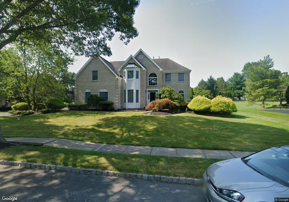
26 Hawthorne Dr Princeton Junction, NJ 08550
Estimated Value: $1,257,206 - $1,439,000
--
Bed
--
Bath
3,221
Sq Ft
$414/Sq Ft
Est. Value
About This Home
This home is located at 26 Hawthorne Dr, Princeton Junction, NJ 08550 and is currently estimated at $1,334,802, approximately $414 per square foot. 26 Hawthorne Dr is a home located in Mercer County with nearby schools including Village Elementary School, Dutch Neck Elementary School, and Community Middle School.
Ownership History
Date
Name
Owned For
Owner Type
Purchase Details
Closed on
Jun 24, 2002
Sold by
Magid Abou Gharbia
Bought by
Ferguson Alan and Ferguson Susan
Current Estimated Value
Home Financials for this Owner
Home Financials are based on the most recent Mortgage that was taken out on this home.
Original Mortgage
$450,000
Outstanding Balance
$190,001
Interest Rate
6.79%
Mortgage Type
Purchase Money Mortgage
Estimated Equity
$1,144,801
Purchase Details
Closed on
Apr 28, 1995
Sold by
Calton Homes Inc
Bought by
Gharbia Magid Abow and Shalaby Lamaa
Home Financials for this Owner
Home Financials are based on the most recent Mortgage that was taken out on this home.
Original Mortgage
$240,000
Interest Rate
8.36%
Mortgage Type
Purchase Money Mortgage
Create a Home Valuation Report for This Property
The Home Valuation Report is an in-depth analysis detailing your home's value as well as a comparison with similar homes in the area
Home Values in the Area
Average Home Value in this Area
Purchase History
| Date | Buyer | Sale Price | Title Company |
|---|---|---|---|
| Ferguson Alan | $649,900 | -- | |
| Gharbia Magid Abow | $349,700 | -- |
Source: Public Records
Mortgage History
| Date | Status | Borrower | Loan Amount |
|---|---|---|---|
| Open | Ferguson Alan | $450,000 | |
| Previous Owner | Gharbia Magid Abow | $240,000 |
Source: Public Records
Tax History Compared to Growth
Tax History
| Year | Tax Paid | Tax Assessment Tax Assessment Total Assessment is a certain percentage of the fair market value that is determined by local assessors to be the total taxable value of land and additions on the property. | Land | Improvement |
|---|---|---|---|---|
| 2025 | $22,914 | $747,600 | $297,500 | $450,100 |
| 2024 | $21,957 | $747,600 | $297,500 | $450,100 |
| 2023 | $21,957 | $747,600 | $297,500 | $450,100 |
| 2022 | $21,531 | $747,600 | $297,500 | $450,100 |
| 2021 | $21,351 | $747,600 | $297,500 | $450,100 |
| 2020 | $20,963 | $747,600 | $297,500 | $450,100 |
| 2019 | $20,723 | $747,600 | $297,500 | $450,100 |
| 2018 | $20,529 | $747,600 | $297,500 | $450,100 |
| 2017 | $20,103 | $747,600 | $297,500 | $450,100 |
| 2016 | $19,669 | $747,600 | $297,500 | $450,100 |
| 2015 | $19,213 | $747,600 | $297,500 | $450,100 |
| 2014 | $18,989 | $747,600 | $297,500 | $450,100 |
Source: Public Records
Map
Nearby Homes
- 19 Shadow Dr
- 16 Spruce St
- 10 Manor Ridge Dr
- 22 Slayback Dr
- 5 Glengarry Way
- 42 Nassau Place
- 32 W Kincaid Dr
- 12 Ziff La
- 12 Ziff Ln
- 44 Sapphire Dr
- 24 Hereford Dr
- 75 Honeyflower Ln
- 3 Yorktowne Ct
- 26 Rainflower La
- 1 Hawk Dr
- 84 Rainflower La
- 17 Grande Blvd
- 53 N Post Rd
- 6 Grande Blvd
- 90 Princeton Hightstown Rd
- 24 Hawthorne Dr
- 28 Hawthorne Dr
- 2 Shadow Dr
- 26 Huntington Dr
- 24 Huntington Dr
- 22 Hawthorne Dr
- 30 Hawthorne Dr
- 2 Shelton Ct
- 4 Shadow Dr
- 25 Hawthorne Dr
- 22 Huntington Dr
- 20 Hawthorne Dr
- 29 Hawthorne Dr
- 32 Hawthorne Dr
- 31 Hawthorne Dr
- 23 Hawthorne Dr
- 8 Shadow Dr
- 4 Shelton Ct
- 20 Huntington Dr
- 5 Shadow Dr