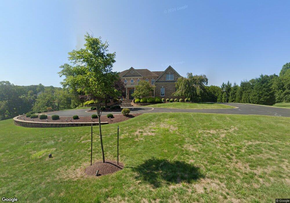
26 Hayhurst Dr Newtown, PA 18940
Estimated Value: $2,079,850 - $2,787,000
4
Beds
5
Baths
6,810
Sq Ft
$344/Sq Ft
Est. Value
About This Home
This home is located at 26 Hayhurst Dr, Newtown, PA 18940 and is currently estimated at $2,345,950, approximately $344 per square foot. 26 Hayhurst Dr is a home located in Bucks County with nearby schools including Sol Feinstone Elementary School, Newtown Middle School, and Council Rock High School North.
Ownership History
Date
Name
Owned For
Owner Type
Purchase Details
Closed on
Nov 17, 2022
Sold by
Patel Sham and Patel Daxa
Bought by
Patel Sehul and Patel Manisha
Current Estimated Value
Purchase Details
Closed on
Oct 30, 2017
Sold by
Khan Zafar and Khan Noreen
Bought by
Patel Sham and Patel Daxa
Purchase Details
Closed on
Oct 24, 2008
Sold by
Toll Pa Ii Lp
Bought by
Khan Zafar and Khan Noreen
Home Financials for this Owner
Home Financials are based on the most recent Mortgage that was taken out on this home.
Original Mortgage
$300,000
Interest Rate
6.08%
Mortgage Type
Unknown
Create a Home Valuation Report for This Property
The Home Valuation Report is an in-depth analysis detailing your home's value as well as a comparison with similar homes in the area
Home Values in the Area
Average Home Value in this Area
Purchase History
| Date | Buyer | Sale Price | Title Company |
|---|---|---|---|
| Patel Sehul | $1,270,000 | Cross Keys Abstract & Assuranc | |
| Patel Sham | $1,190,000 | Cross Keys Abstract | |
| Khan Zafar | $1,485,160 | None Available |
Source: Public Records
Mortgage History
| Date | Status | Borrower | Loan Amount |
|---|---|---|---|
| Previous Owner | Khan Zafar | $300,000 |
Source: Public Records
Tax History Compared to Growth
Tax History
| Year | Tax Paid | Tax Assessment Tax Assessment Total Assessment is a certain percentage of the fair market value that is determined by local assessors to be the total taxable value of land and additions on the property. | Land | Improvement |
|---|---|---|---|---|
| 2025 | $21,049 | $123,050 | $14,270 | $108,780 |
| 2024 | $21,049 | $123,050 | $14,270 | $108,780 |
| 2023 | $20,471 | $123,050 | $14,270 | $108,780 |
| 2022 | $20,366 | $123,050 | $14,270 | $108,780 |
| 2021 | $20,090 | $123,050 | $14,270 | $108,780 |
| 2020 | $19,608 | $123,050 | $14,270 | $108,780 |
| 2019 | $19,154 | $123,050 | $14,270 | $108,780 |
| 2018 | $18,797 | $123,050 | $14,270 | $108,780 |
| 2017 | $18,282 | $123,050 | $14,270 | $108,780 |
| 2016 | $18,559 | $123,050 | $14,270 | $108,780 |
| 2015 | -- | $123,050 | $14,270 | $108,780 |
| 2014 | -- | $123,050 | $14,270 | $108,780 |
Source: Public Records
Map
Nearby Homes
- 8 Keith Ln
- 19 Goldney Dr
- 457 Brownsburg Rd Unit W
- 439 Brownsburg Rd Unit W
- 1089 Eagle Rd
- 3 Tines Field Path
- Lot 4 Ava Ct
- 2034 Woodland Rd
- 220 Stoopville Rd
- 7 Grace Cir
- 313 Matthews Ln
- 316 Monterey Place
- 309 Matthews Ln
- 291 Sequoia Dr
- 101 Laurel Cir
- 83 Cypress Place
- 288 Jane Chapman Dr E Unit E
- 4 Gladiola Cir
- 509 Wheatfield Ln
- 2204 Society Place Unit B2
- 24 Hayhurst Dr
- 28 Hayhurst Dr
- 16 Keith Ln
- 27 Hayhurst Dr
- 12 Keith Ln
- 22 Hayhurst Dr
- 18 Keith Ln
- 21 Hayhurst Dr
- 10 Keith Ln
- 21 Keith Ln
- 20 Keith Ln
- 20 Hayhurst Dr Unit 6
- 20 Hayhurst Dr
- 19 Hayhurst Dr
- 0 Hayhurst Dr Unit 1008111576
- 0 Hayhurst Dr Unit 1008111554
- 0 Hayhurst Dr Unit 1006925676
- 0 Hayhurst Dr
- 0 Hayhurst Dr Unit 5299891
- 0 Hayhurst Dr Unit 5299881