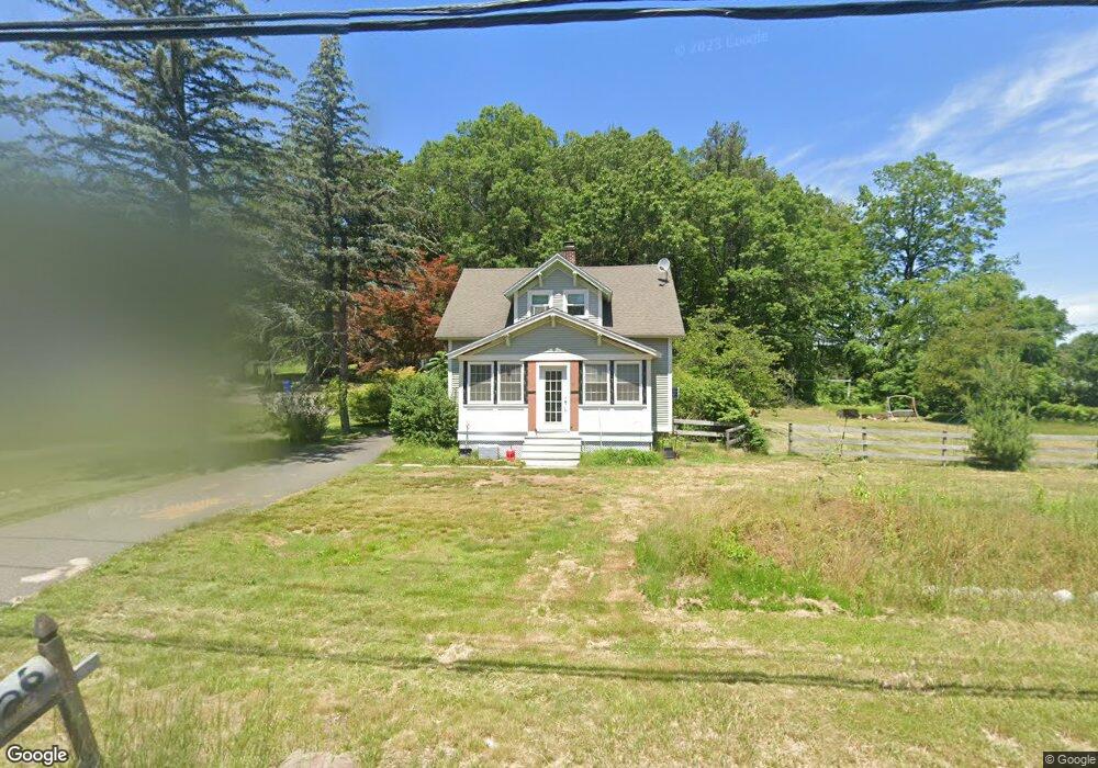
26 Hoskins Rd Simsbury, CT 06070
Estimated Value: $353,000 - $416,000
3
Beds
1
Bath
1,307
Sq Ft
$287/Sq Ft
Est. Value
About This Home
This home is located at 26 Hoskins Rd, Simsbury, CT 06070 and is currently estimated at $375,461, approximately $287 per square foot. 26 Hoskins Rd is a home located in Hartford County with nearby schools including Squadron Line School, Henry James Memorial School, and Simsbury High School.
Ownership History
Date
Name
Owned For
Owner Type
Purchase Details
Closed on
Jul 16, 2001
Sold by
Lashar Susan E
Bought by
Lange Kevin W and Lange Erika
Current Estimated Value
Purchase Details
Closed on
May 28, 1998
Sold by
Avery George and Avery Gertrude
Bought by
Lashas Susan
Create a Home Valuation Report for This Property
The Home Valuation Report is an in-depth analysis detailing your home's value as well as a comparison with similar homes in the area
Home Values in the Area
Average Home Value in this Area
Purchase History
| Date | Buyer | Sale Price | Title Company |
|---|---|---|---|
| Lange Kevin W | $136,000 | -- | |
| Lashas Susan | $109,000 | -- |
Source: Public Records
Mortgage History
| Date | Status | Borrower | Loan Amount |
|---|---|---|---|
| Closed | Lashas Susan | $31,400 | |
| Open | Lashas Susan | $172,000 | |
| Closed | Lashas Susan | $138,000 | |
| Closed | Lashas Susan | $31,100 |
Source: Public Records
Tax History Compared to Growth
Tax History
| Year | Tax Paid | Tax Assessment Tax Assessment Total Assessment is a certain percentage of the fair market value that is determined by local assessors to be the total taxable value of land and additions on the property. | Land | Improvement |
|---|---|---|---|---|
| 2025 | $5,918 | $173,250 | $80,500 | $92,750 |
| 2024 | $5,771 | $173,250 | $80,500 | $92,750 |
| 2023 | $5,513 | $173,250 | $80,500 | $92,750 |
| 2022 | $5,811 | $150,440 | $78,750 | $71,690 |
| 2021 | $5,811 | $150,440 | $78,750 | $71,690 |
| 2020 | $5,580 | $150,440 | $78,750 | $71,690 |
| 2019 | $5,614 | $150,440 | $78,750 | $71,690 |
| 2018 | $5,655 | $150,440 | $78,750 | $71,690 |
| 2017 | $5,456 | $140,770 | $76,730 | $64,040 |
| 2016 | $5,225 | $140,770 | $76,730 | $64,040 |
| 2015 | $5,225 | $140,770 | $76,730 | $64,040 |
| 2014 | $5,228 | $140,770 | $76,730 | $64,040 |
Source: Public Records
Map
Nearby Homes
- 45 Hoskins Rd
- 19 Simsbury Landing
- 26 Winterset Ln
- 14 Gordon St
- 21 Berkshire Way
- 16 Berkshire Way
- 7 Knollwood Cir
- 14 Brettonwood Dr
- 11 Mallard Cir
- 2 Quail Dr Unit 2
- 14 Teal Cir Unit 14
- 23 Maple St
- 324 Firetown Rd
- 65 Chriswell Dr
- 14 Main Street Extension
- 9 Tunxis Place
- 19 Elaine Dr
- 5 Tunxis Place Unit C
- 141 Firetown Rd
- 24 Hunting Ridge Dr