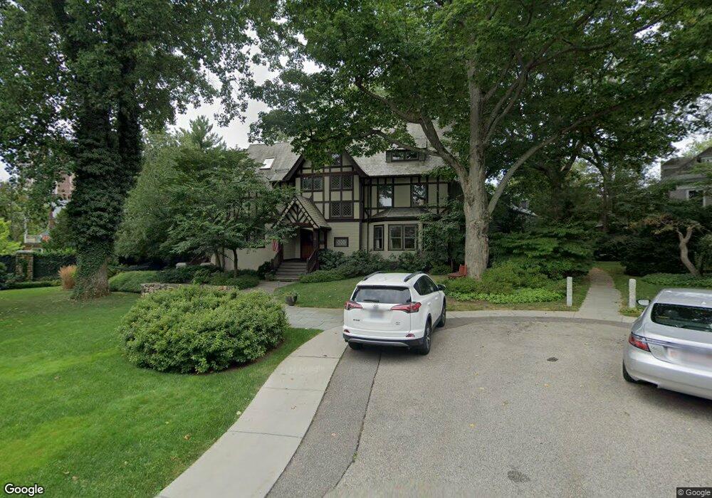
26 Hubbard Park Rd Cambridge, MA 02138
West Cambridge NeighborhoodEstimated Value: $5,681,000 - $7,183,000
6
Beds
5
Baths
5,328
Sq Ft
$1,253/Sq Ft
Est. Value
About This Home
This home is located at 26 Hubbard Park Rd, Cambridge, MA 02138 and is currently estimated at $6,678,218, approximately $1,253 per square foot. 26 Hubbard Park Rd is a home located in Middlesex County with nearby schools including St Peter School, Cambridge Montessori School, and Shady Hill School.
Ownership History
Date
Name
Owned For
Owner Type
Purchase Details
Closed on
Jul 13, 2007
Sold by
Smith Jean M and Mason Smith W
Bought by
Three Maples T and Subbiah Ilavenil
Current Estimated Value
Create a Home Valuation Report for This Property
The Home Valuation Report is an in-depth analysis detailing your home's value as well as a comparison with similar homes in the area
Home Values in the Area
Average Home Value in this Area
Purchase History
| Date | Buyer | Sale Price | Title Company |
|---|---|---|---|
| Three Maples T | $3,800,000 | -- |
Source: Public Records
Tax History Compared to Growth
Tax History
| Year | Tax Paid | Tax Assessment Tax Assessment Total Assessment is a certain percentage of the fair market value that is determined by local assessors to be the total taxable value of land and additions on the property. | Land | Improvement |
|---|---|---|---|---|
| 2025 | $48,154 | $7,583,300 | $3,100,500 | $4,482,800 |
| 2024 | $43,254 | $7,306,500 | $3,075,600 | $4,230,900 |
| 2023 | $39,858 | $6,801,700 | $3,063,200 | $3,738,500 |
| 2022 | $35,993 | $6,079,900 | $2,772,300 | $3,307,600 |
| 2021 | $34,286 | $5,860,800 | $2,720,500 | $3,140,300 |
| 2020 | $32,063 | $5,576,200 | $2,603,600 | $2,972,600 |
| 2019 | $29,317 | $4,935,500 | $2,193,000 | $2,742,500 |
| 2018 | $30,517 | $4,851,600 | $2,181,800 | $2,669,800 |
| 2017 | $30,047 | $4,629,700 | $2,080,500 | $2,549,200 |
| 2016 | $29,147 | $4,169,800 | $1,799,400 | $2,370,400 |
| 2015 | $29,710 | $3,799,200 | $1,687,000 | $2,112,200 |
| 2014 | $31,215 | $3,724,900 | $1,642,000 | $2,082,900 |
Source: Public Records
Map
Nearby Homes
- 48 Hubbard Park Rd
- 15 Hubbard Park Rd
- 158 Brattle St
- 20 Maynard Place
- 153 Brattle St
- 1010 Memorial Dr Unit 6G
- 172 Brattle St
- 234 Huron Ave
- 3 Berkeley Place
- 32 Hawthorn St
- 12 Berkeley St
- 71-73 Reservoir St
- 988 Memorial Dr Unit 386
- 22 Concord Ave Unit 10
- 92 Fayerweather St Unit 2
- 5 Brewer St Unit 5
- 148 Huron Ave
- 422-424 Walden St
- 382 Huron Ave
- 52 Garden St Unit B2
- 32 Hubbard Park Rd
- 10 Lowell St
- 20 Hubbard Park Rd
- 140 Foster St
- 140 Foster St Unit 1
- 140 Foster St
- 140 Foster St Unit 4
- 148 Foster St
- 8 Lowell St
- 16 Lowell St
- 40 Gibson St
- 40 Gibson St Unit 3
- 40 Gibson St Unit 3D
- 40 Gibson St Unit 5B
- 40 Gibson St Unit 38-3D
- 40 Gibson St Unit 38-5B
- 40 Gibson St Unit 38-3B
- 40 Gibson St Unit 38-5C
- 40 Gibson St Unit 4
- 40 Gibson St Unit 5C