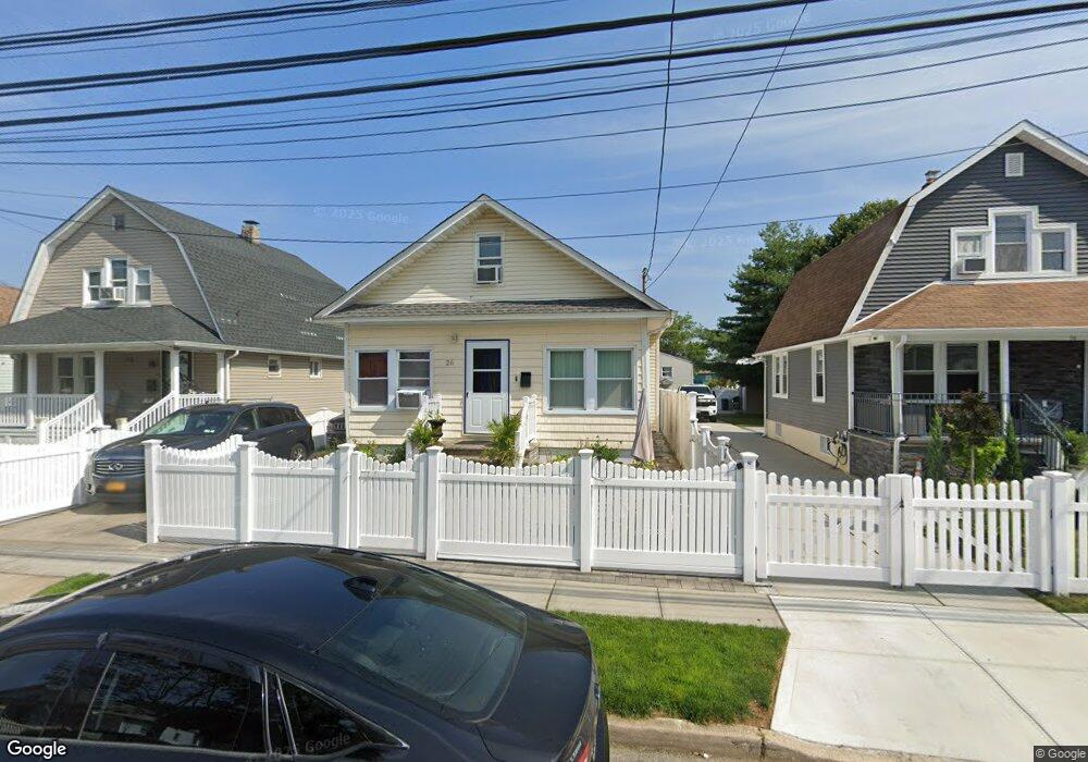
26 Independence Ave Freeport, NY 11520
Estimated Value: $562,000 - $631,112
4
Beds
2
Baths
1,200
Sq Ft
$497/Sq Ft
Est. Value
About This Home
This home is located at 26 Independence Ave, Freeport, NY 11520 and is currently estimated at $596,556, approximately $497 per square foot. 26 Independence Ave is a home located in Nassau County with nearby schools including Caroline G. Atkinson Intermediate School, Columbus Avenue School, and John W Dodd Middle School.
Ownership History
Date
Name
Owned For
Owner Type
Purchase Details
Closed on
Jun 6, 2016
Sold by
Sophiella Enterprise Llc
Bought by
Powell Barrington G and Powell Carline
Current Estimated Value
Home Financials for this Owner
Home Financials are based on the most recent Mortgage that was taken out on this home.
Original Mortgage
$279,837
Outstanding Balance
$224,871
Interest Rate
3.87%
Mortgage Type
FHA
Estimated Equity
$371,685
Purchase Details
Closed on
Jul 7, 2014
Sold by
Mayes Carrie S and Mays Carrie S
Bought by
Us Bank Na and Sasco Mortgage Loan Trust 2002 Wf2
Create a Home Valuation Report for This Property
The Home Valuation Report is an in-depth analysis detailing your home's value as well as a comparison with similar homes in the area
Home Values in the Area
Average Home Value in this Area
Purchase History
| Date | Buyer | Sale Price | Title Company |
|---|---|---|---|
| Powell Barrington G | $285,000 | Judicial Title Insurance Age | |
| Us Bank Na | $148,750 | -- |
Source: Public Records
Mortgage History
| Date | Status | Borrower | Loan Amount |
|---|---|---|---|
| Open | Powell Barrington G | $279,837 |
Source: Public Records
Tax History Compared to Growth
Tax History
| Year | Tax Paid | Tax Assessment Tax Assessment Total Assessment is a certain percentage of the fair market value that is determined by local assessors to be the total taxable value of land and additions on the property. | Land | Improvement |
|---|---|---|---|---|
| 2025 | $6,469 | $308 | $106 | $202 |
| 2024 | $651 | $303 | $104 | $199 |
| 2023 | $7,067 | $333 | $129 | $204 |
| 2022 | $7,067 | $318 | $109 | $209 |
| 2021 | $10,454 | $327 | $112 | $215 |
| 2020 | $8,093 | $532 | $344 | $188 |
| 2019 | $7,829 | $532 | $344 | $188 |
| 2018 | $7,703 | $669 | $0 | $0 |
| 2017 | $8,051 | $669 | $344 | $325 |
| 2016 | $9,055 | $669 | $344 | $325 |
| 2015 | $966 | $669 | $344 | $325 |
| 2014 | $966 | $669 | $344 | $325 |
| 2013 | $913 | $669 | $344 | $325 |
Source: Public Records
Map
Nearby Homes
- 12 Prospect Ct
- 63 E Seaman Ave
- 92 Leonard Ave
- 72 Woodside Ave
- 222 N Ocean Ave
- 110 Woodside Ave
- 101 Harris Ave
- 63 Lincoln Place
- 64 W Milton St
- 67 E Dean St
- 259 N Columbus Ave
- 365 Wallace St
- 247 N Columbus Ave
- 272 N Columbus Ave
- 188 Woodside Ave
- 251 N Long Beach Ave
- 173 E Seaman Ave
- 27 W Woodbine Dr
- 45 Dehnhoff Ave
- 400 N Columbus Ave
- 24 Independence Ave
- 28 Independence Ave
- 22 Independence Ave
- 30 Independence Ave
- 15 Independence Ave
- 40 Stevens St
- 42 Stevens St
- 32 Independence Ave
- 44 Stevens St
- 38 Stevens St
- 36 Stevens St
- 46 Stevens St
- 18 Independence Ave
- 25 Independence Ave
- 34 Independence Ave
- 27 Independence Ave
- 23 Independence Ave
- 34 Stevens St
- 48 Stevens St
- 29 Independence Ave