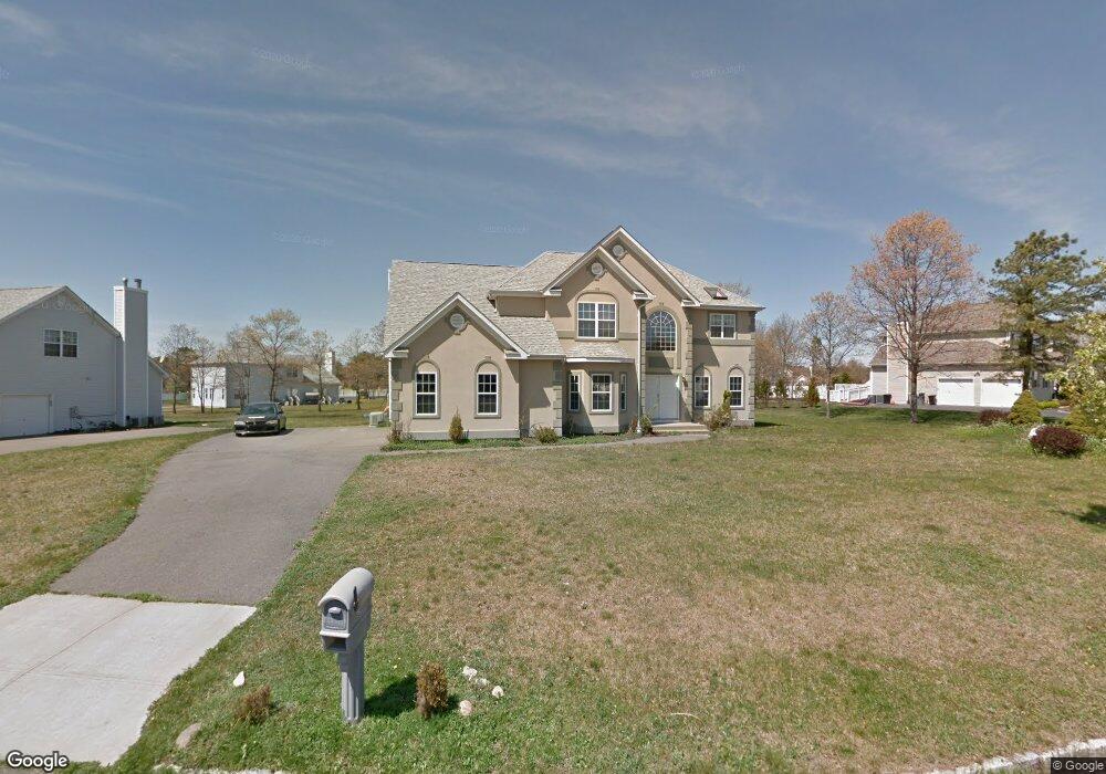
26 Jordan Dr Medford, NY 11763
Estimated Value: $798,000 - $1,028,000
4
Beds
3
Baths
3,061
Sq Ft
$296/Sq Ft
Est. Value
About This Home
This home is located at 26 Jordan Dr, Medford, NY 11763 and is currently estimated at $905,148, approximately $295 per square foot. 26 Jordan Dr is a home located in Suffolk County with nearby schools including Longwood Middle School, Longwood Junior High School, and Longwood Senior High School.
Ownership History
Date
Name
Owned For
Owner Type
Purchase Details
Closed on
Jun 6, 2017
Sold by
Makhanlall Aubrey
Bought by
Oommen Valsan and Oommen Sybil
Current Estimated Value
Home Financials for this Owner
Home Financials are based on the most recent Mortgage that was taken out on this home.
Original Mortgage
$441,849
Outstanding Balance
$363,870
Interest Rate
3.75%
Mortgage Type
FHA
Estimated Equity
$541,278
Purchase Details
Closed on
Oct 12, 2016
Sold by
Referee Of Suffolk County and Baum Esq Jonathan A
Bought by
Makhanlall Aubrey
Create a Home Valuation Report for This Property
The Home Valuation Report is an in-depth analysis detailing your home's value as well as a comparison with similar homes in the area
Home Values in the Area
Average Home Value in this Area
Purchase History
| Date | Buyer | Sale Price | Title Company |
|---|---|---|---|
| Oommen Valsan | $450,000 | None Available | |
| Oommen Valsan | $450,000 | None Available | |
| Makhanlall Aubrey | $284,000 | None Available | |
| Makhanlall Aubrey | $284,000 | None Available |
Source: Public Records
Mortgage History
| Date | Status | Borrower | Loan Amount |
|---|---|---|---|
| Open | Oommen Valsan | $441,849 | |
| Closed | Oommen Valsan | $441,849 | |
| Closed | Makhanlall Aubrey | $0 |
Source: Public Records
Tax History Compared to Growth
Tax History
| Year | Tax Paid | Tax Assessment Tax Assessment Total Assessment is a certain percentage of the fair market value that is determined by local assessors to be the total taxable value of land and additions on the property. | Land | Improvement |
|---|---|---|---|---|
| 2024 | $19,023 | $4,450 | $285 | $4,165 |
| 2023 | $19,023 | $4,450 | $285 | $4,165 |
| 2022 | $17,565 | $4,450 | $285 | $4,165 |
| 2021 | $17,565 | $4,450 | $285 | $4,165 |
| 2020 | $17,920 | $4,450 | $285 | $4,165 |
| 2019 | $17,920 | $0 | $0 | $0 |
| 2018 | $17,097 | $4,450 | $285 | $4,165 |
| 2017 | $17,097 | $4,450 | $285 | $4,165 |
| 2016 | $16,903 | $4,450 | $285 | $4,165 |
| 2015 | -- | $4,450 | $285 | $4,165 |
| 2014 | -- | $4,450 | $285 | $4,165 |
Source: Public Records
Map
Nearby Homes
- 4 Taylor Ln
- 37 Lot 2 Locust Ave S
- 37 Lot 1 Locust Ave S
- 35 Timber Trail Ln
- 21 Locust Ave S
- 2697 Heather Ave
- 0 Bellport Ave
- 2617 Kane Ave
- 279 Augusta Dr
- 2812 Sipp Ave
- 2401 Race Ave
- 2909 Falcon Ave
- 2712 Falcon Ave
- 3115 Heather Ave
- 222 Country Rd
- 77 Lincoln Rd
- 3019 Sipp Ave
- 3110 Kane Ave
- 0 Cedar Ln Unit ONE3556748
- 60 Pacific Dunes Ct