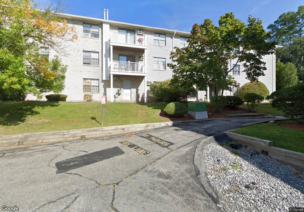
26 Kenmar Dr Unit 253 Billerica, MA 01821
Estimated Value: $245,000 - $265,000
1
Bed
1
Bath
610
Sq Ft
$421/Sq Ft
Est. Value
About This Home
This home is located at 26 Kenmar Dr Unit 253, Billerica, MA 01821 and is currently estimated at $257,035, approximately $421 per square foot. 26 Kenmar Dr Unit 253 is a home located in Middlesex County with nearby schools including Billerica Memorial High School.
Ownership History
Date
Name
Owned For
Owner Type
Purchase Details
Closed on
Jun 22, 2023
Sold by
Amal Rt and El-Fakih
Bought by
Amal Realty 3 Inc
Current Estimated Value
Purchase Details
Closed on
Feb 28, 2000
Sold by
Otoe Realty Corp
Bought by
El-Fakih Adham and El-Fakih Hazaa
Home Financials for this Owner
Home Financials are based on the most recent Mortgage that was taken out on this home.
Original Mortgage
$50,000
Interest Rate
8.15%
Mortgage Type
Purchase Money Mortgage
Create a Home Valuation Report for This Property
The Home Valuation Report is an in-depth analysis detailing your home's value as well as a comparison with similar homes in the area
Home Values in the Area
Average Home Value in this Area
Purchase History
| Date | Buyer | Sale Price | Title Company |
|---|---|---|---|
| Amal Realty 3 Inc | -- | None Available | |
| El-Fakih Adham | $62,500 | -- |
Source: Public Records
Mortgage History
| Date | Status | Borrower | Loan Amount |
|---|---|---|---|
| Previous Owner | El-Fakih Adham | $50,000 |
Source: Public Records
Tax History Compared to Growth
Tax History
| Year | Tax Paid | Tax Assessment Tax Assessment Total Assessment is a certain percentage of the fair market value that is determined by local assessors to be the total taxable value of land and additions on the property. | Land | Improvement |
|---|---|---|---|---|
| 2025 | $2,666 | $234,500 | $0 | $234,500 |
| 2024 | $2,635 | $233,400 | $0 | $233,400 |
| 2023 | $2,431 | $204,800 | $0 | $204,800 |
| 2022 | $2,324 | $183,900 | $0 | $183,900 |
| 2021 | $2,133 | $164,100 | $0 | $164,100 |
| 2020 | $2,075 | $159,700 | $0 | $159,700 |
| 2019 | $1,845 | $136,900 | $0 | $136,900 |
| 2018 | $1,728 | $121,800 | $0 | $121,800 |
| 2017 | $1,453 | $103,100 | $0 | $103,100 |
| 2016 | $1,432 | $101,300 | $0 | $101,300 |
| 2015 | $1,313 | $93,500 | $0 | $93,500 |
| 2014 | $1,329 | $93,000 | $0 | $93,000 |
Source: Public Records
Map
Nearby Homes
- 22 Kenmar Dr Unit 194Y
- 14 Kenmar Dr Unit 111
- 10 Charnstaff Ln Unit 204
- 1 Purcell Dr
- 2 Karen Cir Unit 2
- 5 Karen Cir Unit 16
- 405 Boston Rd Unit 2
- 19 Parker St
- 396 Boston Rd Unit 103
- 37 Porter St
- 454 Middlesex Turnpike
- 8 Swan Ln
- 463 Middlesex Turnpike
- 14 Elsie Ave
- 481 Middlesex Turnpike
- 483 Middlesex Turnpike
- 86 Lexington Rd
- 8 Water St
- 88 Lexington Rd
- 10 Avondale Ave
- 26 Kenmar Dr Unit 264
- 26 Kenmar Dr Unit 263
- 26 Kenmar Dr Unit 262
- 26 Kenmar Dr Unit 261
- 26 Kenmar Dr Unit 260
- 26 Kenmar Dr Unit 259
- 26 Kenmar Dr Unit 258
- 26 Kenmar Dr Unit 257
- 26 Kenmar Dr Unit 256
- 26 Kenmar Dr Unit 255
- 26 Kenmar Dr Unit 254
- 26 Kenmar Dr Unit 252
- 26 Kenmar Dr Unit 251
- 26 Kenmar Dr Unit 250
- 26 Kenmar Dr Unit 249
- 26 Kenmar Dr Unit 248
- 26 Kenmar Dr Unit 247
- 26 Kenmar Dr Unit 246
- 26 Kenmar Dr Unit 245
- 26 Kenmar Dr Unit 244