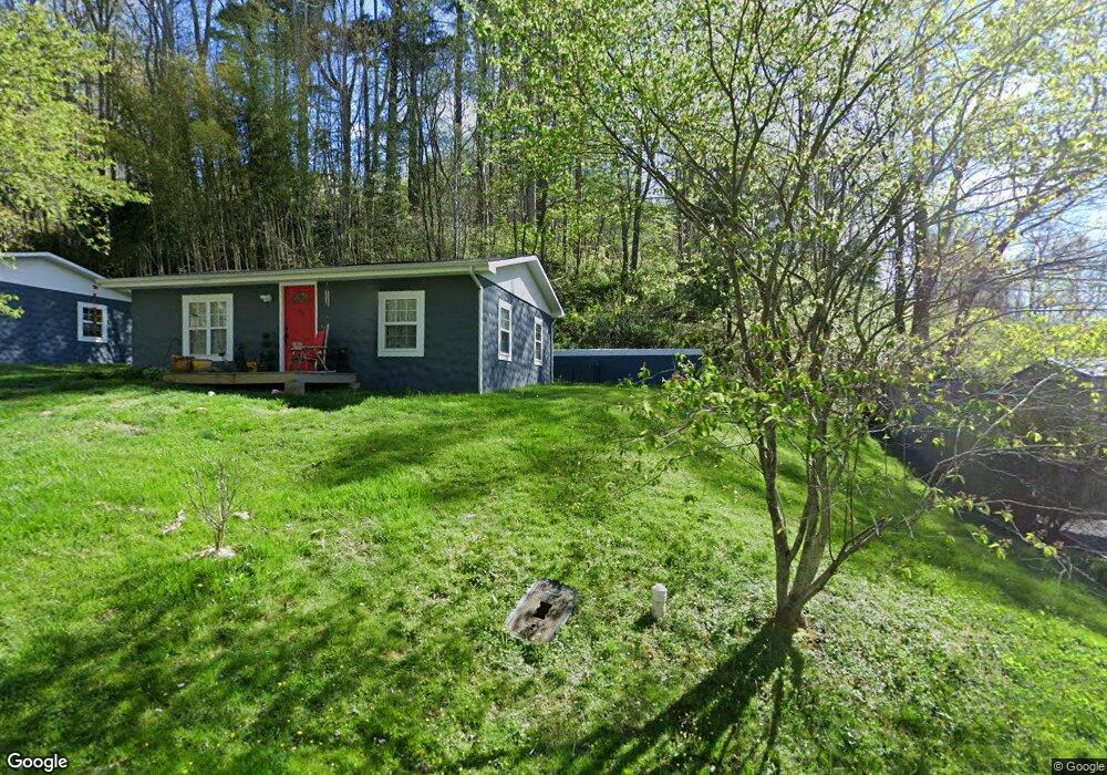
26 Lansing Rd Waynesville, NC 28786
Estimated Value: $225,393
1
Bed
1
Bath
720
Sq Ft
$313/Sq Ft
Est. Value
About This Home
This home is located at 26 Lansing Rd, Waynesville, NC 28786 and is currently priced at $225,393, approximately $313 per square foot. 26 Lansing Rd is a home located in Haywood County with nearby schools including Hazelwood Elementary, Waynesville Middle, and Tuscola High.
Ownership History
Date
Name
Owned For
Owner Type
Purchase Details
Closed on
May 17, 2023
Sold by
Miller Richard
Bought by
Miller Richard A and Miller Brenda Kay
Current Estimated Value
Purchase Details
Closed on
Aug 2, 2007
Sold by
Gilkey Michael J
Bought by
Miller Richard
Home Financials for this Owner
Home Financials are based on the most recent Mortgage that was taken out on this home.
Original Mortgage
$75,000
Interest Rate
6.65%
Mortgage Type
Purchase Money Mortgage
Purchase Details
Closed on
Mar 24, 2005
Sold by
Clayton Carolyn B and Ostrom Mary B
Bought by
Gilkey Michael J
Create a Home Valuation Report for This Property
The Home Valuation Report is an in-depth analysis detailing your home's value as well as a comparison with similar homes in the area
Home Values in the Area
Average Home Value in this Area
Purchase History
| Date | Buyer | Sale Price | Title Company |
|---|---|---|---|
| Miller Richard A | -- | None Listed On Document | |
| Miller Richard | $112,000 | None Available | |
| Gilkey Michael J | $60,000 | None Available |
Source: Public Records
Mortgage History
| Date | Status | Borrower | Loan Amount |
|---|---|---|---|
| Previous Owner | Miller Richard | $75,000 |
Source: Public Records
Tax History Compared to Growth
Tax History
| Year | Tax Paid | Tax Assessment Tax Assessment Total Assessment is a certain percentage of the fair market value that is determined by local assessors to be the total taxable value of land and additions on the property. | Land | Improvement |
|---|---|---|---|---|
| 2022 | $1,180 | $144,800 | $33,400 | $111,400 |
| 2021 | $1,180 | $144,800 | $33,400 | $111,400 |
| 2020 | $954 | $98,600 | $28,600 | $70,000 |
| 2019 | $964 | $98,600 | $28,600 | $70,000 |
| 2018 | $964 | $98,600 | $28,600 | $70,000 |
| 2017 | $1,045 | $98,600 | $0 | $0 |
| 2016 | $1,045 | $126,600 | $0 | $0 |
| 2015 | $1,045 | $126,600 | $0 | $0 |
| 2014 | $869 | $126,600 | $0 | $0 |
Source: Public Records
Map
Nearby Homes
- 106 Culpepper Dr
- 1200 Rocky Knob Rd
- 000 Dolan Rd Unit 3
- 000 Dolan Rd Unit 2
- 000 Dolan Rd Unit 1
- 401 Ray St
- 21 Carolinda Ln
- 220 Love Ln
- 58 Collier Ln
- 000 Larchwood Point
- 39 4th St
- 0 Blink Bonny Dr Unit B9 CAR4292577
- 0 Blink Bonny Dr Unit B11
- 0 Blink Bonny Dr Unit B9 & B11 CAR4292604
- 106 Arnold Heights
- 34 Leap Frog Park
- 25 Leap Frog Park
- 45 Leap Frog Park
- 20 Leap Frog Park
- 21 Leap Frog Park
- 40 Lansing Rd
- 12 Linsonwood Rd
- 11 Linson Wood Rd
- 1 Lansing Rd
- 96 Lansing Rd Unit 8
- 72 Lansing Rd Unit 7
- 72 Lansing Rd
- 88 Coventry Ln
- 41 Lansing Rd
- 18 Shingle Cove Rd
- 408 Sylvan St
- 437 Sylvan St
- 427 Sylvan St
- 133 Coventry Ln
- 100 Lansing Rd
- 332 Sylvan St
- 89 Coventry Ln
- 121 Lansing Rd Unit 4
- 207 Lansing Rd
- 000 Garci Dr