Estimated Value: $1,073,167 - $1,094,000
5
Beds
4
Baths
4,298
Sq Ft
$253/Sq Ft
Est. Value
About This Home
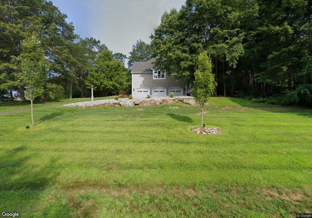
This home is located at 26 Lofgren Rd, Avon, CT 06001 and is currently estimated at $1,086,722, approximately $252 per square foot. 26 Lofgren Rd is a home located in Hartford County with nearby schools including Roaring Brook School, Thompson Brook School, and Avon Middle School.
Ownership History
Date
Name
Owned For
Owner Type
Purchase Details
Closed on
Dec 9, 2004
Sold by
Fortugno Peter P and Fortugno Jane A
Bought by
Cendant Mobility Fincl
Current Estimated Value
Purchase Details
Closed on
Mar 17, 2003
Sold by
Primacy Closing Corp
Bought by
Fortugno Peter P and Fortugno Jane A
Purchase Details
Closed on
Oct 7, 1997
Sold by
Village Developers
Bought by
Shader Scott and Shader Anna
Create a Home Valuation Report for This Property
The Home Valuation Report is an in-depth analysis detailing your home's value as well as a comparison with similar homes in the area
Home Values in the Area
Average Home Value in this Area
Purchase History
| Date | Buyer | Sale Price | Title Company |
|---|---|---|---|
| Cendant Mobility Fincl | $740,000 | -- | |
| Cendant Mobility Fincl | $740,000 | -- | |
| Fortugno Peter P | $647,500 | -- | |
| Primacy Closing Corp | $647,500 | -- | |
| Primacy Closing Corp | $647,500 | -- | |
| Shader Scott | $500,000 | -- | |
| Shader Scott | $500,000 | -- |
Source: Public Records
Mortgage History
| Date | Status | Borrower | Loan Amount |
|---|---|---|---|
| Open | Shader Scott | $200,000 | |
| Closed | Shader Scott | $147,000 |
Source: Public Records
Tax History Compared to Growth
Tax History
| Year | Tax Paid | Tax Assessment Tax Assessment Total Assessment is a certain percentage of the fair market value that is determined by local assessors to be the total taxable value of land and additions on the property. | Land | Improvement |
|---|---|---|---|---|
| 2025 | $16,552 | $538,290 | $140,280 | $398,010 |
| 2024 | $15,966 | $538,290 | $140,280 | $398,010 |
| 2023 | $15,600 | $440,800 | $122,780 | $318,020 |
| 2022 | $15,256 | $440,800 | $122,780 | $318,020 |
| 2021 | $15,080 | $440,800 | $122,780 | $318,020 |
| 2020 | $14,502 | $440,800 | $122,780 | $318,020 |
| 2019 | $14,502 | $440,800 | $122,780 | $318,020 |
| 2018 | $14,557 | $464,350 | $140,280 | $324,070 |
| 2017 | $14,204 | $464,350 | $140,280 | $324,070 |
| 2016 | $13,708 | $464,350 | $140,280 | $324,070 |
| 2015 | $13,373 | $464,350 | $140,280 | $324,070 |
| 2014 | $13,150 | $464,350 | $140,280 | $324,070 |
Source: Public Records
Map
Nearby Homes
- 25 Sheffield Ln
- 12 School St
- 58 Weatherstone
- 48 Weatherstone
- 44 Weatherstone
- 61 Weatherstone
- 41 Verville Rd
- 1 Blanchard Rd
- 31 Stockbridge Dr
- 20 Found Land Way
- 78 Deepwood Dr
- 245 Kingswood Dr
- 99 Bridgewater Dr
- 3 E Hill Rd
- 64 Lovely St
- 114 Daniel Trace
- 133 Craigemore Cir
- 8 Town Bridge Rd
- 95 Cold Spring Rd
- 141 Dowd Ave