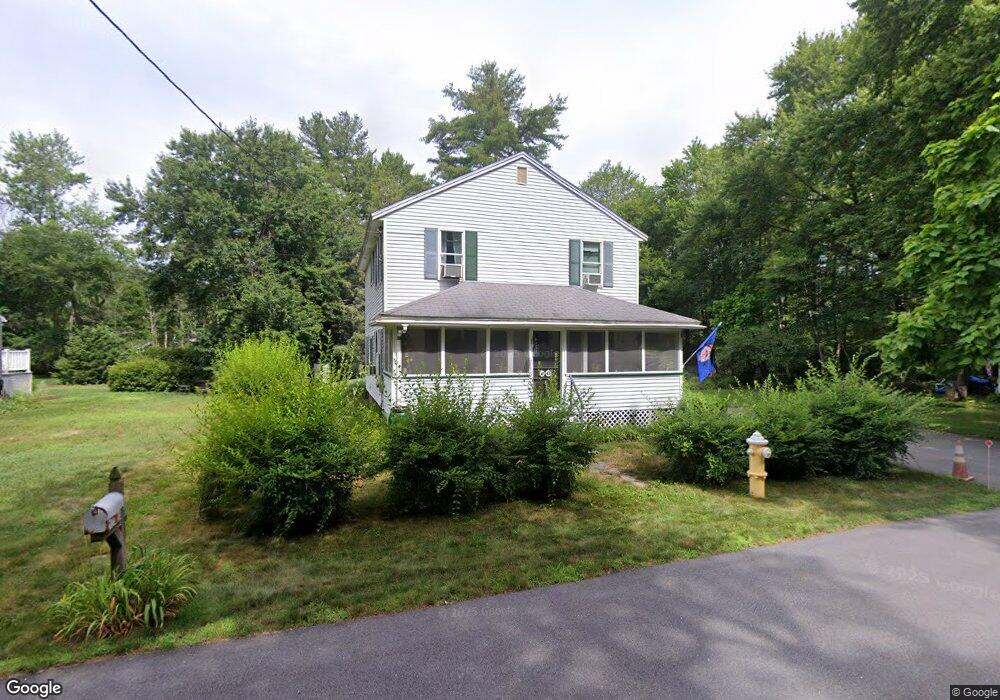
26 Maple St Westford, MA 01886
Estimated Value: $641,000 - $738,000
3
Beds
3
Baths
1,704
Sq Ft
$403/Sq Ft
Est. Value
About This Home
This home is located at 26 Maple St, Westford, MA 01886 and is currently estimated at $687,206, approximately $403 per square foot. 26 Maple St is a home located in Middlesex County with nearby schools including Rita E. Miller Elementary School, Day Elementary School, and Stony Brook School.
Create a Home Valuation Report for This Property
The Home Valuation Report is an in-depth analysis detailing your home's value as well as a comparison with similar homes in the area
Home Values in the Area
Average Home Value in this Area
Tax History
| Year | Tax Paid | Tax Assessment Tax Assessment Total Assessment is a certain percentage of the fair market value that is determined by local assessors to be the total taxable value of land and additions on the property. | Land | Improvement |
|---|---|---|---|---|
| 2025 | $7,716 | $572,800 | $309,800 | $263,000 |
| 2024 | $7,512 | $545,500 | $295,000 | $250,500 |
| 2023 | $7,443 | $504,300 | $281,000 | $223,300 |
| 2022 | $7,285 | $451,900 | $228,700 | $223,200 |
| 2021 | $6,934 | $416,700 | $228,700 | $188,000 |
| 2020 | $6,805 | $416,700 | $228,700 | $188,000 |
| 2019 | $4,536 | $378,100 | $219,100 | $159,000 |
| 2018 | $5,964 | $368,600 | $209,600 | $159,000 |
| 2017 | $5,730 | $349,200 | $209,600 | $139,600 |
| 2016 | $5,535 | $339,600 | $200,000 | $139,600 |
| 2015 | $4,898 | $301,600 | $176,000 | $125,600 |
| 2014 | $4,691 | $282,600 | $168,000 | $114,600 |
Source: Public Records
Map
Nearby Homes
- 17 Maple St
- 7 3rd St
- 11 River St
- 3 Hillside Ave
- 3 Cheyenne Valley Unit 3
- 23 Apache Way Unit 23
- 18 B Pilgrim Dr Unit 18b
- 2 Wendell Place Unit 1
- 2 Lady Constance Way Unit 19
- 4 Lady Constance Way Unit 20
- 34 West St
- 8 Bixby Ln
- 2 Lakeside Terrace
- 38 Groton Rd
- 35 Forge Village Rd
- 13 Long Rd
- 4 Heywood Rd
- 12 Patten Rd
- 66 Patten Rd
- 6 Colonel Rolls Dr
Your Personal Tour Guide
Ask me questions while you tour the home.