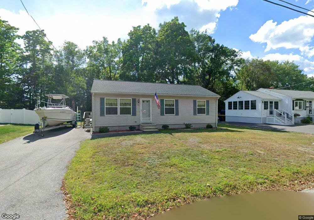
26 Marshall St Leominster, MA 01453
Estimated Value: $372,000 - $501,000
3
Beds
1
Bath
960
Sq Ft
$437/Sq Ft
Est. Value
About This Home
This home is located at 26 Marshall St, Leominster, MA 01453 and is currently estimated at $419,863, approximately $437 per square foot. 26 Marshall St is a home located in Worcester County with nearby schools including Leominster High School, St. Leo School, and St. Anna Catholic School.
Ownership History
Date
Name
Owned For
Owner Type
Purchase Details
Closed on
Sep 16, 1997
Sold by
Sewell William A
Bought by
Hill Harold R
Current Estimated Value
Home Financials for this Owner
Home Financials are based on the most recent Mortgage that was taken out on this home.
Original Mortgage
$90,000
Outstanding Balance
$13,752
Interest Rate
7.31%
Mortgage Type
Purchase Money Mortgage
Estimated Equity
$406,111
Create a Home Valuation Report for This Property
The Home Valuation Report is an in-depth analysis detailing your home's value as well as a comparison with similar homes in the area
Home Values in the Area
Average Home Value in this Area
Purchase History
| Date | Buyer | Sale Price | Title Company |
|---|---|---|---|
| Hill Harold R | $90,000 | -- |
Source: Public Records
Mortgage History
| Date | Status | Borrower | Loan Amount |
|---|---|---|---|
| Open | Hill Harold R | $90,000 | |
| Closed | Hill Harold R | $75,000 | |
| Previous Owner | Hill Harold R | $25,000 |
Source: Public Records
Tax History Compared to Growth
Tax History
| Year | Tax Paid | Tax Assessment Tax Assessment Total Assessment is a certain percentage of the fair market value that is determined by local assessors to be the total taxable value of land and additions on the property. | Land | Improvement |
|---|---|---|---|---|
| 2025 | $4,786 | $341,100 | $118,400 | $222,700 |
| 2024 | $4,645 | $320,100 | $112,700 | $207,400 |
| 2023 | $4,494 | $289,200 | $98,000 | $191,200 |
| 2022 | $4,345 | $262,400 | $85,200 | $177,200 |
| 2021 | $3,981 | $219,600 | $66,300 | $153,300 |
| 2020 | $3,790 | $210,800 | $66,300 | $144,500 |
| 2019 | $3,626 | $195,600 | $63,100 | $132,500 |
| 2018 | $3,537 | $183,000 | $61,300 | $121,700 |
| 2017 | $3,348 | $169,700 | $57,300 | $112,400 |
| 2016 | $3,266 | $166,800 | $57,300 | $109,500 |
| 2015 | $3,107 | $159,800 | $57,300 | $102,500 |
| 2014 | $2,975 | $157,500 | $60,500 | $97,000 |
Source: Public Records
Map
Nearby Homes
- 593 Main St Unit SL4
- 66 Hamilton St Unit 3
- 146 Sacramento Dr
- 57 Liberty St Unit 2
- 36 Sunrise Ave
- 11 Rosewood Dr
- 14 Fernwood Dr Unit D
- 17 Fernwood Dr Unit G
- 36 Fox Meadow Rd Unit A
- 17 Fernwood Dr Unit D
- 51 Fox Meadow Rd Unit C
- 55 Fox Meadow Rd Unit H
- 32 Fox Meadow Rd Unit E
- 12 Whitman St Unit 12
- 54 Green St Unit 119
- 291 Joslin St
- 75 Dale Ave
- 1018 Main St
- 12 Lindell Ave
- 58 4th St
- 20 Marshall St
- 34 Marshall St
- 31 Marshall St
- 38 Marshall St
- 12 Marshall St
- 37 Marshall St
- 44 Marshall St
- 588 Main St
- 18 Marcello Ave
- 46 Marshall St
- 47 Marshall St
- 568 Main St
- 22 Marcello Ave
- 2 Marcello Ave
- 33 Hamilton St
- 25 Hamilton St
- 0 Marcello Ave
- 41 Hamilton St Unit 18
- 41 Hamilton St Unit 17
- 41 Hamilton St Unit 16