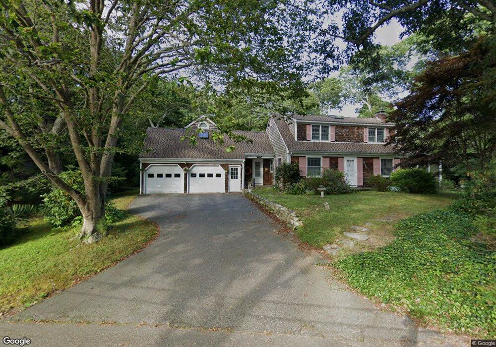
26 Mullen Way Falmouth, MA 02540
Falmouth Village NeighborhoodEstimated Value: $1,131,733 - $2,091,000
3
Beds
3
Baths
2,393
Sq Ft
$606/Sq Ft
Est. Value
About This Home
This home is located at 26 Mullen Way, Falmouth, MA 02540 and is currently estimated at $1,450,433, approximately $606 per square foot. 26 Mullen Way is a home located in Barnstable County with nearby schools including Mullen-Hall School, Lawrence School, and Morse Pond School.
Ownership History
Date
Name
Owned For
Owner Type
Purchase Details
Closed on
May 26, 1994
Sold by
Dimmock Richard H and Dimmock Margaret
Bought by
Hecker Barbara
Current Estimated Value
Create a Home Valuation Report for This Property
The Home Valuation Report is an in-depth analysis detailing your home's value as well as a comparison with similar homes in the area
Home Values in the Area
Average Home Value in this Area
Purchase History
| Date | Buyer | Sale Price | Title Company |
|---|---|---|---|
| Hecker Barbara | $162,000 | -- | |
| Hecker Barbara | $162,000 | -- |
Source: Public Records
Mortgage History
| Date | Status | Borrower | Loan Amount |
|---|---|---|---|
| Open | Hecker Barbara | $185,437 | |
| Closed | Hecker Barbara | $241,550 | |
| Closed | Hecker Barbara | $245,000 | |
| Closed | Hecker Barbara | $50,000 |
Source: Public Records
Tax History Compared to Growth
Tax History
| Year | Tax Paid | Tax Assessment Tax Assessment Total Assessment is a certain percentage of the fair market value that is determined by local assessors to be the total taxable value of land and additions on the property. | Land | Improvement |
|---|---|---|---|---|
| 2025 | $5,339 | $909,600 | $356,100 | $553,500 |
| 2024 | $5,197 | $827,500 | $323,800 | $503,700 |
| 2023 | $5,247 | $758,300 | $323,800 | $434,500 |
| 2022 | $5,191 | $644,800 | $295,300 | $349,500 |
| 2021 | $5,023 | $590,900 | $282,400 | $308,500 |
| 2020 | $4,855 | $565,200 | $256,700 | $308,500 |
| 2019 | $4,752 | $555,100 | $256,700 | $298,400 |
| 2018 | $4,447 | $517,100 | $256,700 | $260,400 |
| 2017 | $4,321 | $506,600 | $256,700 | $249,900 |
| 2016 | $4,240 | $506,600 | $256,700 | $249,900 |
| 2015 | $4,149 | $506,600 | $256,700 | $249,900 |
| 2014 | $4,087 | $501,500 | $256,800 | $244,700 |
Source: Public Records
Map
Nearby Homes
- 38 Landfall Unit 38
- 38 Landfall
- 71 Main St
- 15 Hedge Ln
- 98 Main St
- 98 Main St Unit 1
- 65 Walker St
- 30 Katherine Lee Bates Rd
- 33 Oakwood Ave
- 87 Oyster Pond Rd
- 251 Woods Hole Rd
- 45 Haynes Ave
- 480 Main St Unit 1
- 27 Upland Ave
- 110 Dillingham Ave Unit 322
- 110 Dillingham Ave Unit 224
- 44 Carey Ln
- 253 Scranton Ave
- 354 Gifford St Unit 5
- 354 Gifford St Unit 2
- 31 Katy Hatchs Rd
- 22 Mullen Way
- 0 Katy Hatchs Rd
- 31 Katy Hatch's
- 25 Mullen Way
- 29 Mullen Way
- 27 Katy Hatchs Rd
- 0 Mullen Way
- 36 Katy Hatchs Rd
- 42 Katy Hatchs Rd
- 32 Katy Hatchs Rd
- 43 Katy Hatchs Rd
- 10 Mullen Way
- 23 Katy Hatchs Rd
- 26 Katy Hatchs Rd
- 18 Turtle Pond Rd
- 12 Turtle Pond Rd
- 47 Katy Hatchs Rd
- 22 Turtle Pond Rd
- 11 Mullen Way