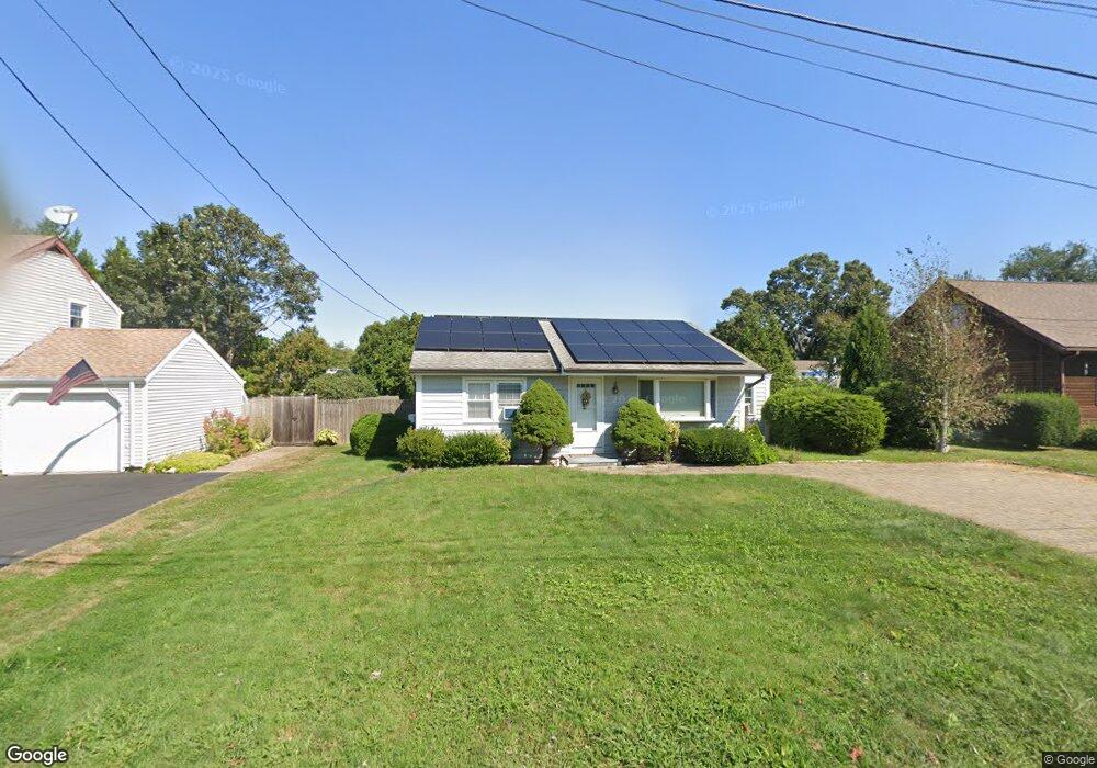
26 Muller Dr Westbrook, CT 06498
Estimated Value: $507,000 - $800,000
3
Beds
2
Baths
1,016
Sq Ft
$625/Sq Ft
Est. Value
About This Home
This home is located at 26 Muller Dr, Westbrook, CT 06498 and is currently estimated at $635,373, approximately $625 per square foot. 26 Muller Dr is a home located in Middlesex County with nearby schools including Daisy Ingraham School, Westbrook Middle School, and Westbrook High School.
Ownership History
Date
Name
Owned For
Owner Type
Purchase Details
Closed on
Mar 27, 2023
Sold by
Miner Nancy G M
Bought by
Doshie Ft and Miner M
Current Estimated Value
Purchase Details
Closed on
Nov 3, 2009
Sold by
Rose William and Rose Margaret
Bought by
Johnston Margaret and Miner Nancy
Purchase Details
Closed on
May 3, 2004
Sold by
Boychew Stephen M and Stone Amy E
Bought by
Rose William and Rose Margaret
Home Financials for this Owner
Home Financials are based on the most recent Mortgage that was taken out on this home.
Original Mortgage
$100,000
Interest Rate
5.36%
Mortgage Type
Purchase Money Mortgage
Purchase Details
Closed on
May 1, 2002
Sold by
Demarco Christopher M and Demarco Cynthia D
Bought by
Boychew Stephen M and Stone Amy E
Home Financials for this Owner
Home Financials are based on the most recent Mortgage that was taken out on this home.
Original Mortgage
$193,500
Interest Rate
7.13%
Mortgage Type
Purchase Money Mortgage
Purchase Details
Closed on
Jul 25, 1997
Sold by
Tedford Earle C and Tedford Sybil R
Bought by
Demarco Christopher M and Demarco Cynthia D
Create a Home Valuation Report for This Property
The Home Valuation Report is an in-depth analysis detailing your home's value as well as a comparison with similar homes in the area
Home Values in the Area
Average Home Value in this Area
Purchase History
| Date | Buyer | Sale Price | Title Company |
|---|---|---|---|
| Doshie Ft | -- | None Available | |
| Johnston Margaret | $306,000 | -- | |
| Rose William | $295,000 | -- | |
| Boychew Stephen M | $215,000 | -- | |
| Demarco Christopher M | $137,000 | -- |
Source: Public Records
Mortgage History
| Date | Status | Borrower | Loan Amount |
|---|---|---|---|
| Previous Owner | Demarco Christopher M | $100,000 | |
| Previous Owner | Demarco Christopher M | $239,000 | |
| Previous Owner | Demarco Christopher M | $193,500 | |
| Previous Owner | Demarco Christopher M | $135,502 |
Source: Public Records
Tax History
| Year | Tax Paid | Tax Assessment Tax Assessment Total Assessment is a certain percentage of the fair market value that is determined by local assessors to be the total taxable value of land and additions on the property. | Land | Improvement |
|---|---|---|---|---|
| 2025 | $6,287 | $279,400 | $167,730 | $111,670 |
| 2024 | $6,063 | $279,400 | $167,730 | $111,670 |
| 2023 | $5,957 | $279,400 | $167,730 | $111,670 |
| 2022 | $5,800 | $279,400 | $167,730 | $111,670 |
| 2021 | $5,489 | $219,560 | $120,960 | $98,600 |
| 2020 | $5,489 | $219,560 | $120,960 | $98,600 |
| 2019 | $5,417 | $219,560 | $120,960 | $98,600 |
| 2018 | $5,351 | $219,560 | $120,960 | $98,600 |
| 2017 | $5,351 | $219,560 | $120,960 | $98,600 |
| 2016 | $4,963 | $214,480 | $115,580 | $98,900 |
| 2015 | $4,828 | $214,480 | $115,580 | $98,900 |
| 2014 | $4,674 | $214,480 | $115,580 | $98,900 |
Source: Public Records
Map
Nearby Homes
- 8 Cook Terrace
- 39 Sagamore Terrace Rd
- 118 Sandy Point Rd
- 1780 Boston Post Rd
- 19 Old Forge Rd
- 21 Harvey Dr
- 14 Denmore Ln
- 2 Pequot Trail
- 29 Salt Island Rd
- 41 Trolley Rd
- 10 Winterberry Cir
- 1333 Boston Post Rd Unit 1
- 39 Middletown Ave
- 25 Sunset Rd Unit 7
- 60 Ingham Hill Rd
- 11a/11b Pond Circle Rd
- 11 S View Terrace
- 85 McVeagh Rd
- 951 Old Clinton Rd Unit 15
- 328 Hammock Rd N
Your Personal Tour Guide
Ask me questions while you tour the home.