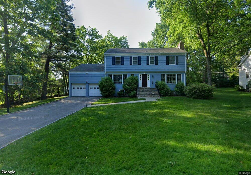
26 Myrtledale Rd Scarsdale, NY 10583
Secor Farms NeighborhoodEstimated Value: $2,097,023 - $2,808,000
4
Beds
3
Baths
2,805
Sq Ft
$840/Sq Ft
Est. Value
About This Home
This home is located at 26 Myrtledale Rd, Scarsdale, NY 10583 and is currently estimated at $2,357,006, approximately $840 per square foot. 26 Myrtledale Rd is a home located in Westchester County with nearby schools including Scarsdale Middle School, Scarsdale High School, and Kodomono Kuni School.
Ownership History
Date
Name
Owned For
Owner Type
Purchase Details
Closed on
Aug 13, 2009
Sold by
Maybaum Lauren B
Bought by
Tabak Daniel H and Tabak Jennifer S
Current Estimated Value
Home Financials for this Owner
Home Financials are based on the most recent Mortgage that was taken out on this home.
Original Mortgage
$729,750
Outstanding Balance
$479,429
Interest Rate
5.36%
Mortgage Type
New Conventional
Estimated Equity
$1,877,577
Purchase Details
Closed on
Oct 18, 2003
Sold by
Maybaum Richard E and Maybaum Lauren B
Bought by
Maybaum Lauren B
Purchase Details
Closed on
Dec 28, 2000
Sold by
The Bellefair Home & Land Company
Bought by
Fiderer Martin and Fiderer Adele
Create a Home Valuation Report for This Property
The Home Valuation Report is an in-depth analysis detailing your home's value as well as a comparison with similar homes in the area
Home Values in the Area
Average Home Value in this Area
Purchase History
| Date | Buyer | Sale Price | Title Company |
|---|---|---|---|
| Tabak Daniel H | $1,277,500 | The Judicial Title Insurance | |
| Maybaum Lauren B | -- | -- | |
| Fiderer Martin | $610,600 | -- |
Source: Public Records
Mortgage History
| Date | Status | Borrower | Loan Amount |
|---|---|---|---|
| Open | Tabak Daniel H | $729,750 |
Source: Public Records
Tax History Compared to Growth
Tax History
| Year | Tax Paid | Tax Assessment Tax Assessment Total Assessment is a certain percentage of the fair market value that is determined by local assessors to be the total taxable value of land and additions on the property. | Land | Improvement |
|---|---|---|---|---|
| 2024 | $33,701 | $1,225,000 | $950,000 | $275,000 |
| 2023 | $32,517 | $1,225,000 | $950,000 | $275,000 |
| 2022 | $24,169 | $1,225,000 | $950,000 | $275,000 |
| 2021 | $29,870 | $1,225,000 | $950,000 | $275,000 |
| 2020 | $29,575 | $1,225,000 | $950,000 | $275,000 |
| 2019 | $29,330 | $1,225,000 | $950,000 | $275,000 |
| 2018 | $34,405 | $1,225,000 | $950,000 | $275,000 |
| 2017 | $0 | $1,225,000 | $950,000 | $275,000 |
| 2016 | $28,288 | $1,225,000 | $950,000 | $275,000 |
| 2015 | -- | $1,235,000 | $789,000 | $446,000 |
| 2014 | -- | $1,235,000 | $789,000 | $446,000 |
| 2013 | -- | $22,475 | $8,000 | $14,475 |
Source: Public Records
Map
Nearby Homes
- 21 Springdale Rd
- 28 Aspen Rd
- 229 Mamaroneck Rd
- 32 Sycamore Rd
- 66 Secor Rd
- 96 Brookby Rd
- 8 Dell Rd
- 18 Lincoln Rd
- 36 Secor Rd
- 101 Carthage Rd
- 16 Coralyn Rd
- 9 Hazelton Dr
- 61 Lincoln Rd
- 2 Weaver St Unit 9
- 2 Weaver St Unit 3
- 14 Wakefield Rd
- 85 Wiltshire Rd Unit B11
- 103 Wiltshire Rd Unit D2
- 109 Mamaroneck Rd
- 14 Coralyn Ave
- 65 Saxon Woods Rd
- 61 Saxon Woods Rd
- 28 Myrtledale Rd
- 23 Myrtledale Rd
- 67 Saxon Woods Rd
- 22 Myrtledale Rd
- 27 Myrtledale Rd
- 21 Myrtledale Rd
- 30 Myrtledale Rd
- 55 Saxon Woods Rd
- 20 Myrtledale Rd
- 20 Springdale Rd
- 22 Springdale Rd
- 18 Springdale Rd
- 24 Springdale Rd
- 32 Myrtledale Rd
- 29 Myrtledale Rd
- 26 Springdale Rd
- 16 Springdale Rd
- 18 Myrtledale Rd