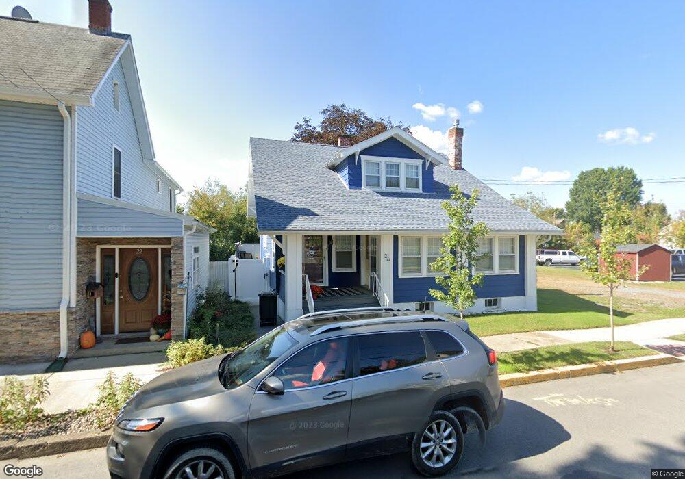
26 N High St Selinsgrove, PA 17870
Estimated Value: $136,657 - $237,000
--
Bed
--
Bath
--
Sq Ft
5,663
Sq Ft Lot
About This Home
This home is located at 26 N High St, Selinsgrove, PA 17870 and is currently estimated at $189,164. 26 N High St is a home located in Snyder County with nearby schools including Selinsgrove Area Elementary School, Selinsgrove Intermediate School, and Selinsgrove Area Middle School.
Ownership History
Date
Name
Owned For
Owner Type
Purchase Details
Closed on
Nov 14, 2018
Sold by
Aurand Justin R and Aurand Michele T
Bought by
Keister Taffera Rebekah
Current Estimated Value
Home Financials for this Owner
Home Financials are based on the most recent Mortgage that was taken out on this home.
Original Mortgage
$78,000
Outstanding Balance
$68,585
Interest Rate
4.8%
Mortgage Type
New Conventional
Estimated Equity
$120,579
Purchase Details
Closed on
Nov 10, 2007
Sold by
Mitrenko Alexander V and Mitrenko A
Bought by
Aurand Justin R and Aurand Michele T
Home Financials for this Owner
Home Financials are based on the most recent Mortgage that was taken out on this home.
Original Mortgage
$81,000
Interest Rate
6.41%
Mortgage Type
Purchase Money Mortgage
Purchase Details
Closed on
Jul 7, 2006
Sold by
Sheriff Of Snyder Co
Bought by
Regions Bank and Union Planters Bank
Create a Home Valuation Report for This Property
The Home Valuation Report is an in-depth analysis detailing your home's value as well as a comparison with similar homes in the area
Home Values in the Area
Average Home Value in this Area
Purchase History
| Date | Buyer | Sale Price | Title Company |
|---|---|---|---|
| Keister Taffera Rebekah | $105,000 | None Available | |
| Aurand Justin R | $81,000 | Robert H Slivinski | |
| Regions Bank | $60,000 | -- |
Source: Public Records
Mortgage History
| Date | Status | Borrower | Loan Amount |
|---|---|---|---|
| Open | Keister Taffera Rebekah | $78,000 | |
| Previous Owner | Aurand Justin R | $81,000 | |
| Closed | Regions Bank | -- |
Source: Public Records
Tax History Compared to Growth
Tax History
| Year | Tax Paid | Tax Assessment Tax Assessment Total Assessment is a certain percentage of the fair market value that is determined by local assessors to be the total taxable value of land and additions on the property. | Land | Improvement |
|---|---|---|---|---|
| 2025 | $1,651 | $13,800 | $1,640 | $12,160 |
| 2024 | $1,550 | $13,800 | $1,640 | $12,160 |
| 2023 | $618 | $13,800 | $1,640 | $12,160 |
| 2022 | $1,488 | $13,800 | $1,640 | $12,160 |
| 2021 | $1,474 | $13,800 | $1,640 | $12,160 |
| 2020 | $1,467 | $13,800 | $1,640 | $12,160 |
| 2019 | $1,460 | $13,800 | $1,640 | $12,160 |
| 2018 | $1,446 | $13,800 | $1,640 | $12,160 |
| 2017 | $1,432 | $13,800 | $1,640 | $12,160 |
| 2016 | $770 | $13,800 | $1,640 | $12,160 |
| 2015 | $50,801 | $13,800 | $1,640 | $12,160 |
| 2014 | $50,801 | $13,800 | $1,640 | $12,160 |
Source: Public Records
Map
Nearby Homes
- 207 Orange St Unit 209
- 500 N Orange St
- 501 N 9th St
- APN 18-08-086 S Market St
- 223 E Pine St
- 301 E Pine St
- 301 E Walnut St
- 722 N 8th St
- 104 18th St
- 21 Calvett Place
- Lot 1 522 Route S
- 321 Pleasant Dr
- 20 Quarry Rd
- 0 Market St Unit PASY2002452
- 0 Wedgewood Dr
- 456 State School Rd
- 1262 N Old Trail
- 0 Mill Rd
- 34 Oakmont Ct
- 85 Old Colony Rd