Estimated Value: $575,000 - $657,000
4
Beds
3
Baths
1,512
Sq Ft
$397/Sq Ft
Est. Value
About This Home
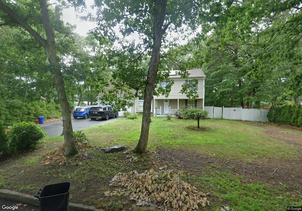
This home is located at 26 Pauls Path, Coram, NY 11727 and is currently estimated at $600,496, approximately $397 per square foot. 26 Pauls Path is a home located in Suffolk County with nearby schools including Longwood Middle School, Longwood Junior High School, and Longwood Senior High School.
Ownership History
Date
Name
Owned For
Owner Type
Purchase Details
Closed on
Jun 21, 2016
Sold by
Goshen Mortgage Reo Llc
Bought by
Phillip Akeem H and Phillip Saturne
Current Estimated Value
Purchase Details
Closed on
Sep 2, 2014
Sold by
Greene Esq Pamela and Sukul Yudhister R
Bought by
Goshen Mortgage Reo Llc
Purchase Details
Closed on
Jun 18, 2001
Sold by
Daniel Romane and Daniel Michele
Bought by
Sukul Yudhister R and Sukul Jillian
Home Financials for this Owner
Home Financials are based on the most recent Mortgage that was taken out on this home.
Original Mortgage
$169,600
Interest Rate
7.14%
Mortgage Type
Purchase Money Mortgage
Create a Home Valuation Report for This Property
The Home Valuation Report is an in-depth analysis detailing your home's value as well as a comparison with similar homes in the area
Home Values in the Area
Average Home Value in this Area
Purchase History
| Date | Buyer | Sale Price | Title Company |
|---|---|---|---|
| Phillip Akeem H | $307,970 | None Available | |
| Goshen Mortgage Reo Llc | $789,520 | None Available | |
| Sukul Yudhister R | $212,000 | -- |
Source: Public Records
Mortgage History
| Date | Status | Borrower | Loan Amount |
|---|---|---|---|
| Previous Owner | Sukul Yudhister R | $169,600 | |
| Closed | Goshen Mortgage Reo Llc | $0 |
Source: Public Records
Tax History Compared to Growth
Tax History
| Year | Tax Paid | Tax Assessment Tax Assessment Total Assessment is a certain percentage of the fair market value that is determined by local assessors to be the total taxable value of land and additions on the property. | Land | Improvement |
|---|---|---|---|---|
| 2024 | $14,134 | $3,120 | $300 | $2,820 |
| 2023 | $14,134 | $3,120 | $300 | $2,820 |
| 2022 | $12,838 | $3,120 | $300 | $2,820 |
| 2021 | $12,838 | $3,120 | $300 | $2,820 |
| 2020 | $13,133 | $3,120 | $300 | $2,820 |
| 2019 | $13,133 | $0 | $0 | $0 |
| 2018 | $12,518 | $3,120 | $300 | $2,820 |
| 2017 | $12,518 | $3,120 | $300 | $2,820 |
| 2016 | $12,362 | $3,120 | $300 | $2,820 |
| 2015 | -- | $3,120 | $300 | $2,820 |
| 2014 | -- | $3,120 | $300 | $2,820 |
Source: Public Records
Map
Nearby Homes
- 40 Pauls Path
- 77 Birchwood Rd
- 3 4th St Unit 3-4
- 92 Birchwood Rd
- 99 Birchwood Rd
- 356 Clubhouse Ct
- 150 Birchwood Rd
- 154 Birchwood Rd
- 58 Birchwood Rd
- 37 Willow Cir Unit 37
- 729 Hilltop Ct Unit 729
- 23 Birchwood Rd Unit 23
- 262 Brettonwoods Dr
- 215 Birchwood Rd
- 217 Birchwood Rd
- 269 Brettonwoods Dr
- 11 Theodore Dr
- The Bedford Plan at Willow Wood at Overton Preserve
- The Augusta Plan at Willow Wood at Overton Preserve
- The Erie Plan at Willow Wood at Overton Preserve