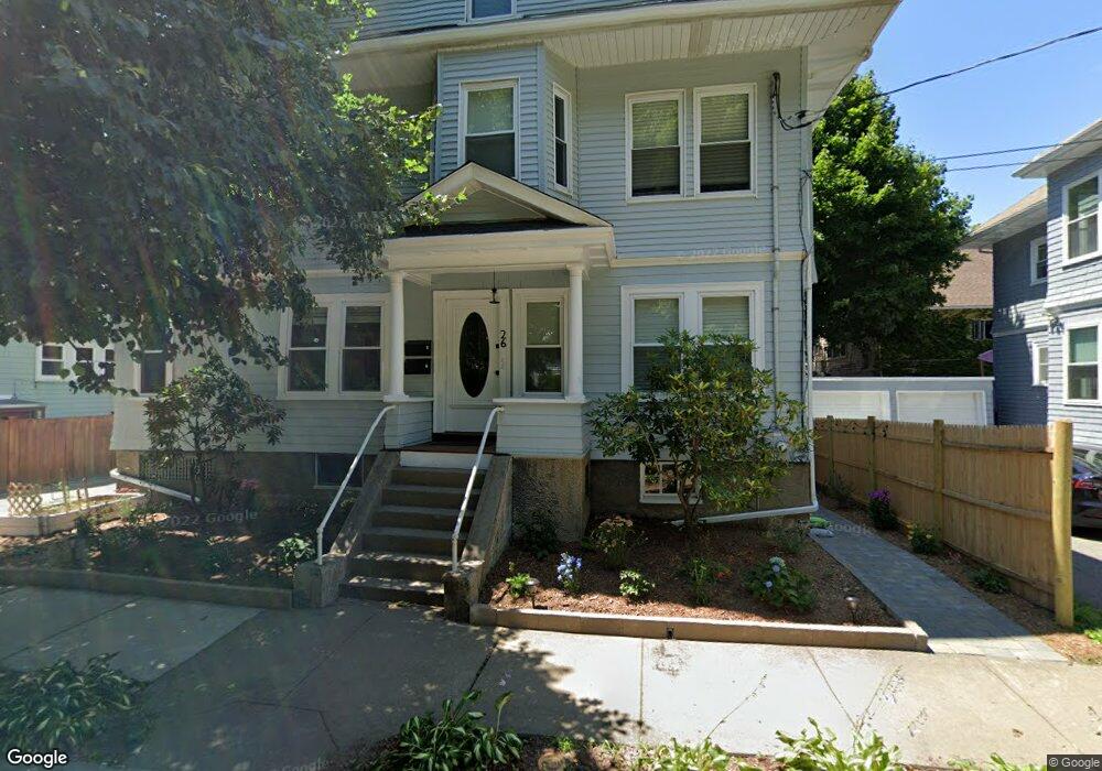
26 Playstead Rd Newton, MA 02458
Newton Corner NeighborhoodEstimated Value: $1,280,000 - $1,602,000
5
Beds
3
Baths
2,885
Sq Ft
$502/Sq Ft
Est. Value
About This Home
This home is located at 26 Playstead Rd, Newton, MA 02458 and is currently estimated at $1,448,064, approximately $501 per square foot. 26 Playstead Rd is a home located in Middlesex County with nearby schools including Underwood Elementary School, Bigelow Middle School, and Newton North High School.
Ownership History
Date
Name
Owned For
Owner Type
Purchase Details
Closed on
Nov 14, 2022
Sold by
Simmons Jacob M
Bought by
Simmons Jacob M and Kapotsis Melina
Current Estimated Value
Purchase Details
Closed on
Jan 21, 2021
Sold by
26 Playstead Road Llc
Bought by
Simmons Jacob M
Home Financials for this Owner
Home Financials are based on the most recent Mortgage that was taken out on this home.
Original Mortgage
$1,024,500
Interest Rate
3.25%
Mortgage Type
Purchase Money Mortgage
Purchase Details
Closed on
Dec 27, 2012
Sold by
Brennan Carol C and Cedrone Joseph G
Bought by
26 Plastead Road Llc
Create a Home Valuation Report for This Property
The Home Valuation Report is an in-depth analysis detailing your home's value as well as a comparison with similar homes in the area
Home Values in the Area
Average Home Value in this Area
Purchase History
| Date | Buyer | Sale Price | Title Company |
|---|---|---|---|
| Simmons Jacob M | -- | None Available | |
| Simmons Jacob M | $1,050,000 | None Available | |
| 26 Plastead Road Llc | -- | -- |
Source: Public Records
Mortgage History
| Date | Status | Borrower | Loan Amount |
|---|---|---|---|
| Previous Owner | Simmons Jacob M | $1,024,500 |
Source: Public Records
Property History
| Date | Event | Price | List to Sale | Price per Sq Ft |
|---|---|---|---|---|
| 10/08/2024 10/08/24 | Off Market | $5,500 | -- | -- |
| 09/01/2023 09/01/23 | For Rent | $5,500 | -- | -- |
Tax History Compared to Growth
Tax History
| Year | Tax Paid | Tax Assessment Tax Assessment Total Assessment is a certain percentage of the fair market value that is determined by local assessors to be the total taxable value of land and additions on the property. | Land | Improvement |
|---|---|---|---|---|
| 2025 | $12,154 | $1,240,200 | $805,600 | $434,600 |
| 2024 | $11,752 | $1,204,100 | $782,100 | $422,000 |
| 2023 | $11,279 | $1,108,000 | $621,000 | $487,000 |
| 2022 | $9,774 | $929,100 | $575,000 | $354,100 |
| 2021 | $8,923 | $829,300 | $527,500 | $301,800 |
| 2020 | $8,658 | $829,300 | $527,500 | $301,800 |
| 2019 | $8,099 | $775,000 | $493,000 | $282,000 |
| 2018 | $8,066 | $745,500 | $465,000 | $280,500 |
| 2017 | $7,605 | $683,900 | $426,600 | $257,300 |
| 2016 | $7,140 | $627,400 | $391,400 | $236,000 |
| 2015 | $6,808 | $586,400 | $365,800 | $220,600 |
Source: Public Records
Map
Nearby Homes
- 121 Tremont St Unit B1
- 70 Washington St Unit 70
- 70 Washington St
- 99 Tremont St Unit 105
- 99 Tremont St Unit 413
- 8 Tremont Place
- 106 Farlow Rd
- 69 Presentation Rd
- 21 Glenley Terrace
- 39 Champney St
- 427-435 Faneuil St Unit R4
- 180 Hunnewell Ave Unit 180
- 206 Franklin St
- 159 Washington St Unit 4
- 68 Vernon St
- 18 Breck Ave Unit 18
- 65-67 Saint James Cir
- 4 Remick Terrace
- 4 Remick Terrace Unit 4
- 9 Baldwin St Unit 15C
- 26 Playstead Rd
- 26 Playstead Rd Unit 1
- 26 Playstead Rd Unit 2
- 163 Tremont St
- 163 Tremont St Unit 2
- 163 Tremont St Unit 1
- 30 Playstead Rd
- 30 Playstead Rd Unit 1
- 10 Playstead Rd
- 10 Playstead Rd Unit 1
- 159 Tremont St
- 169 Tremont St
- 169 Tremont St Unit 2
- 169 Tremont St Unit 4bed 1-bath unit 1
- 169 Tremont St
- 169 Tremont St Unit 10
- 169 Tremont St Unit 1
- 169 Tremont St
- 25 Playstead Rd
- 34 Playstead Rd Unit 2