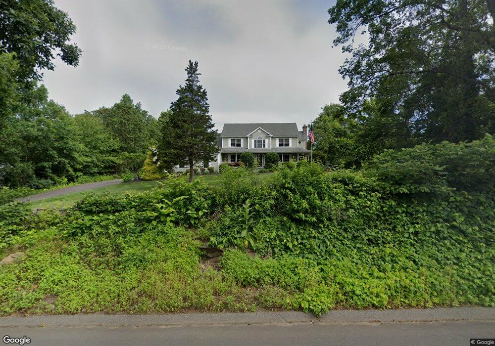
26 Punkup Rd Oxford, CT 06478
Estimated Value: $724,000 - $802,000
3
Beds
3
Baths
3,022
Sq Ft
$253/Sq Ft
Est. Value
About This Home
This home is located at 26 Punkup Rd, Oxford, CT 06478 and is currently estimated at $765,960, approximately $253 per square foot. 26 Punkup Rd is a home located in New Haven County with nearby schools including Quaker Farms School, Oxford Middle School, and Oxford High School.
Ownership History
Date
Name
Owned For
Owner Type
Purchase Details
Closed on
Jul 3, 2003
Sold by
Rusbarsky Steven and Rusbarsky Carol
Bought by
Raimo Brenda A and Nichols David B
Current Estimated Value
Home Financials for this Owner
Home Financials are based on the most recent Mortgage that was taken out on this home.
Original Mortgage
$250,000
Interest Rate
5.12%
Create a Home Valuation Report for This Property
The Home Valuation Report is an in-depth analysis detailing your home's value as well as a comparison with similar homes in the area
Home Values in the Area
Average Home Value in this Area
Purchase History
| Date | Buyer | Sale Price | Title Company |
|---|---|---|---|
| Raimo Brenda A | $130,000 | -- | |
| Raimo Brenda A | $130,000 | -- |
Source: Public Records
Mortgage History
| Date | Status | Borrower | Loan Amount |
|---|---|---|---|
| Open | Raimo Brenda A | $214,000 | |
| Closed | Raimo Brenda A | $250,000 |
Source: Public Records
Tax History
| Year | Tax Paid | Tax Assessment Tax Assessment Total Assessment is a certain percentage of the fair market value that is determined by local assessors to be the total taxable value of land and additions on the property. | Land | Improvement |
|---|---|---|---|---|
| 2025 | $8,582 | $428,890 | $74,270 | $354,620 |
| 2024 | $7,617 | $295,100 | $81,000 | $214,100 |
| 2023 | $7,233 | $295,100 | $81,000 | $214,100 |
| 2022 | $7,189 | $295,100 | $81,000 | $214,100 |
| 2021 | $6,787 | $295,100 | $81,000 | $214,100 |
| 2020 | $7,016 | $294,300 | $81,100 | $213,200 |
| 2019 | $7,016 | $294,300 | $81,100 | $213,200 |
| 2018 | $6,784 | $294,300 | $81,100 | $213,200 |
| 2017 | $6,536 | $294,300 | $81,100 | $213,200 |
| 2016 | $7,125 | $294,300 | $81,100 | $213,200 |
| 2015 | $7,600 | $304,500 | $81,100 | $223,400 |
| 2014 | $7,573 | $304,500 | $81,100 | $223,400 |
Source: Public Records
Map
Nearby Homes
- 185 Quaker Farms Rd
- 134 Shelton Rd
- 44 Old Country Rd
- 19 Good Hill Rd
- 567 Roosevelt Dr
- 81 Oneil Rd
- 159 Freeman Rd
- 151 Great Hill Rd
- 76 Dorman Rd
- 181 Great Hill Rd
- 215 Meadow Brook Rd Unit 215
- 22 Frances Dr
- 30 Fairfield Rd
- 56 Downs Rd
- 18 Forest St
- 132 Botsford Rd
- 6 Park Rd
- 42 Greenwood Cir
- 106 Botsford Rd
- 57 Balance Rock Rd Unit 17
Your Personal Tour Guide
Ask me questions while you tour the home.