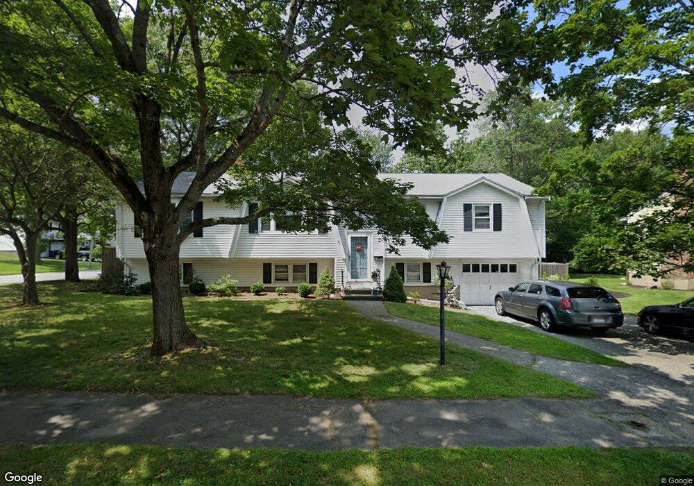
26 Randall Rd Reading, MA 01867
Estimated Value: $918,000 - $996,000
3
Beds
2
Baths
2,107
Sq Ft
$447/Sq Ft
Est. Value
About This Home
This home is located at 26 Randall Rd, Reading, MA 01867 and is currently estimated at $941,116, approximately $446 per square foot. 26 Randall Rd is a home located in Middlesex County with nearby schools including Alice M. Barrows Elementary School, Walter S. Parker Middle School, and Reading Memorial High School.
Ownership History
Date
Name
Owned For
Owner Type
Purchase Details
Closed on
Oct 24, 1984
Bought by
Coleman Francis J and Coleman Nancy S
Current Estimated Value
Create a Home Valuation Report for This Property
The Home Valuation Report is an in-depth analysis detailing your home's value as well as a comparison with similar homes in the area
Home Values in the Area
Average Home Value in this Area
Purchase History
| Date | Buyer | Sale Price | Title Company |
|---|---|---|---|
| Coleman Francis J | $136,100 | -- |
Source: Public Records
Mortgage History
| Date | Status | Borrower | Loan Amount |
|---|---|---|---|
| Open | Coleman Francis J | $92,000 | |
| Closed | Coleman Francis J | $94,500 | |
| Closed | Coleman Francis J | $20,000 | |
| Closed | Coleman Francis J | $102,000 |
Source: Public Records
Tax History
| Year | Tax Paid | Tax Assessment Tax Assessment Total Assessment is a certain percentage of the fair market value that is determined by local assessors to be the total taxable value of land and additions on the property. | Land | Improvement |
|---|---|---|---|---|
| 2025 | $9,276 | $814,400 | $483,300 | $331,100 |
| 2024 | $9,172 | $782,600 | $464,300 | $318,300 |
| 2023 | $8,892 | $706,300 | $418,600 | $287,700 |
| 2022 | $8,567 | $642,700 | $380,600 | $262,100 |
| 2021 | $8,642 | $625,800 | $364,600 | $261,200 |
| 2020 | $3,536 | $595,900 | $347,000 | $248,900 |
| 2019 | $8,081 | $567,900 | $330,500 | $237,400 |
| 2018 | $7,433 | $535,900 | $311,700 | $224,200 |
| 2017 | $3,275 | $506,000 | $294,100 | $211,900 |
| 2016 | $6,608 | $455,700 | $265,600 | $190,100 |
| 2015 | $6,383 | $434,200 | $252,900 | $181,300 |
| 2014 | $5,961 | $404,400 | $235,300 | $169,100 |
Source: Public Records
Map
Nearby Homes
- 212 West St Unit 1
- 16 Munroe Ave
- 18 Talbot Ln Unit 18
- 168 Summer Ave
- 106 Johnson Woods Dr Unit 106
- 141 Johnson Woods Dr
- 17 Courtyard Place Unit 17
- 5 Washington St Unit A1
- 1 Wood End Ln
- 24 Minot St
- 20 Pinevale Ave
- 33 Old Farm Rd
- 11 Linden St
- 295 Main St Unit 16
- 241 Main St Unit C3
- 20 Pilgrim Rd
- 52 Sanborn St Unit 7
- 84 Curtis St
- 48 Village St Unit 1001
- 14 Federal St
Your Personal Tour Guide
Ask me questions while you tour the home.