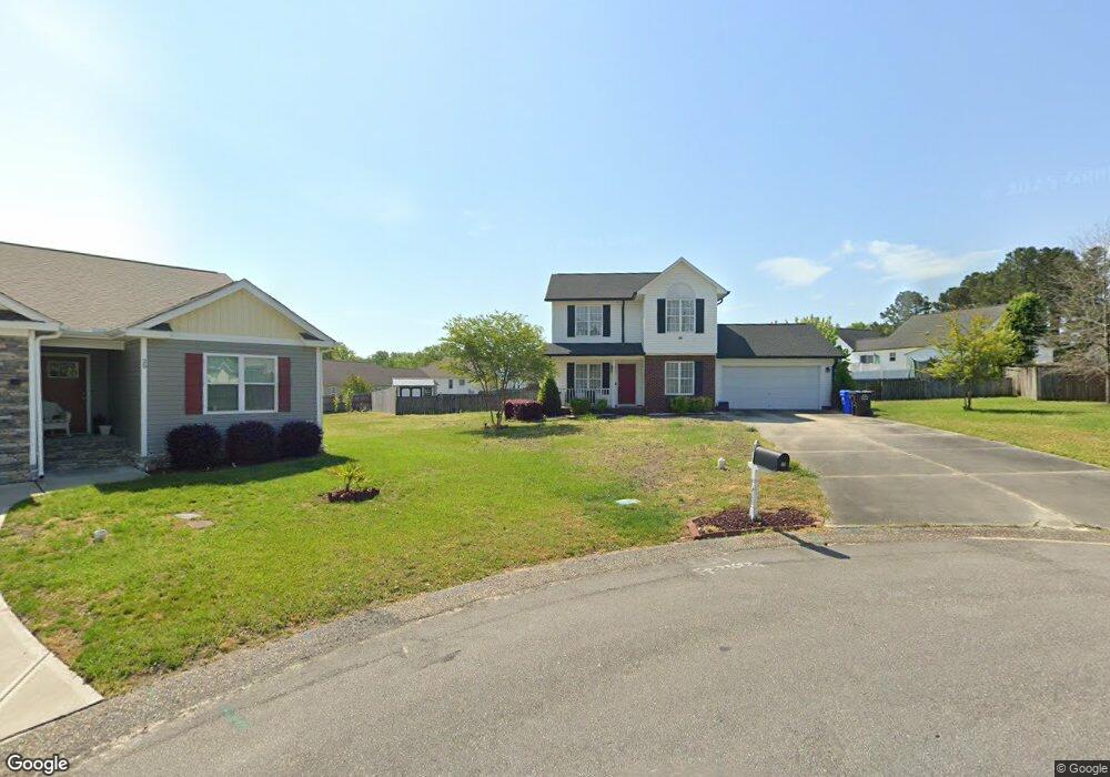
26 Rene Cir Angier, NC 27501
Estimated Value: $274,000 - $302,700
3
Beds
3
Baths
1,382
Sq Ft
$209/Sq Ft
Est. Value
About This Home
This home is located at 26 Rene Cir, Angier, NC 27501 and is currently estimated at $288,425, approximately $208 per square foot. 26 Rene Cir is a home located in Harnett County with nearby schools including Angier Elementary School, North Harnett Primary School, and Harnett Central Middle School.
Ownership History
Date
Name
Owned For
Owner Type
Purchase Details
Closed on
Oct 20, 2016
Sold by
White Adam William
Bought by
Chinyama Lessa and Machowa Madalitso
Current Estimated Value
Home Financials for this Owner
Home Financials are based on the most recent Mortgage that was taken out on this home.
Original Mortgage
$145,959
Outstanding Balance
$116,865
Interest Rate
3.42%
Mortgage Type
New Conventional
Estimated Equity
$171,560
Purchase Details
Closed on
Apr 7, 2011
Sold by
Tompkins Robert Scott and Tompkins Courtney Nicholson
Bought by
White Adam William and White Laura Decker
Home Financials for this Owner
Home Financials are based on the most recent Mortgage that was taken out on this home.
Original Mortgage
$137,823
Interest Rate
4.92%
Mortgage Type
New Conventional
Create a Home Valuation Report for This Property
The Home Valuation Report is an in-depth analysis detailing your home's value as well as a comparison with similar homes in the area
Home Values in the Area
Average Home Value in this Area
Purchase History
| Date | Buyer | Sale Price | Title Company |
|---|---|---|---|
| Chinyama Lessa | $145,000 | -- | |
| White Adam William | $133,000 | -- |
Source: Public Records
Mortgage History
| Date | Status | Borrower | Loan Amount |
|---|---|---|---|
| Open | Chinyama Lessa | $145,959 | |
| Previous Owner | White Adam William | $137,823 |
Source: Public Records
Tax History Compared to Growth
Tax History
| Year | Tax Paid | Tax Assessment Tax Assessment Total Assessment is a certain percentage of the fair market value that is determined by local assessors to be the total taxable value of land and additions on the property. | Land | Improvement |
|---|---|---|---|---|
| 2025 | $2,539 | $210,470 | $0 | $0 |
| 2024 | $2,539 | $210,470 | $0 | $0 |
| 2023 | $2,518 | $210,470 | $0 | $0 |
| 2022 | $1,946 | $210,470 | $0 | $0 |
| 2021 | $1,946 | $137,860 | $0 | $0 |
| 2020 | $1,946 | $137,860 | $0 | $0 |
| 2019 | $1,931 | $137,860 | $0 | $0 |
| 2018 | $1,931 | $137,860 | $0 | $0 |
| 2017 | $1,931 | $137,860 | $0 | $0 |
| 2016 | $1,828 | $130,210 | $0 | $0 |
| 2015 | $1,828 | $130,210 | $0 | $0 |
| 2014 | $1,828 | $130,210 | $0 | $0 |
Source: Public Records
Map
Nearby Homes
- 157 Vaughan Farms Dr
- 158 Dr
- 127 Vaughan Farms Dr
- 148 Vaughan Farms Dr
- 119 Vaughan Farms Dr
- 140 Vaughan Farms Dr
- 56 Twin Birch Dr
- 52 Twin Birch Dr
- 44 Twin Birch Dr
- 22 Twin Birch Dr
- 18 Twin Birch Dr
- 306 Thistle Patch Place
- Redwood Plan at Vaughan Farms
- Shenandoah Plan at Vaughan Farms
- Aurora II Plan at Vaughan Farms
- Summit Plan at Vaughan Farms
- Cascades Plan at Vaughan Farms
- Glades Plan at Vaughan Farms
- Aurora Plan at Vaughan Farms
- 212 Thistle Patch Place
- 26 Rene Cir Unit L29
- 24 Rene Cir
- 25 Rene Cir
- 420 Cambridge Dr
- 272 Cambridge Dr
- 432 Cambridge Dr
- 252 Cambridge Dr
- 252 Cambridge Elm Dr
- 134 Cambridge Dr
- 394 Cambridge Dr
- 450 Cambridge Dr
- 168 Cambridge Dr
- 234 Cambridge Dr
- 292 Cambridge Dr
- 114 Cambridge Dr
- 198 Cambridge Dr
- 374 Cambridge Dr
- 425 Cambridge Dr
- 104 Cambridge Dr
- 0 Lot 36 Cambridge Dr Unit 506036