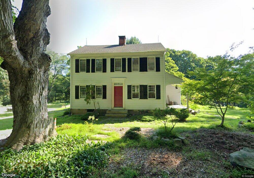
26 Sanfordtown Rd Redding, CT 06896
Estimated Value: $729,803 - $976,000
3
Beds
2
Baths
2,114
Sq Ft
$400/Sq Ft
Est. Value
About This Home
This home is located at 26 Sanfordtown Rd, Redding, CT 06896 and is currently estimated at $845,951, approximately $400 per square foot. 26 Sanfordtown Rd is a home located in Fairfield County with nearby schools including Redding Elementary School, John Read Middle School, and Joel Barlow High School.
Ownership History
Date
Name
Owned For
Owner Type
Purchase Details
Closed on
Aug 16, 2000
Sold by
Kaminskas James J and Mccall Carolyn W
Bought by
Dow John P
Current Estimated Value
Purchase Details
Closed on
Jan 18, 1996
Sold by
Rudy Marian W and Rudy William H
Bought by
Kaminskas James J and Mccall Carolyn
Create a Home Valuation Report for This Property
The Home Valuation Report is an in-depth analysis detailing your home's value as well as a comparison with similar homes in the area
Home Values in the Area
Average Home Value in this Area
Purchase History
| Date | Buyer | Sale Price | Title Company |
|---|---|---|---|
| Dow John P | $564,000 | -- | |
| Kaminskas James J | $399,800 | -- |
Source: Public Records
Mortgage History
| Date | Status | Borrower | Loan Amount |
|---|---|---|---|
| Closed | Kaminskas James J | $404,416 | |
| Closed | Kaminskas James J | $424,000 | |
| Closed | Kaminskas James J | $175,000 | |
| Closed | Kaminskas James J | $448,000 |
Source: Public Records
Tax History Compared to Growth
Tax History
| Year | Tax Paid | Tax Assessment Tax Assessment Total Assessment is a certain percentage of the fair market value that is determined by local assessors to be the total taxable value of land and additions on the property. | Land | Improvement |
|---|---|---|---|---|
| 2025 | $12,132 | $410,700 | $162,900 | $247,800 |
| 2024 | $11,795 | $410,700 | $162,900 | $247,800 |
| 2023 | $11,372 | $410,700 | $162,900 | $247,800 |
| 2022 | $10,415 | $312,400 | $175,200 | $137,200 |
| 2021 | $3,715 | $312,400 | $175,200 | $137,200 |
| 2020 | $9,442 | $312,400 | $175,200 | $137,200 |
| 2019 | $10,259 | $312,400 | $175,200 | $137,200 |
| 2018 | $9,909 | $312,400 | $175,200 | $137,200 |
| 2017 | $12,695 | $428,600 | $247,400 | $181,200 |
| 2016 | $12,532 | $428,600 | $247,400 | $181,200 |
| 2015 | $12,391 | $428,600 | $247,400 | $181,200 |
| 2014 | $12,391 | $428,600 | $247,400 | $181,200 |
Source: Public Records
Map
Nearby Homes
- 280 Newtown Turnpike
- 15 Tunxis Trail
- 56 Cross Hwy
- 10 Shady Ln
- 22 Lonetown Rd
- 45 Great Pasture Rd
- 41 Sullivan Dr
- 241 Black Rock Turnpike
- 16 Black Rock Turnpike
- 2 Longwood Dr
- 90 Old Stagecoach Rd
- 4 Orchard Dr
- 477 Newtown Turnpike
- 283 Redding Rd
- 22 Ledgewood Rd
- 34 Fox Run Rd
- 35 Diamond Hill Rd
- 492 Newtown Turnpike
- 104 Blue Spruce Cir
- 28 Sunnyview Dr
- 24 Sanfordtown Rd
- 16 Sanfordtown Rd
- 21 Sanfordtown Rd
- 36 Sanfordtown Rd
- 30 Sanfordtown Rd
- 269 Newtown Turnpike
- 269 Newtown Turnpike
- 46 Sanfordtown Rd
- 7 Sanfordtown Rd
- 50 Sherman Turnpike
- 50 Sanfordtown Rd
- 8 Sanfordtown Rd
- 54 Sanfordtown Rd
- 267 Newtown Turnpike
- 56 Sanfordtown Rd
- 271 Newtown Turnpike
- 254 Newtown Turnpike
- 248 Newtown Turnpike
- 59 Sherman Turnpike
- 41 Sherman Turnpike