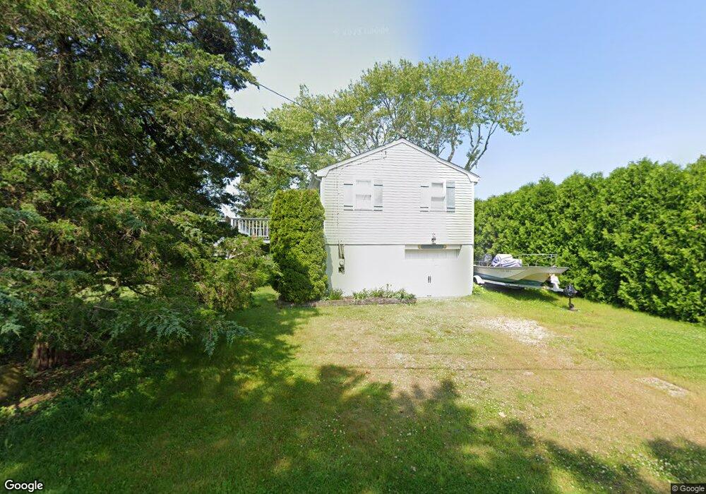
26 Scallop Shell Rd Narragansett, RI 02882
Estimated Value: $646,803 - $915,000
2
Beds
2
Baths
720
Sq Ft
$1,049/Sq Ft
Est. Value
About This Home
This home is located at 26 Scallop Shell Rd, Narragansett, RI 02882 and is currently estimated at $754,951, approximately $1,048 per square foot. 26 Scallop Shell Rd is a home located in Washington County with nearby schools including Narragansett Elementary School, Narragansett Pier Middle School, and Narragansett High School.
Ownership History
Date
Name
Owned For
Owner Type
Purchase Details
Closed on
Oct 18, 1999
Sold by
Silusarski Ronald S and Silusarski Jill S
Bought by
Ferrari Robert C and Ferrari Tammy
Current Estimated Value
Home Financials for this Owner
Home Financials are based on the most recent Mortgage that was taken out on this home.
Original Mortgage
$120,000
Outstanding Balance
$36,150
Interest Rate
7.8%
Estimated Equity
$718,801
Create a Home Valuation Report for This Property
The Home Valuation Report is an in-depth analysis detailing your home's value as well as a comparison with similar homes in the area
Home Values in the Area
Average Home Value in this Area
Purchase History
| Date | Buyer | Sale Price | Title Company |
|---|---|---|---|
| Ferrari Robert C | $160,000 | -- |
Source: Public Records
Mortgage History
| Date | Status | Borrower | Loan Amount |
|---|---|---|---|
| Open | Ferrari Robert C | $120,000 |
Source: Public Records
Tax History Compared to Growth
Tax History
| Year | Tax Paid | Tax Assessment Tax Assessment Total Assessment is a certain percentage of the fair market value that is determined by local assessors to be the total taxable value of land and additions on the property. | Land | Improvement |
|---|---|---|---|---|
| 2024 | $3,411 | $520,700 | $317,200 | $203,500 |
| 2023 | $3,170 | $340,500 | $204,700 | $135,800 |
| 2022 | $3,017 | $340,500 | $204,700 | $135,800 |
| 2021 | $3,017 | $340,500 | $204,700 | $135,800 |
| 2020 | $3,130 | $298,700 | $164,300 | $134,400 |
| 2019 | $3,056 | $298,700 | $164,300 | $134,400 |
| 2018 | $2,972 | $298,700 | $164,300 | $134,400 |
| 2017 | $3,125 | $295,900 | $196,600 | $99,300 |
| 2016 | $2,983 | $295,900 | $196,600 | $99,300 |
| 2015 | $2,941 | $295,900 | $196,600 | $99,300 |
| 2014 | $2,797 | $278,600 | $179,300 | $99,300 |
Source: Public Records
Map
Nearby Homes
- 25 Scallop Shell Rd
- 17 Goose Island Rd
- 20 Marine Dr
- 31 E Pond Rd
- 392 Gooseberry Rd
- 124 Houston Ave
- 110 Houston Ave
- 129 Sand Hill Cove Rd
- 45 Durkin Dr
- 0 Houston Ave
- 6 MacAlder St
- 18 Beach Row
- 16 High Tides Ln
- 89 Sand Hill Cove Rd
- 689 Succotash Rd
- 691 Succotash Rd
- 83 Gooseberry Rd
- 101 Kenyon Farm Rd
- 14 E Pointe Ct Unit 14
- 1125 Point Judith Rd Unit B6
- 7 Periwinkle Rd
- 57 Conch Rd
- 13 Periwinkle Rd
- 6 Teal Pond Rd
- 49 Conch Rd
- 12 Scallop Shell Rd
- 10 Periwinkle Rd
- 10 Teal Pond Rd
- 45 Conch Rd
- 2 Periwinkle Rd
- 17 Periwinkle Rd
- 14 Teal Pond Rd
- 14 Periwinkle Rd
- 41 Conch Rd
- 13 Nautilus Rd
- 52 Conch Rd
- 9 Teal Pond Rd
- 11 Scallop Shell Rd
- 46 Conch Rd
- 56 Conch Rd