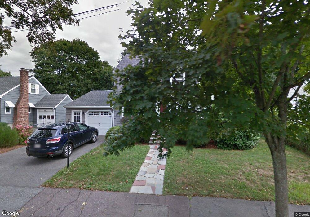
26 Sherman Rd Wakefield, MA 01880
Greenwood NeighborhoodEstimated Value: $715,000 - $865,453
2
Beds
2
Baths
1,103
Sq Ft
$722/Sq Ft
Est. Value
About This Home
This home is located at 26 Sherman Rd, Wakefield, MA 01880 and is currently estimated at $796,863, approximately $722 per square foot. 26 Sherman Rd is a home located in Middlesex County with nearby schools including Wakefield Memorial High School, St Joseph School, and St. Patrick Elementary School.
Ownership History
Date
Name
Owned For
Owner Type
Purchase Details
Closed on
May 30, 2003
Sold by
Keech Gregory K and Keech Wendy J
Bought by
Martin Kevin and Janusz Elizabeth
Current Estimated Value
Home Financials for this Owner
Home Financials are based on the most recent Mortgage that was taken out on this home.
Original Mortgage
$270,000
Interest Rate
5.86%
Mortgage Type
Purchase Money Mortgage
Purchase Details
Closed on
Dec 20, 2000
Sold by
Hanson Scott W and Hanson Kathy M
Bought by
Keech Wendy J and Keech Gregory J
Purchase Details
Closed on
May 29, 1998
Sold by
Hanson Barbara A
Bought by
Hanson Scott W and Hanson Kathleen
Purchase Details
Closed on
Apr 12, 1991
Sold by
Hanson Ronald W and Hanson Barbara A
Bought by
Hanson Barbara A
Create a Home Valuation Report for This Property
The Home Valuation Report is an in-depth analysis detailing your home's value as well as a comparison with similar homes in the area
Home Values in the Area
Average Home Value in this Area
Purchase History
| Date | Buyer | Sale Price | Title Company |
|---|---|---|---|
| Martin Kevin | $337,500 | -- | |
| Keech Wendy J | $276,500 | -- | |
| Hanson Scott W | $220,000 | -- | |
| Hanson Barbara A | $15,000 | -- |
Source: Public Records
Mortgage History
| Date | Status | Borrower | Loan Amount |
|---|---|---|---|
| Open | Hanson Scott W | $263,000 | |
| Closed | Martin Kevin | $270,000 | |
| Previous Owner | Hanson Scott W | $240,000 |
Source: Public Records
Tax History Compared to Growth
Tax History
| Year | Tax Paid | Tax Assessment Tax Assessment Total Assessment is a certain percentage of the fair market value that is determined by local assessors to be the total taxable value of land and additions on the property. | Land | Improvement |
|---|---|---|---|---|
| 2025 | $8,729 | $769,100 | $375,000 | $394,100 |
| 2024 | $8,053 | $715,800 | $348,800 | $367,000 |
| 2023 | $7,842 | $668,500 | $325,600 | $342,900 |
| 2022 | $7,361 | $597,500 | $290,700 | $306,800 |
| 2021 | $7,200 | $565,600 | $265,800 | $299,800 |
| 2020 | $6,771 | $530,200 | $249,200 | $281,000 |
| 2019 | $6,350 | $494,900 | $232,600 | $262,300 |
| 2018 | $5,496 | $424,400 | $222,200 | $202,200 |
| 2017 | $5,168 | $396,600 | $207,600 | $189,000 |
| 2016 | $5,084 | $376,900 | $205,000 | $171,900 |
| 2015 | $4,752 | $352,500 | $191,500 | $161,000 |
| 2014 | $4,398 | $344,100 | $186,900 | $157,200 |
Source: Public Records
Map
Nearby Homes
- 1 Sidney St
- 772 Main St Unit 2
- 762 Main St
- 3 Hickory Hill Rd Unit 1
- 24 Myrtle Ave
- 61 Forest St
- 6 Castle Clare Cir
- 9 Lovis Ave
- 12 Lovis Ave
- 6 Lovis Ave
- 70 Old Nahant Rd
- 134 Nahant St Unit B
- 9 Lilah Cir
- 199 Nahant St
- 19 Fellsmere Ave
- 1 Ludlow Ave
- 38 Bennett St Unit 3D
- 81 Spring St
- 35 Richardson St Unit 2
- 22 Mount Zion Rd