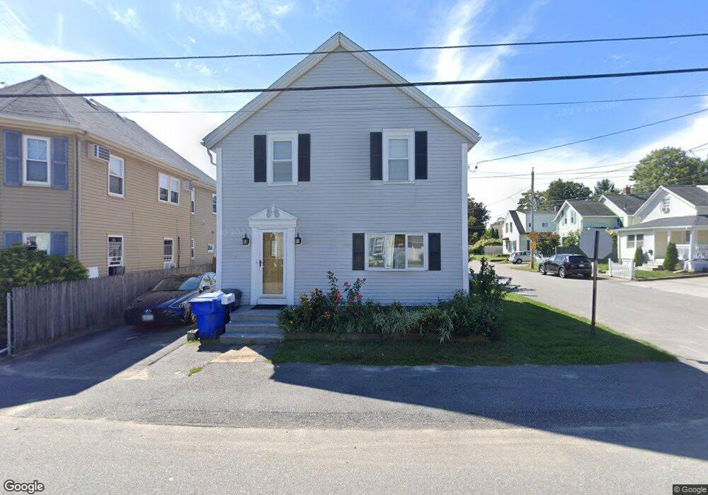
26 Sherman St Riverside, RI 02915
Riverside NeighborhoodEstimated Value: $302,000 - $412,000
3
Beds
1
Bath
1,248
Sq Ft
$306/Sq Ft
Est. Value
About This Home
This home is located at 26 Sherman St, Riverside, RI 02915 and is currently estimated at $381,282, approximately $305 per square foot. 26 Sherman St is a home located in Providence County with nearby schools including East Providence High School, St Mary Academy-Bay View, and St Luke Elementary School.
Ownership History
Date
Name
Owned For
Owner Type
Purchase Details
Closed on
Oct 26, 1994
Sold by
Westbound Assoc Ii
Bought by
Rj Whitford Constr Co
Current Estimated Value
Purchase Details
Closed on
Nov 16, 1983
Bought by
Asquino Joseph L
Create a Home Valuation Report for This Property
The Home Valuation Report is an in-depth analysis detailing your home's value as well as a comparison with similar homes in the area
Home Values in the Area
Average Home Value in this Area
Purchase History
| Date | Buyer | Sale Price | Title Company |
|---|---|---|---|
| Rj Whitford Constr Co | $44,000 | -- | |
| Asquino Joseph L | -- | -- | |
| Rj Whitford Constr Co | $44,000 | -- |
Source: Public Records
Mortgage History
| Date | Status | Borrower | Loan Amount |
|---|---|---|---|
| Open | Asquino Joseph L | $180,000 | |
| Closed | Asquino Joseph L | $144,000 |
Source: Public Records
Tax History Compared to Growth
Tax History
| Year | Tax Paid | Tax Assessment Tax Assessment Total Assessment is a certain percentage of the fair market value that is determined by local assessors to be the total taxable value of land and additions on the property. | Land | Improvement |
|---|---|---|---|---|
| 2025 | $4,322 | $330,700 | $80,400 | $250,300 |
| 2024 | $4,311 | $281,200 | $67,000 | $214,200 |
| 2023 | $4,151 | $281,200 | $67,000 | $214,200 |
| 2022 | $3,948 | $180,600 | $48,200 | $132,400 |
| 2021 | $3,883 | $180,600 | $47,100 | $133,500 |
| 2020 | $3,719 | $180,600 | $47,100 | $133,500 |
| 2019 | $3,616 | $180,600 | $47,100 | $133,500 |
| 2018 | $3,453 | $150,900 | $47,200 | $103,700 |
| 2017 | $3,376 | $150,900 | $47,200 | $103,700 |
| 2016 | $3,359 | $150,900 | $47,200 | $103,700 |
| 2015 | $3,392 | $147,800 | $48,100 | $99,700 |
| 2014 | $3,392 | $147,800 | $48,100 | $99,700 |
Source: Public Records
Map
Nearby Homes
- 28 Sherman St
- 139 Stanton Ave Unit 141
- 145 Stanton Ave
- 147 Stanton Ave
- 25 Sherman St
- 493 Bullocks Point Ave
- 501 Bullocks Point Ave
- 17 Sherman St
- 12 Sherman St
- 149 Stanton Ave
- 149 Stanton Ave Unit 2
- 487 Bullocks Point Ave
- 489 Bullocks Point Ave
- 0 White Ave
- 144 Halleck Ave
- 503 Bullocks Point Ave
- 123 Stanton Ave
- 15 Sherman St
- 8 Sherman St
- 146 Halleck Ave Unit 152