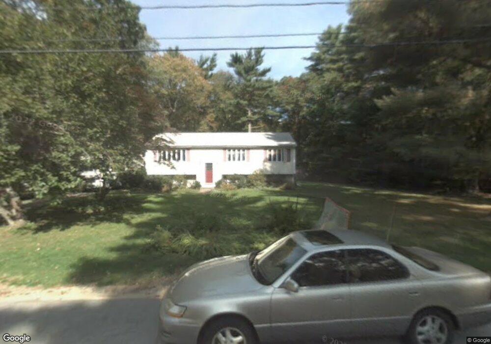
26 Sleigh Dr Hanson, MA 02341
Estimated Value: $503,000 - $673,000
2
Beds
1
Bath
1,296
Sq Ft
$454/Sq Ft
Est. Value
About This Home
This home is located at 26 Sleigh Dr, Hanson, MA 02341 and is currently estimated at $588,124, approximately $453 per square foot. 26 Sleigh Dr is a home located in Plymouth County with nearby schools including Cadence Academy Preschool - Hanover and Cardinal Cushing Centers.
Ownership History
Date
Name
Owned For
Owner Type
Purchase Details
Closed on
Mar 26, 2010
Sold by
Hunsinger Robert A and Hunsinger Rachele L
Bought by
Hunsinger Rachele L
Current Estimated Value
Home Financials for this Owner
Home Financials are based on the most recent Mortgage that was taken out on this home.
Original Mortgage
$186,000
Outstanding Balance
$124,005
Interest Rate
5.02%
Mortgage Type
Purchase Money Mortgage
Estimated Equity
$464,119
Purchase Details
Closed on
Aug 28, 1997
Sold by
26 Sleigh Drive Rt
Bought by
Hunsinger Robert A and Barber Rachele L
Home Financials for this Owner
Home Financials are based on the most recent Mortgage that was taken out on this home.
Original Mortgage
$121,000
Interest Rate
7.41%
Mortgage Type
Purchase Money Mortgage
Create a Home Valuation Report for This Property
The Home Valuation Report is an in-depth analysis detailing your home's value as well as a comparison with similar homes in the area
Home Values in the Area
Average Home Value in this Area
Purchase History
| Date | Buyer | Sale Price | Title Company |
|---|---|---|---|
| Hunsinger Rachele L | -- | -- | |
| Hunsinger Robert A | $160,725 | -- |
Source: Public Records
Mortgage History
| Date | Status | Borrower | Loan Amount |
|---|---|---|---|
| Open | Hunsinger Robert A | $35,000 | |
| Open | Hunsinger Rachele L | $186,000 | |
| Previous Owner | Hunsinger Robert A | $135,000 | |
| Previous Owner | Hunsinger Robert A | $116,000 | |
| Previous Owner | Hunsinger Robert A | $121,000 |
Source: Public Records
Tax History
| Year | Tax Paid | Tax Assessment Tax Assessment Total Assessment is a certain percentage of the fair market value that is determined by local assessors to be the total taxable value of land and additions on the property. | Land | Improvement |
|---|---|---|---|---|
| 2025 | $5,575 | $416,700 | $182,800 | $233,900 |
| 2024 | $5,414 | $404,600 | $177,500 | $227,100 |
| 2023 | $5,373 | $378,900 | $177,500 | $201,400 |
| 2022 | $5,245 | $347,600 | $161,300 | $186,300 |
| 2021 | $792 | $316,700 | $155,100 | $161,600 |
| 2020 | $4,714 | $308,700 | $149,900 | $158,800 |
| 2019 | $760 | $294,100 | $147,000 | $147,100 |
| 2018 | $4,477 | $282,800 | $141,300 | $141,500 |
| 2017 | $4,340 | $271,600 | $134,600 | $137,000 |
| 2016 | $4,432 | $267,800 | $134,600 | $133,200 |
| 2015 | $4,184 | $262,800 | $134,600 | $128,200 |
Source: Public Records
Map
Nearby Homes
- 339 State St
- 430 Brook Bend Rd
- 177 Dwelley St
- 108 Waterford Dr
- 114 Graham Hill Dr
- 139 Fairwood Dr
- 95 Tecumseh Dr
- 51 Farmside Dr
- 51 Cervelli Farm Dr
- 37 Dr
- 23 Cervelli Farm Dr
- 38 Cervelli Farm Dr
- 9 Cervelli Farm Dr
- 250 Center St
- 36 Grove St
- 35 Sproul Rd
- 26 Stonebridge Dr
- 7 Farmside Dr
- 70 Bardin St
- 285 W Elm St
Your Personal Tour Guide
Ask me questions while you tour the home.