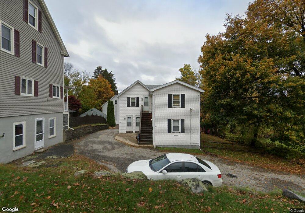
26 Soutn Palmer, MA 01080
Estimated Value: $279,048 - $424,000
4
Beds
3
Baths
1,879
Sq Ft
$182/Sq Ft
Est. Value
About This Home
This home is located at 26 Soutn, Palmer, MA 01080 and is currently estimated at $342,262, approximately $182 per square foot. 26 Soutn is a home located in Hampden County with nearby schools including Old Mill Pond Elementary School, Palmer High School, and Converse Middle School.
Ownership History
Date
Name
Owned For
Owner Type
Purchase Details
Closed on
May 27, 2021
Sold by
Schofield Wayne S and Desroches Tammy A
Bought by
Graveline Marc P
Current Estimated Value
Purchase Details
Closed on
Nov 13, 2013
Sold by
Flynn Gerald F and Flynn Ruth L
Bought by
Schofield Wayne S and Abel Tammy A
Home Financials for this Owner
Home Financials are based on the most recent Mortgage that was taken out on this home.
Original Mortgage
$112,500
Interest Rate
4.24%
Mortgage Type
New Conventional
Purchase Details
Closed on
Aug 1, 2007
Sold by
Flynn Ft and Flynn
Bought by
Flynn Gerald F and Flynn Ruth L
Home Financials for this Owner
Home Financials are based on the most recent Mortgage that was taken out on this home.
Original Mortgage
$110,000
Interest Rate
6.73%
Mortgage Type
Purchase Money Mortgage
Purchase Details
Closed on
Mar 14, 1988
Sold by
Finnegan James R
Bought by
Flynn Gerald F
Create a Home Valuation Report for This Property
The Home Valuation Report is an in-depth analysis detailing your home's value as well as a comparison with similar homes in the area
Home Values in the Area
Average Home Value in this Area
Purchase History
| Date | Buyer | Sale Price | Title Company |
|---|---|---|---|
| Graveline Marc P | $215,000 | None Available | |
| Graveline Marc P | $215,000 | None Available | |
| Schofield Wayne S | $150,000 | -- | |
| Schofield Wayne S | $150,000 | -- | |
| Schofield Wayne S | $150,000 | -- | |
| Flynn Gerald F | -- | -- | |
| Flynn Gerald F | -- | -- | |
| Flynn Gerald F | -- | -- | |
| Flynn Gerald F | $137,000 | -- |
Source: Public Records
Mortgage History
| Date | Status | Borrower | Loan Amount |
|---|---|---|---|
| Previous Owner | Schofield Wayne S | $112,500 | |
| Previous Owner | Flynn Gerald F | $110,000 | |
| Previous Owner | Flynn Gerald F | $85,500 |
Source: Public Records
Tax History
| Year | Tax Paid | Tax Assessment Tax Assessment Total Assessment is a certain percentage of the fair market value that is determined by local assessors to be the total taxable value of land and additions on the property. | Land | Improvement |
|---|---|---|---|---|
| 2025 | $4,494 | $246,500 | $60,800 | $185,700 |
| 2024 | $4,219 | $223,700 | $55,300 | $168,400 |
| 2023 | $4,043 | $205,000 | $55,300 | $149,700 |
| 2022 | $3,760 | $172,300 | $48,500 | $123,800 |
| 2021 | $3,527 | $151,500 | $53,800 | $97,700 |
| 2020 | $3,419 | $146,000 | $53,800 | $92,200 |
| 2019 | $3,343 | $146,000 | $53,800 | $92,200 |
| 2018 | $3,278 | $143,100 | $52,200 | $90,900 |
| 2017 | $3,200 | $143,800 | $52,200 | $91,600 |
| 2016 | $3,271 | $147,400 | $50,700 | $96,700 |
| 2015 | $3,147 | $147,400 | $50,700 | $96,700 |
Source: Public Records
Map
Nearby Homes
- 2022-2024 Prospect St
- 2166-2168 Main St
- 2151 Main St
- 2034 Pleasant St
- 2136 Baptist Hill Rd
- 22 Pine View
- 54-57 Breton and Calkins Rd
- 164 Railroad St
- 15 Quaboag Valley Co-Op St Unit 15
- 1682 N Main St
- L16 Wilbraham St
- 8 Summit Dr
- 34 Commercial St
- Lots 39-42 Lawrence
- 62-91 Lawrence St
- 30 Red Bridge Rd Land Lot 3
- 30 Red Bridge Rd Land Lot 1
- 30 Red Bridge Rd Land Lot 6
- 30 Red Bridge Rd Land Lot 8
- 30 Red Bridge Rd Land Lot 4
- 26 South St
- 30 South St
- 2029 High St Unit 2031
- 20 South St
- 34-36 South St
- 34 South St Unit 36
- 34 South St Unit 1
- 2009 High St Unit 2009
- 2009 High St Unit 2013
- 2033 High St
- 42 South St Unit 44
- 2014-2020 Palmer Rd
- 2041 High St Unit 2043
- 2010 Palmer Rd
- 2020 Palmer Rd
- 2020 Palmer Rd Unit 2020
- 2020 Palmer Rd
- 2014 Palmer Rd Unit 2014
- 2014 Palmer Rd Unit 2020
- 2014 Palmer Rd
Your Personal Tour Guide
Ask me questions while you tour the home.