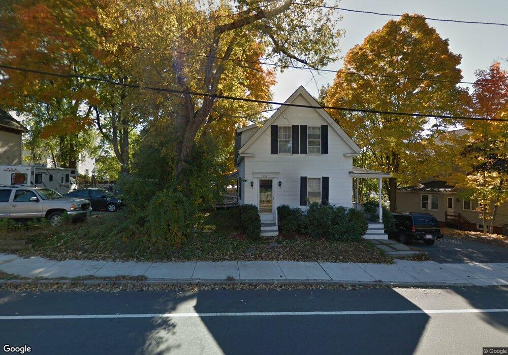
26 Sparhawk St Amesbury, MA 01913
Estimated Value: $563,107 - $655,000
5
Beds
1
Bath
1,476
Sq Ft
$408/Sq Ft
Est. Value
About This Home
This home is located at 26 Sparhawk St, Amesbury, MA 01913 and is currently estimated at $602,777, approximately $408 per square foot. 26 Sparhawk St is a home located in Essex County with nearby schools including Amesbury High School, River Valley Charter School, and Amesbury Seventh-Day Adventist School.
Ownership History
Date
Name
Owned For
Owner Type
Purchase Details
Closed on
Oct 28, 2025
Sold by
Belmont Olivia H and Hazleton William L
Bought by
Belmont Olivia H and Jones Kenneth C
Current Estimated Value
Home Financials for this Owner
Home Financials are based on the most recent Mortgage that was taken out on this home.
Original Mortgage
$315,000
Outstanding Balance
$315,000
Interest Rate
6.26%
Mortgage Type
New Conventional
Estimated Equity
$287,777
Purchase Details
Closed on
Jul 8, 2019
Sold by
Lincoln-Hazelton William
Bought by
Sparhawk Street Irt and Hazelton
Purchase Details
Closed on
Aug 22, 2018
Sold by
26 Sparhawk Street Rt
Bought by
Hazelton William L
Purchase Details
Closed on
Nov 7, 2016
Sold by
Hazelton Cheryl
Bought by
26 Sparhawk Street Rt and Hazelton
Purchase Details
Closed on
May 21, 1993
Sold by
Ward Kevin M and Ward Bonnijo
Bought by
Hazelton Cheryl
Home Financials for this Owner
Home Financials are based on the most recent Mortgage that was taken out on this home.
Original Mortgage
$95,150
Interest Rate
7.54%
Mortgage Type
Purchase Money Mortgage
Create a Home Valuation Report for This Property
The Home Valuation Report is an in-depth analysis detailing your home's value as well as a comparison with similar homes in the area
Home Values in the Area
Average Home Value in this Area
Purchase History
| Date | Buyer | Sale Price | Title Company |
|---|---|---|---|
| Belmont Olivia H | $315,000 | -- | |
| Belmont Olivia H | -- | -- | |
| Sparhawk Street Irt | -- | -- | |
| Hazelton William L | -- | -- | |
| Hazelton William L | -- | -- | |
| 26 Sparhawk Street Rt | -- | -- | |
| Hazelton Cheryl | $98,000 | -- |
Source: Public Records
Mortgage History
| Date | Status | Borrower | Loan Amount |
|---|---|---|---|
| Open | Belmont Olivia H | $315,000 | |
| Previous Owner | Hazelton Cheryl | $10,000 | |
| Previous Owner | Hazelton Cheryl | $95,150 | |
| Previous Owner | Hazelton Cheryl | $20,000 |
Source: Public Records
Tax History Compared to Growth
Tax History
| Year | Tax Paid | Tax Assessment Tax Assessment Total Assessment is a certain percentage of the fair market value that is determined by local assessors to be the total taxable value of land and additions on the property. | Land | Improvement |
|---|---|---|---|---|
| 2025 | $6,636 | $433,700 | $193,000 | $240,700 |
| 2024 | $6,262 | $400,400 | $182,100 | $218,300 |
| 2023 | $6,154 | $376,600 | $158,300 | $218,300 |
| 2022 | $5,604 | $316,800 | $137,700 | $179,100 |
| 2021 | $5,398 | $295,800 | $106,400 | $189,400 |
| 2020 | $4,771 | $277,700 | $102,300 | $175,400 |
| 2019 | $4,758 | $259,000 | $102,300 | $156,700 |
| 2018 | $4,573 | $240,800 | $97,400 | $143,400 |
| 2017 | $4,365 | $218,800 | $97,400 | $121,400 |
| 2016 | $4,324 | $213,200 | $97,400 | $115,800 |
| 2015 | $4,244 | $206,600 | $97,400 | $109,200 |
| 2014 | $4,079 | $194,500 | $97,400 | $97,100 |
Source: Public Records
Map
Nearby Homes
- 93 Friend St
- 43 Aubin St Unit 43
- 37 Millyard Unit 204
- 4 Greenwood St
- 18 E Greenwood St
- 13 High St Unit 2
- 4 Winter St
- 49 W Greenwood St
- 31 Whitter Meadows Dr Unit 31
- 4 Clark St
- 5 Richs Ct Unit 3
- 48 Orchard St
- 97 Elm St
- 118 Elm St
- 25 Cedar St Unit 4
- 25 Cedar St Unit 14
- 25 Cedar St Unit 7
- 3 Arlington St
- 161 Elm St Unit A
- 101 Market St Unit B
- 22 Sparhawk St
- 22 Sparhawk St Unit 2
- 20 Lincoln Ct
- 18 Sparhawk St Unit 20
- 22 Lincoln Ct
- 16 Lincoln Ct
- 16 Lincoln Ct Unit 16,1
- 14 Lincoln Ct
- 14 14 Lincoln Ct
- 32 Sparhawk St
- 12 Lincoln Ct
- 12 Lincon Ct Unit 12
- 34 Sparhawk St
- 34 Sparhawk St Unit 2
- 12 Sparhawk St Unit A
- 14 Sparhawk St Unit 14
- 16 Sparhawk St
- 14 Sparhawk St
- 12 Sparhawk St
- 12 Sparhawk St Unit A 12-14-16