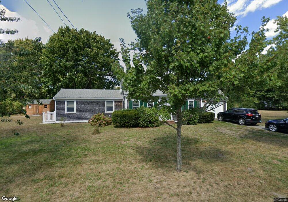
26 Stetson St Hyannis, MA 02601
Estimated Value: $653,000 - $718,000
3
Beds
3
Baths
1,515
Sq Ft
$451/Sq Ft
Est. Value
About This Home
This home is located at 26 Stetson St, Hyannis, MA 02601 and is currently estimated at $683,327, approximately $451 per square foot. 26 Stetson St is a home located in Barnstable County with nearby schools including Hyannis West Elementary School, Barnstable United Elementary School, and Barnstable Intermediate School.
Ownership History
Date
Name
Owned For
Owner Type
Purchase Details
Closed on
Jul 26, 2024
Sold by
Apseloff Ft and Apseloff
Bought by
Apseloff Cape House Llc
Current Estimated Value
Purchase Details
Closed on
Mar 14, 2012
Sold by
Apseloff Marilyn F and Apseloff Stanford S
Bought by
Apseloff Ft
Create a Home Valuation Report for This Property
The Home Valuation Report is an in-depth analysis detailing your home's value as well as a comparison with similar homes in the area
Home Values in the Area
Average Home Value in this Area
Purchase History
| Date | Buyer | Sale Price | Title Company |
|---|---|---|---|
| Apseloff Cape House Llc | -- | None Available | |
| Apseloff Cape House Llc | -- | None Available | |
| Apseloff Ft | -- | -- | |
| Apseloff Ft | -- | -- |
Source: Public Records
Tax History Compared to Growth
Tax History
| Year | Tax Paid | Tax Assessment Tax Assessment Total Assessment is a certain percentage of the fair market value that is determined by local assessors to be the total taxable value of land and additions on the property. | Land | Improvement |
|---|---|---|---|---|
| 2025 | $5,121 | $552,400 | $216,400 | $336,000 |
| 2024 | $4,805 | $530,900 | $216,400 | $314,500 |
| 2023 | $4,556 | $476,100 | $196,700 | $279,400 |
| 2022 | $4,287 | $370,500 | $135,300 | $235,200 |
| 2021 | $4,033 | $338,600 | $137,400 | $201,200 |
| 2020 | $3,925 | $318,300 | $137,400 | $180,900 |
| 2019 | $3,855 | $306,400 | $145,700 | $160,700 |
| 2018 | $3,793 | $308,400 | $169,800 | $138,600 |
| 2017 | $3,621 | $302,000 | $169,800 | $132,200 |
| 2016 | $3,560 | $303,500 | $171,300 | $132,200 |
| 2015 | $3,736 | $322,900 | $166,900 | $156,000 |
Source: Public Records
Map
Nearby Homes
- 342 Sea St
- 281 Gosnold St
- 230 Gosnold St Unit 11A-11B-11C
- 230 Gosnold St Unit 11ABC
- 93 Sea St
- 49 Snow Creek Dr
- 50 Redwood Ln
- 6 Harrington Way
- 113 Briarwood Ave
- 20 Stanley Place
- 24 Betty's Pond Rd Unit 1K
- 24 Bettys Pond Rd Unit K
- 381 Ocean St Unit 1
- 574 Main St
- 287 Ocean St Unit C2
- 287 Ocean St Unit 2 BLDG C
- 500 Ocean St Unit 147
- 500 Ocean St Unit 152
- 112 W Main St Unit 8
- 112 W Main St Unit 7
- 19 Stetson St
- 40 Stetson St
- 33 Stetson St
- 33 Stetson St Unit 3
- 33 Stetson St Unit 4
- 29 Nautical Way
- 293 Sea St
- 41 Nautical Way
- 7 Stetson St
- 7 Stetson St
- 41 Stetson St
- 76 Stetson St
- 285 Sea St
- 20 Nautical Way
- 12 Nautical Way
- 50 Stetson St
- 49 Stetson St
- 311 Sea St
- 51 Nautical Way
- 0 Nautical Way Unit 2 2024424