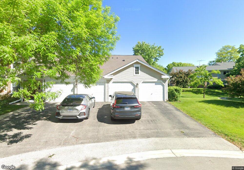
26 Superior Ct Unit 1819R Schaumburg, IL 60193
Olde Schaumburg NeighborhoodEstimated Value: $246,000 - $286,000
2
Beds
--
Bath
1,500
Sq Ft
$178/Sq Ft
Est. Value
About This Home
This home is located at 26 Superior Ct Unit 1819R, Schaumburg, IL 60193 and is currently estimated at $267,526, approximately $178 per square foot. 26 Superior Ct Unit 1819R is a home located in Cook County with nearby schools including Michael Collins Elementary School, Robert Frost Junior High School, and J B Conant High School.
Ownership History
Date
Name
Owned For
Owner Type
Purchase Details
Closed on
Jan 24, 2020
Sold by
Reid Laura L
Bought by
Reid Laura L and Reid Kyle Alexander
Current Estimated Value
Purchase Details
Closed on
Jul 26, 2019
Sold by
Plucinski Michael H and Plucinski Jamie
Bought by
Reid Laura L
Purchase Details
Closed on
Nov 22, 2013
Sold by
Infelise Catherine C and Infelise Guido F
Bought by
Plucinski Michael H
Home Financials for this Owner
Home Financials are based on the most recent Mortgage that was taken out on this home.
Original Mortgage
$110,250
Interest Rate
4.75%
Mortgage Type
New Conventional
Purchase Details
Closed on
Nov 13, 1998
Sold by
Infelise Guido F and Infelise Catherine C
Bought by
Infelise Guido F and Infelise Catherine C
Create a Home Valuation Report for This Property
The Home Valuation Report is an in-depth analysis detailing your home's value as well as a comparison with similar homes in the area
Home Values in the Area
Average Home Value in this Area
Purchase History
| Date | Buyer | Sale Price | Title Company |
|---|---|---|---|
| Reid Laura L | -- | Fidelity National Title | |
| Reid Laura L | $152,500 | Chicago Title Company | |
| Plucinski Michael H | $61,500 | Fidelity Natl Title Ins Co | |
| Infelise Guido F | -- | -- |
Source: Public Records
Mortgage History
| Date | Status | Borrower | Loan Amount |
|---|---|---|---|
| Previous Owner | Plucinski Michael H | $110,250 |
Source: Public Records
Tax History Compared to Growth
Tax History
| Year | Tax Paid | Tax Assessment Tax Assessment Total Assessment is a certain percentage of the fair market value that is determined by local assessors to be the total taxable value of land and additions on the property. | Land | Improvement |
|---|---|---|---|---|
| 2024 | $3,456 | $15,654 | $4,466 | $11,188 |
| 2023 | $3,323 | $15,654 | $4,466 | $11,188 |
| 2022 | $3,323 | $15,654 | $4,466 | $11,188 |
| 2021 | $2,457 | $11,437 | $5,722 | $5,715 |
| 2020 | $2,483 | $11,437 | $5,722 | $5,715 |
| 2019 | $3,408 | $12,714 | $5,722 | $6,992 |
| 2018 | $2,754 | $9,177 | $4,815 | $4,362 |
| 2017 | $2,711 | $9,177 | $4,815 | $4,362 |
| 2016 | $2,535 | $9,177 | $4,815 | $4,362 |
| 2015 | $2,602 | $8,697 | $4,187 | $4,510 |
| 2014 | $2,573 | $8,697 | $4,187 | $4,510 |
| 2013 | $2,820 | $9,782 | $4,187 | $5,595 |
Source: Public Records
Map
Nearby Homes
- 125 Cleveland Ct Unit M2
- 22 Waterbury Ln Unit N1
- 287 Pembridge Ln Unit B2
- 91 Lambert Dr Unit B1
- 300 S Roselle Rd Unit 419
- 300 S Roselle Rd Unit 519
- 300 S Roselle Rd Unit 116
- 300 S Roselle Rd Unit 207
- 350 Newgate Ct Unit 2Z
- 21 White Pine Dr
- 13 Sarahs Grove Ln
- 28 Ascot Cir
- 22 Ascot Cir
- 147 Fulbright Ln
- 153 Fulbright Ln
- 232 W Beech Dr
- 421 Summit Dr
- 121 Chatsworth Cir
- 553 Stone Gate Cir
- 226 Timbercrest Dr
- 26 Superior Ct Unit N2
- 26 Superior Ct Unit N1
- 26 Superior Ct Unit 1819R
- 26 Superior Ct Unit 1819R
- 26 Superior Ct Unit 1819R
- 26 Superior Ct Unit O2
- 26 Superior Ct Unit 1
- 22 Superior Ct Unit 1819L
- 22 Superior Ct Unit 1819L
- 22 Superior Ct Unit 1819L
- 22 Superior Ct Unit 1819L
- 22 Superior Ct Unit M1
- 22 Superior Ct Unit L2
- 22 Superior Ct Unit L1
- 21 Illinois Ave Unit 11122
- 21 Illinois Ave Unit 11122
- 21 Illinois Ave Unit 11122
- 21 Illinois Ave Unit 11122
- 21 Illinois Ave Unit O2
- 25 Illinois Ave Unit 11122