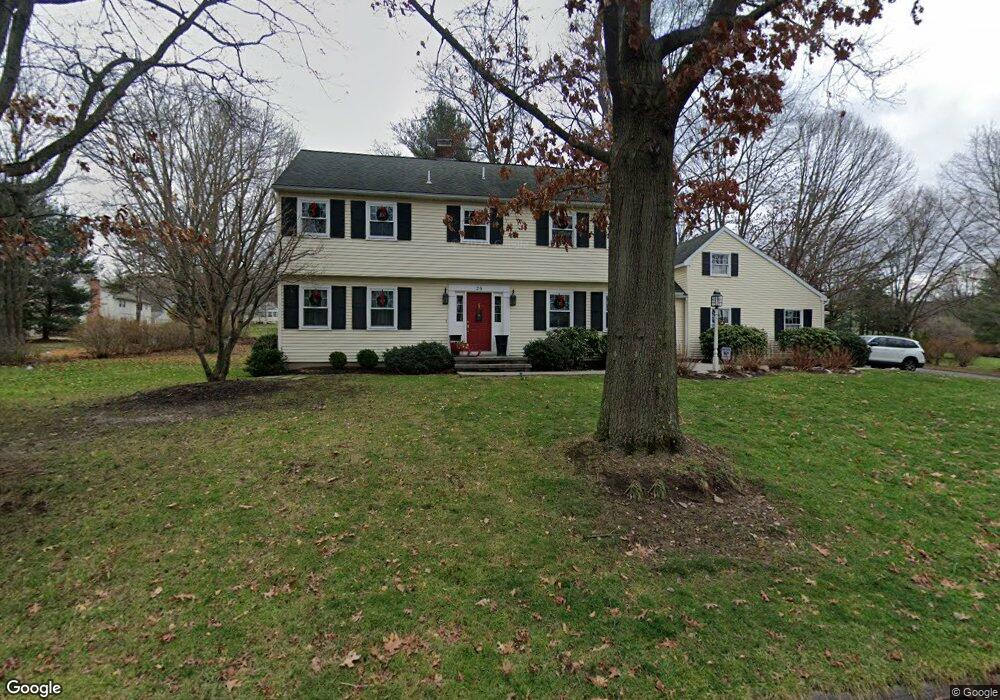
26 Tamanini Dr Wyoming, PA 18644
Estimated Value: $412,000 - $552,000
4
Beds
3
Baths
2,350
Sq Ft
$200/Sq Ft
Est. Value
About This Home
This home is located at 26 Tamanini Dr, Wyoming, PA 18644 and is currently estimated at $470,720, approximately $200 per square foot. 26 Tamanini Dr is a home located in Luzerne County with nearby schools including Dallas Senior High School.
Ownership History
Date
Name
Owned For
Owner Type
Purchase Details
Closed on
Apr 27, 2010
Sold by
Myers Byron and Myers Jean D
Bought by
Murray Ronald S and Murray Erin E
Current Estimated Value
Home Financials for this Owner
Home Financials are based on the most recent Mortgage that was taken out on this home.
Original Mortgage
$250,750
Outstanding Balance
$168,561
Interest Rate
5.11%
Mortgage Type
New Conventional
Estimated Equity
$302,159
Create a Home Valuation Report for This Property
The Home Valuation Report is an in-depth analysis detailing your home's value as well as a comparison with similar homes in the area
Home Values in the Area
Average Home Value in this Area
Purchase History
| Date | Buyer | Sale Price | Title Company |
|---|---|---|---|
| Murray Ronald S | $295,000 | None Available |
Source: Public Records
Mortgage History
| Date | Status | Borrower | Loan Amount |
|---|---|---|---|
| Open | Murray Ronald S | $250,750 |
Source: Public Records
Tax History Compared to Growth
Tax History
| Year | Tax Paid | Tax Assessment Tax Assessment Total Assessment is a certain percentage of the fair market value that is determined by local assessors to be the total taxable value of land and additions on the property. | Land | Improvement |
|---|---|---|---|---|
| 2025 | $6,620 | $305,700 | $50,200 | $255,500 |
| 2024 | $6,416 | $305,700 | $50,200 | $255,500 |
| 2023 | $6,416 | $305,700 | $50,200 | $255,500 |
| 2022 | $6,360 | $305,700 | $50,200 | $255,500 |
| 2021 | $6,360 | $305,700 | $50,200 | $255,500 |
| 2020 | $6,360 | $305,700 | $50,200 | $255,500 |
| 2019 | $6,300 | $305,700 | $50,200 | $255,500 |
| 2018 | $6,239 | $305,700 | $50,200 | $255,500 |
| 2017 | $6,149 | $305,700 | $50,200 | $255,500 |
| 2016 | -- | $305,700 | $50,200 | $255,500 |
| 2015 | $5,202 | $305,700 | $50,200 | $255,500 |
| 2014 | $5,202 | $305,700 | $50,200 | $255,500 |
Source: Public Records
Map
Nearby Homes
- 2 Manor Dr
- 7 Echo Valley Dr
- 318 Echo Valley Dr
- 235 E Center St
- 209 Terrace Ave
- 120 Frangorma Dr
- 120 Ondish Rd
- 205 Beech St
- 10 Roosevelt St
- The Burlington Plan at Saddle Ridge
- The Rutherford Plan at Saddle Ridge
- The Edison Plan at Saddle Ridge
- The Abilene Plan at Saddle Ridge
- The Clarksville Plan at Saddle Ridge
- The Standford Plan at Saddle Ridge
- The Baywood Plan at Saddle Ridge
- The Vicksburg Plan at Saddle Ridge
- The Frankford Plan at Saddle Ridge
- The Nottingham Plan at Saddle Ridge
- The Hatteras Plan at Saddle Ridge