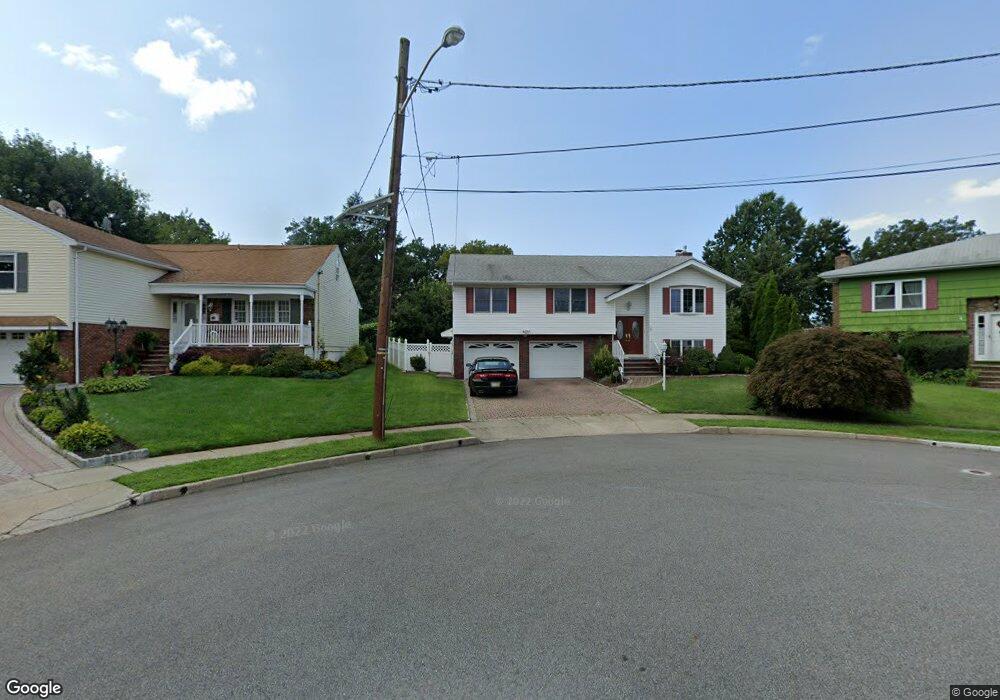
26 Tulp Ct Clifton, NJ 07013
Maple Valley NeighborhoodEstimated Value: $828,392 - $944,000
4
Beds
3
Baths
2,756
Sq Ft
$318/Sq Ft
Est. Value
About This Home
This home is located at 26 Tulp Ct, Clifton, NJ 07013 and is currently estimated at $877,348, approximately $318 per square foot. 26 Tulp Ct is a home located in Passaic County with nearby schools including Clifton High School, The Magical Palace of Knowledge, and Saint Philip the Apostle Preparatory School.
Ownership History
Date
Name
Owned For
Owner Type
Purchase Details
Closed on
May 5, 2021
Sold by
Marotta Gene and Marotta Jo Ann
Bought by
Matari Yusra I
Current Estimated Value
Home Financials for this Owner
Home Financials are based on the most recent Mortgage that was taken out on this home.
Original Mortgage
$400,000
Outstanding Balance
$362,500
Interest Rate
3.1%
Mortgage Type
New Conventional
Estimated Equity
$514,848
Purchase Details
Closed on
Apr 15, 1997
Sold by
Cosentino Maria
Bought by
Marotta Gene and Marotta Jo Ann
Home Financials for this Owner
Home Financials are based on the most recent Mortgage that was taken out on this home.
Original Mortgage
$130,000
Interest Rate
7.77%
Create a Home Valuation Report for This Property
The Home Valuation Report is an in-depth analysis detailing your home's value as well as a comparison with similar homes in the area
Home Values in the Area
Average Home Value in this Area
Purchase History
| Date | Buyer | Sale Price | Title Company |
|---|---|---|---|
| Matari Yusra I | $600,000 | Title Agency Of Nj Inc | |
| Matari Yusra I | $600,000 | Title Agency | |
| Marotta Gene | $270,000 | -- |
Source: Public Records
Mortgage History
| Date | Status | Borrower | Loan Amount |
|---|---|---|---|
| Open | Matari Yusra I | $400,000 | |
| Closed | Matari Yusra I | $400,000 | |
| Previous Owner | Marotta Gene | $130,000 |
Source: Public Records
Tax History Compared to Growth
Tax History
| Year | Tax Paid | Tax Assessment Tax Assessment Total Assessment is a certain percentage of the fair market value that is determined by local assessors to be the total taxable value of land and additions on the property. | Land | Improvement |
|---|---|---|---|---|
| 2025 | $16,027 | $270,000 | $111,900 | $158,100 |
| 2024 | $15,644 | $270,000 | $111,900 | $158,100 |
| 2022 | $15,417 | $270,000 | $111,900 | $158,100 |
| 2021 | $14,783 | $270,000 | $111,900 | $158,100 |
| 2020 | $14,831 | $270,000 | $111,900 | $158,100 |
| 2019 | $14,726 | $270,000 | $111,900 | $158,100 |
| 2018 | $14,642 | $270,000 | $111,900 | $158,100 |
| 2017 | $14,483 | $270,000 | $111,900 | $158,100 |
| 2016 | $14,202 | $270,000 | $111,900 | $158,100 |
| 2015 | $14,064 | $270,000 | $111,900 | $158,100 |
| 2014 | $13,775 | $270,000 | $111,900 | $158,100 |
Source: Public Records
Map
Nearby Homes
- 83 Larkspur Ln
- 124 Thanksgiving Ln
- 69 Larkspur Ln
- 148 Urma Ave
- 54 Village Rd
- 32 Greendale Rd
- 16 Marie Place
- 30 Notch Rd
- 82 van Breeman Dr
- 678 Broad St Unit A003
- 678 Broad St Unit A3
- 16 Lynn Dr
- 479 Grove St
- 33 Graydon Terrace
- 119 Highview Dr
- 43 Graydon Terrace
- 375 Colfax Ave
- 159 George Russell Way Unit 311
- 15 Scott Terrace
- 7 Barrister St Unit 170