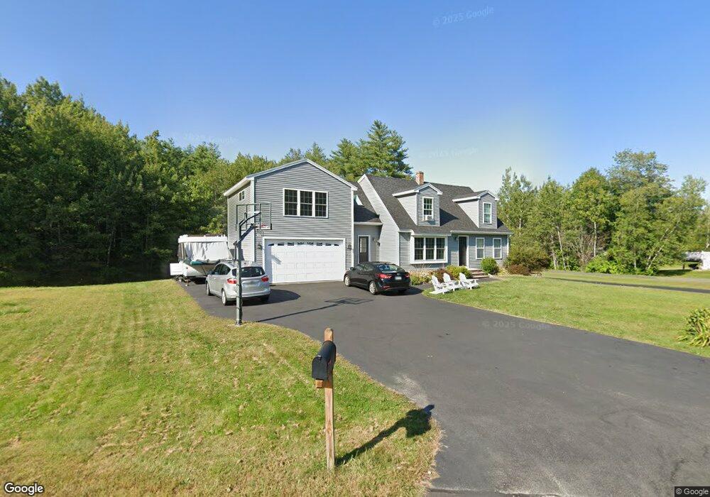
26 Wedgewood Dr Saco, ME 04072
North Saco NeighborhoodEstimated Value: $641,000 - $715,000
3
Beds
2
Baths
2,132
Sq Ft
$311/Sq Ft
Est. Value
About This Home
This home is located at 26 Wedgewood Dr, Saco, ME 04072 and is currently estimated at $662,260, approximately $310 per square foot. 26 Wedgewood Dr is a home located in York County with nearby schools including C K Burns School and Saco Middle School.
Ownership History
Date
Name
Owned For
Owner Type
Purchase Details
Closed on
Jan 11, 2023
Sold by
Toppen Joseph D
Bought by
Toppen Lindsay
Current Estimated Value
Home Financials for this Owner
Home Financials are based on the most recent Mortgage that was taken out on this home.
Original Mortgage
$199,000
Outstanding Balance
$192,292
Interest Rate
6.49%
Mortgage Type
Purchase Money Mortgage
Estimated Equity
$469,968
Purchase Details
Closed on
Jun 15, 2007
Sold by
Folsom Peter
Bought by
Toppen Lindsay E and Toppen Joseph D
Home Financials for this Owner
Home Financials are based on the most recent Mortgage that was taken out on this home.
Original Mortgage
$2,247,000
Interest Rate
6.19%
Mortgage Type
Purchase Money Mortgage
Purchase Details
Closed on
Dec 7, 2005
Sold by
Houston Ann M and Folsom Peter
Bought by
Folsom Peter
Home Financials for this Owner
Home Financials are based on the most recent Mortgage that was taken out on this home.
Original Mortgage
$232,000
Interest Rate
6.17%
Mortgage Type
Purchase Money Mortgage
Create a Home Valuation Report for This Property
The Home Valuation Report is an in-depth analysis detailing your home's value as well as a comparison with similar homes in the area
Home Values in the Area
Average Home Value in this Area
Purchase History
| Date | Buyer | Sale Price | Title Company |
|---|---|---|---|
| Toppen Lindsay | -- | None Available | |
| Toppen Lindsay E | -- | -- | |
| Folsom Peter | -- | -- | |
| Folsom Peter | -- | -- |
Source: Public Records
Mortgage History
| Date | Status | Borrower | Loan Amount |
|---|---|---|---|
| Open | Toppen Lindsay | $199,000 | |
| Previous Owner | Folsom Peter | $207,500 | |
| Previous Owner | Folsom Peter | $2,247,000 | |
| Previous Owner | Folsom Peter | $232,000 | |
| Previous Owner | Folsom Peter | $32,000 |
Source: Public Records
Tax History Compared to Growth
Tax History
| Year | Tax Paid | Tax Assessment Tax Assessment Total Assessment is a certain percentage of the fair market value that is determined by local assessors to be the total taxable value of land and additions on the property. | Land | Improvement |
|---|---|---|---|---|
| 2024 | $7,955 | $566,200 | $152,900 | $413,300 |
| 2023 | $8,351 | $566,200 | $152,900 | $413,300 |
| 2022 | $7,433 | $405,500 | $116,300 | $289,200 |
| 2021 | $6,278 | $332,500 | $105,000 | $227,500 |
| 2020 | $5,368 | $272,900 | $92,700 | $180,200 |
| 2019 | $5,289 | $272,900 | $92,700 | $180,200 |
| 2018 | $5,122 | $264,300 | $84,100 | $180,200 |
| 2017 | $4,729 | $244,000 | $77,100 | $166,900 |
| 2016 | $4,645 | $239,200 | $71,000 | $168,200 |
| 2015 | $4,557 | $237,100 | $71,000 | $166,100 |
| 2014 | $4,441 | $238,500 | $72,400 | $166,100 |
| 2013 | $4,431 | $238,500 | $72,400 | $166,100 |
Source: Public Records
Map
Nearby Homes
- 3 Nonesuch Rd
- 130 Mckenney Rd
- 110/009 Mast Hill Rd
- Lot 1 & 2 Memory Ln
- 9 Jada Dr
- 436 Flag Pond Rd
- 5 Marguerite Rd
- 15 Silver Brook Cir
- 91 C Broadturn Rd
- 9 Bonita Way
- 445 Portland Rd
- 28 E Wind Dr
- Lot 72 Martell Way
- 75 Ash Swamp Rd
- 177 Old Orchard Rd
- 213 Burnham Rd
- 14 David Dr
- 0 Beech Plains Rd
- 295 Buxton Rd
- 13 Mathew Way
- 32 Wedgewood Dr
- 25 Wedgewood Dr
- 29 Wedgewood Dr
- 36 Wedgewood Dr
- 30 Wedgewood Dr
- 28 Wedgewood Dr
- 33 Wedgewood Dr
- 19 Wedgewood Dr
- 80 Wedgewood Dr
- 79 Wedgewood Dr
- 24 Wedgewood Dr
- 78 Wedgewood Dr
- 17 Wedgewood Dr
- 75 Wedgewood Dr
- 39 Wedgewood Dr
- 22 Wedgewood Dr
- 42 Wedgewood Dr
- 43 Wedgewood Dr
- 11 Wedgewood Dr
- 18 Wedgewood Dr