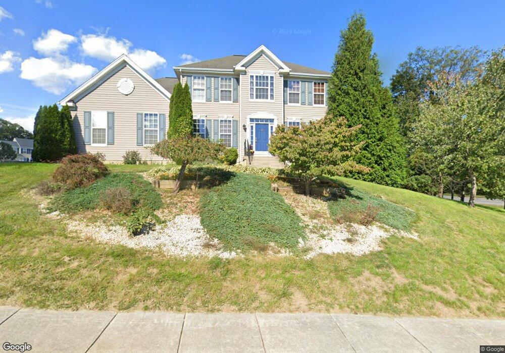
26 Weese Point Shepherdstown, WV 25443
Estimated Value: $376,000 - $453,343
4
Beds
3
Baths
2,277
Sq Ft
$184/Sq Ft
Est. Value
About This Home
This home is located at 26 Weese Point, Shepherdstown, WV 25443 and is currently estimated at $419,336, approximately $184 per square foot. 26 Weese Point is a home located in Jefferson County with nearby schools including Shepherdstown Elementary School, Shepherdstown Middle School, and Jefferson High School.
Ownership History
Date
Name
Owned For
Owner Type
Purchase Details
Closed on
Jun 4, 2008
Sold by
Beazer Homes Corp
Bought by
Northouse Cameron G and Northouse Donna M
Current Estimated Value
Home Financials for this Owner
Home Financials are based on the most recent Mortgage that was taken out on this home.
Original Mortgage
$233,950
Outstanding Balance
$149,430
Interest Rate
6.13%
Mortgage Type
New Conventional
Estimated Equity
$269,906
Create a Home Valuation Report for This Property
The Home Valuation Report is an in-depth analysis detailing your home's value as well as a comparison with similar homes in the area
Home Values in the Area
Average Home Value in this Area
Purchase History
| Date | Buyer | Sale Price | Title Company |
|---|---|---|---|
| Northouse Cameron G | $259,990 | None Available |
Source: Public Records
Mortgage History
| Date | Status | Borrower | Loan Amount |
|---|---|---|---|
| Open | Northouse Cameron G | $233,950 |
Source: Public Records
Tax History Compared to Growth
Tax History
| Year | Tax Paid | Tax Assessment Tax Assessment Total Assessment is a certain percentage of the fair market value that is determined by local assessors to be the total taxable value of land and additions on the property. | Land | Improvement |
|---|---|---|---|---|
| 2025 | $2,602 | $223,900 | $76,300 | $147,600 |
| 2024 | $2,482 | $212,000 | $76,300 | $135,700 |
| 2023 | $2,476 | $212,000 | $76,300 | $135,700 |
| 2022 | $1,985 | $166,600 | $46,900 | $119,700 |
| 2021 | $1,870 | $154,000 | $46,900 | $107,100 |
| 2020 | $1,586 | $139,400 | $32,300 | $107,100 |
| 2019 | $1,630 | $140,600 | $32,300 | $108,300 |
| 2018 | $1,607 | $136,800 | $32,300 | $104,500 |
| 2017 | $1,620 | $137,900 | $32,300 | $105,600 |
| 2016 | $1,628 | $139,000 | $32,300 | $106,700 |
| 2015 | $1,572 | $133,500 | $32,300 | $101,200 |
| 2014 | $1,513 | $128,700 | $26,500 | $102,200 |
Source: Public Records
Map
Nearby Homes
- 302 Starkeys Landing
- 420 Starkeys Landing
- 286 Starkeys Landing
- 115 Swearingen Way
- 51 Swearingen Way
- 95 Riderwood Way
- 55 Open Gate Ln
- 36 Open Gate Ln
- Deerfield Plan at Tollhouse Woods
- Hayden Plan at Tollhouse Woods
- Penwell Plan at Tollhouse Woods
- BRISTOL Plan at Tollhouse Woods
- Neuville Plan at Tollhouse Woods
- Galen Plan at Tollhouse Woods
- 101 Open Gate Ln
- 92 Open Gate Ln
- 185 Shepherd Ln
- 121 Riderwood Ln
- 136 Woodcock Ave
- Lot 2 Martinsburg Pike
- 77 Dr
- 0 Folks Point Unit 1006361136
- 0 Folks Point
- 0 Folks Point Unit 1002269292
- 0 Folks Point Unit 1008811956
- Folks Point
- 1 Weese Point
- 44 Weese Point
- 49 Comegy Dr
- 0 Weese Point
- 33 Weese Point
- 77 Comegy Dr
- 1 Folks Point
- 41 Weese Point
- 48 Weese Point
- 47 Weese Point
- 38 Folks Point
- 31 Folks Point
- 37 Folks Point
- 360 Starkeys Landing