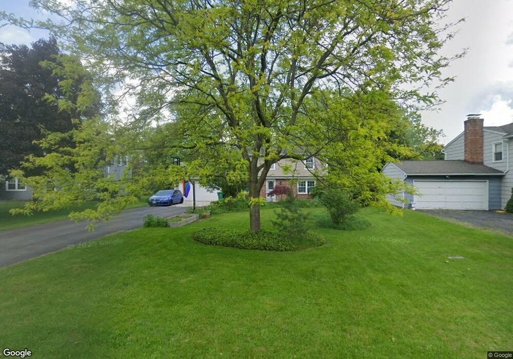
26 Wheatfield Cir Fairport, NY 14450
Estimated Value: $322,000 - $356,226
4
Beds
2
Baths
1,728
Sq Ft
$195/Sq Ft
Est. Value
About This Home
This home is located at 26 Wheatfield Cir, Fairport, NY 14450 and is currently estimated at $337,307, approximately $195 per square foot. 26 Wheatfield Cir is a home located in Monroe County with nearby schools including Dudley School, Northside School, and Martha Brown Middle School.
Ownership History
Date
Name
Owned For
Owner Type
Purchase Details
Closed on
May 16, 2006
Sold by
Hampson Melissa
Bought by
Offord Jason
Current Estimated Value
Home Financials for this Owner
Home Financials are based on the most recent Mortgage that was taken out on this home.
Original Mortgage
$148,697
Outstanding Balance
$86,758
Interest Rate
6.53%
Mortgage Type
FHA
Estimated Equity
$250,549
Purchase Details
Closed on
Apr 25, 2000
Sold by
Garland David
Bought by
Hampton Melissa
Purchase Details
Closed on
Sep 30, 1997
Sold by
Hajjar Roger A
Bought by
Garland David J and Cicero Bonnie Sue
Create a Home Valuation Report for This Property
The Home Valuation Report is an in-depth analysis detailing your home's value as well as a comparison with similar homes in the area
Home Values in the Area
Average Home Value in this Area
Purchase History
| Date | Buyer | Sale Price | Title Company |
|---|---|---|---|
| Offord Jason | $149,900 | Steven Pheterson | |
| Hampton Melissa | $124,900 | Timothy Fitzgerald | |
| Garland David J | $110,000 | -- |
Source: Public Records
Mortgage History
| Date | Status | Borrower | Loan Amount |
|---|---|---|---|
| Open | Offord Jason | $148,697 |
Source: Public Records
Tax History Compared to Growth
Tax History
| Year | Tax Paid | Tax Assessment Tax Assessment Total Assessment is a certain percentage of the fair market value that is determined by local assessors to be the total taxable value of land and additions on the property. | Land | Improvement |
|---|---|---|---|---|
| 2024 | $6,190 | $169,700 | $39,900 | $129,800 |
| 2023 | $5,934 | $169,700 | $39,900 | $129,800 |
| 2022 | $6,315 | $169,700 | $39,900 | $129,800 |
| 2021 | $6,299 | $169,700 | $39,900 | $129,800 |
| 2020 | $5,495 | $169,700 | $39,900 | $129,800 |
| 2019 | $5,037 | $169,700 | $39,900 | $129,800 |
| 2018 | $5,302 | $169,700 | $39,900 | $129,800 |
| 2017 | $3,052 | $157,100 | $39,900 | $117,200 |
| 2016 | $5,037 | $157,100 | $39,900 | $117,200 |
| 2015 | -- | $157,100 | $39,900 | $117,200 |
| 2014 | -- | $157,100 | $39,900 | $117,200 |
Source: Public Records
Map
Nearby Homes
- 0 Lyndon Rd
- 10 Matthew Dr
- 43 Lyndon Rd
- 5 Noahs Bluff
- 4 Noahs Bluff
- 8 Noahs Bluff
- 6 Noahs Bluff
- 4 Triton Ct
- 102 Broadmoor Trail
- 9 Gentian Way
- 28 Winchester Dr
- 29 Bridgewood Dr
- 12 Falling Brook Rd
- 29 Copper Beech Run
- 10 Mildenhall Ridge
- 71 Chadwick Manor
- 31 Belinda Crescent
- 43 Hollingham Rise
- 4 Arbor Ct
- 26 Hampton Ln
- 28 Wheatfield Cir
- 24 Wheatfield Cir
- 30 Wheatfield Cir
- 22 Wheatfield Cir
- 32 Wheatfield Cir
- 27 Wheatfield Cir
- 23 Wheatfield Cir
- 29 Wheatfield Cir
- 20 Wheatfield Cir
- 34 Wheatfield Cir
- 21 Wheatfield Cir
- 36 Wheatfield Cir
- 18 Wheatfield Cir
- 38 Wheatfield Cir
- 19 Wheatfield Cir
- 2 Red Post Crescent
- 22 Delemere Blvd
- 40 Wheatfield Cir
- 16 Wheatfield Cir
- 4 Red Post Crescent