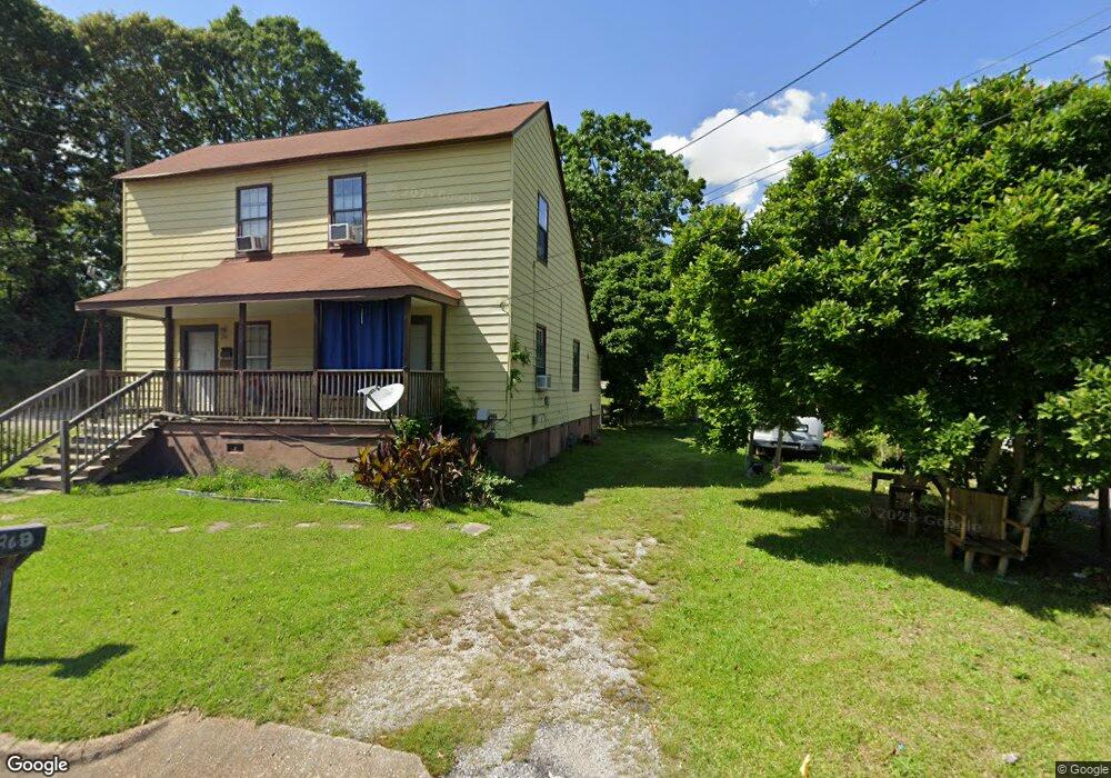
26 Wilcoxon St Newnan, GA 30263
Estimated Value: $143,941 - $216,000
4
Beds
2
Baths
1,764
Sq Ft
$105/Sq Ft
Est. Value
About This Home
This home is located at 26 Wilcoxon St, Newnan, GA 30263 and is currently estimated at $185,985, approximately $105 per square foot. 26 Wilcoxon St is a home located in Coweta County with nearby schools including Jefferson Parkway Elementary School, Arnall Middle School, and East Coweta High School.
Ownership History
Date
Name
Owned For
Owner Type
Purchase Details
Closed on
Mar 22, 2011
Sold by
White Barbara A
Bought by
Vilmar Properties Llc
Current Estimated Value
Purchase Details
Closed on
Jan 6, 2008
Sold by
Norman Roger and Norman Barbara Norman
Bought by
Norman Barbara Ann
Purchase Details
Closed on
Jul 20, 2007
Sold by
Norman Roger
Bought by
Norman Roger and Norman Barbara
Purchase Details
Closed on
Jan 18, 1978
Bought by
Arrington Hilmer
Create a Home Valuation Report for This Property
The Home Valuation Report is an in-depth analysis detailing your home's value as well as a comparison with similar homes in the area
Home Values in the Area
Average Home Value in this Area
Purchase History
| Date | Buyer | Sale Price | Title Company |
|---|---|---|---|
| Vilmar Properties Llc | $15,000 | -- | |
| Norman Barbara Ann | -- | -- | |
| Norman Roger | -- | -- | |
| Arrington Hilmer | -- | -- |
Source: Public Records
Tax History Compared to Growth
Tax History
| Year | Tax Paid | Tax Assessment Tax Assessment Total Assessment is a certain percentage of the fair market value that is determined by local assessors to be the total taxable value of land and additions on the property. | Land | Improvement |
|---|---|---|---|---|
| 2024 | $1,092 | $47,769 | $12,000 | $35,769 |
| 2023 | $1,092 | $44,257 | $2,280 | $41,977 |
| 2022 | $762 | $31,333 | $2,280 | $29,053 |
| 2021 | $782 | $29,092 | $2,280 | $26,812 |
| 2020 | $800 | $29,092 | $2,280 | $26,812 |
| 2019 | $640 | $21,292 | $3,200 | $18,092 |
| 2018 | $643 | $21,292 | $3,200 | $18,092 |
| 2017 | $427 | $14,197 | $2,400 | $11,797 |
| 2016 | $427 | $14,197 | $2,400 | $11,797 |
| 2015 | $428 | $14,197 | $2,400 | $11,797 |
| 2014 | $438 | $14,197 | $2,400 | $11,797 |
Source: Public Records
Map
Nearby Homes
- 40 Wilcoxon St
- 0 Highway 34 Unit 20149159
- 15 Casey St
- 5 Casey Rd
- 55A Perry St
- 0 Georgia 34 Unit 7614778
- 0 Highway 29 N Unit 14.41+/- AC 10432364
- 0 N Highway 29 Unit 20115352
- 144 Jackson St
- 0 Davis St Unit 10606043
- 20 Salbide Ave
- 3 Northside Dr
- 10 Burch Ave
- 12 Burch Ave
- 30 Pinson St
- 61 Clark St
- 42 W Washington St
- 71 Spring St
- 37 Powell Place
- 1 Newnan Views Cir
- 28 Wilcoxon St
- 25 Wilcoxon St
- 27 Wilcoxen St
- 27 Wilcoxon St
- 30 Wilcoxon St
- 6 Swint St
- 29 Wilcoxon St
- 6 Swint St
- 2 Berry Ave
- 0 Swint Place Unit 7B 8349500
- 0 Swint Place Unit 3288572
- 4 Berry Ave
- 4 Swint St
- 32 Wilcoxon St
- 6 Berry Ave
- 31 Wilcoxon St
- 5 Swint St
- 3 Sutherland Dr
- 34 Wilcoxon St
- 33 Wilcoxon St